
Geonarrative: Water-Use Data-Gap Analysis
May 3, 2023
Geonarrative: Water-Use Data-Gap Analysis
Explore water-use data availability in the U.S. and gaps that limit their use in models
Explore water-use data availability in the U.S. and gaps that limit their use in models
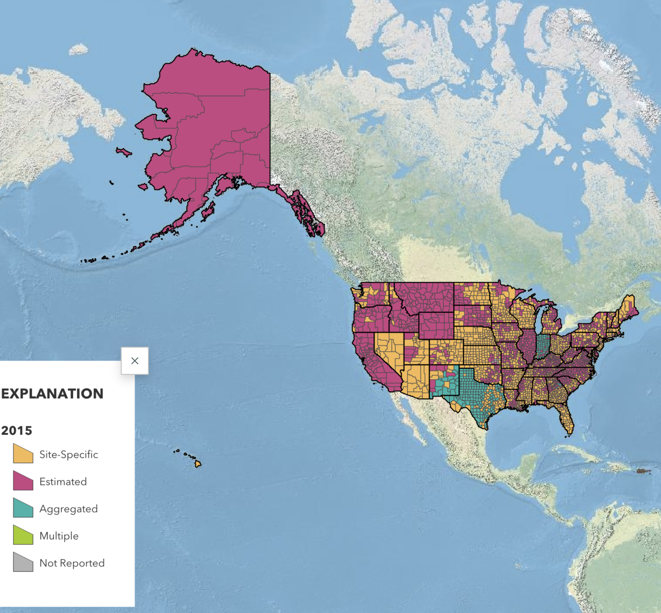
The water-use data-gap analysis includes examining the important regional uses of water, how those uses are spatially distributed across the region, the availability of and level of uncertainty in historical data, the triggers behind water-use decisions, and the suitability of existing data to meet modeling and water-management needs.
Media
Sources/Usage: Public Domain. View Media Details