
Groundwater levels near the Yakima Training Center, Washington
April 27, 2026
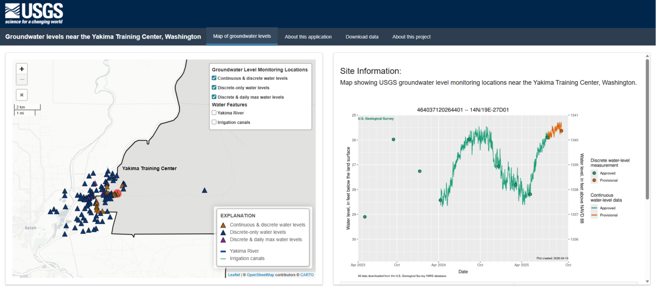
This web page displays groundwater-level data for selected wells monitored by the U.S. Geological Survey (USGS) near the Yakima Training Center, Washington. These data are part of a project to develop a detailed conceptual understanding of the groundwater-flow system near the Yakima Training Center.
Key features include map-based data exploration, hydrographs from project wells, and filterable data downloads.
Media
Sources/Usage: Public Domain. View Media Details
Related
Improving the understanding of groundwater hydrology near the Yakima Training Center, Washington
The Issue: The Yakima Training Center (YTC) is a military training installation located in south-central Washington. Recent sampling of groundwater wells on and off the base has detected per- and polyfluoroalkyl substances (PFAS)—man-made chemicals that, in some areas, exceed State or Federal drinking-water standards. The local geology is highly complex, featuring folded and faulted bedrock...