



Long Island Sound Partnership Compound Flood Hazard Web Map Application
July 16, 2026
This Long Island Sound Partnership Compound Flood Hazard Web Map Application presents individual and combined flood hazard scores from rainfall, coastal storm surge and shallow or emerging groundwater on a 900-meter by 900-meter grid over a study area which encompasses New York City, and Long Island, and Long Island Sound Watersheds in Southeastern New York and Southern Connecticut.
Related
Regional Assessment of Compound Flood Hazard from the Combined Effects of Coastal, Stormwater and Groundwater Emergence Flooding
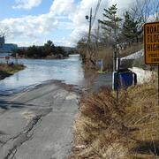
Compound flooding is flooding that results from a co-occurrence of multiple flood drivers. In this project we consider precipitation (pluvial flooding, overland flow of stormwater), coastal storm surge and tidal flooding (coastal flooding), and flooding that occurs as a shallow water table intersects the land surface or critical infrastructure (groundwater emergence flooding). These flooding...
Related
Regional Assessment of Compound Flood Hazard from the Combined Effects of Coastal, Stormwater and Groundwater Emergence Flooding
Compound flooding is flooding that results from a co-occurrence of multiple flood drivers. In this project we consider precipitation (pluvial flooding, overland flow of stormwater), coastal storm surge and tidal flooding (coastal flooding), and flooding that occurs as a shallow water table intersects the land surface or critical infrastructure (groundwater emergence flooding). These flooding...