
A poster presenting the interactive online web application on the Compound Flood Hazards topic
Regional Assessment of Compound Flood Hazard from the Combined Effects of Coastal, Stormwater and Groundwater Emergence Flooding
Active
By New York Water Science Center
April 6, 2025
Compound flooding is flooding that results from a co-occurrence of multiple flood drivers. In this project we consider precipitation (pluvial flooding, overland flow of stormwater), coastal storm surge and tidal flooding (coastal flooding), and flooding that occurs as a shallow water table intersects the land surface or critical infrastructure (groundwater emergence flooding). These flooding hazards have forced communities to reconsider the ways they plan and manage coastal development, as well as when and where they choose to make investments.
Media
Sources/Usage: Public Domain. View Media Details
In 2021, the U.S. Geological Survey (USGS) began a study to assess the compound flood hazard associated with the flood drivers described above, under present-day and possible future hydrologic conditions. The project study area includes New York City and Long Island, and Long Island Sound Watersheds in Southeastern New York, Southern Connecticut, and Southwestern Rhode Island.
The planned outcomes for the study are:
- Displays of the potential (hazard rank) across the study area for precipitation, coastal, and groundwater emergence flooding on a web map application. Additional maps displaying flood influencing variables for the respective drivers as well as the extent of coastal area inundation and groundwater emergence flooding under current mean sea level and future mean sea level scenarios will also be available at higher resolution.
- Analysis of how often flood drivers co-occurred in the past and the likelihood of future compound, or co-occurring, events.
- Development of a fully coupled model framework, at a set of locations, to represent the hydraulic connections between coastal, groundwater and subterranean infrastructure systems. The fully coupled modeling framework will be developed to model processes at the appropriate local scale (e.g., over a watershed or sewershed). The coupled model framework will be applied to study compound flood processes for flood mitigation scenarios under different hydrologic conditions.
Compound Flooding Hazard Assessment application
Compound Flooding Hazard Assessment application
Compound Flood Hazard Assessment Mapper Webinar
Compound Flood Hazard Assessment Mapper Webinar
Media
Flooded front yard of a house near the Wading River after a massive winter storm in January 2024.
Sources/Usage: Public Domain. View Media Details
Media
Flooding after the winter storm of January 12th, 2024, in Wading River along Creek Road and Sound Road.
Sources/Usage: Public Domain. View Media Details
Media
USGS NYWSC staffer making flowtracker measurement ona flooded street in Ithaca, NY
Sources/Usage: Public Domain. View Media Details
Media

Abandoned cars on a flooded street in the Gowanus neighborhood of Brooklyn, NY during a storm in 2023.
Sources/Usage: Public Domain. View Media Details
Understanding Compound Flood Hazards
A poster presenting the interactive online web application on the Compound Flood Hazards topic

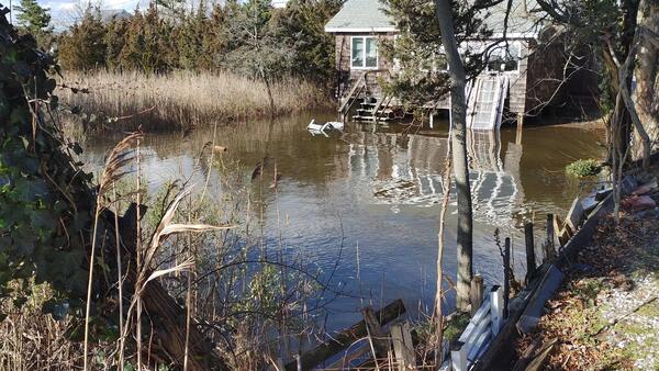
Wading River flooding after a massive winter storm
Wading River flooding after a massive winter stormFlooded front yard of a house near the Wading River after a massive winter storm in January 2024.
Wading River flooding after a massive winter storm
Wading River flooding after a massive winter stormFlooded front yard of a house near the Wading River after a massive winter storm in January 2024.

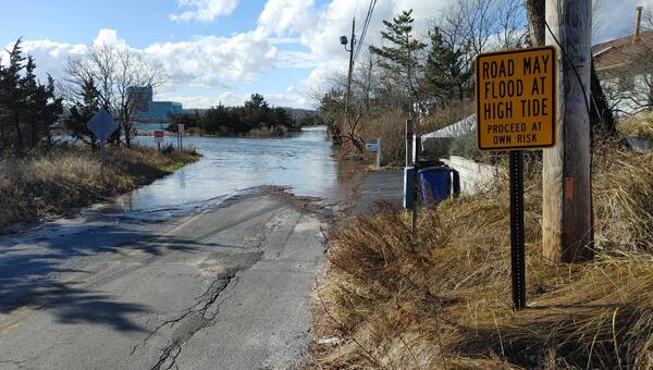
Wading River Flooding
Flooding after the winter storm of January 12th, 2024, in Wading River along Creek Road and Sound Road.
Flooding after the winter storm of January 12th, 2024, in Wading River along Creek Road and Sound Road.
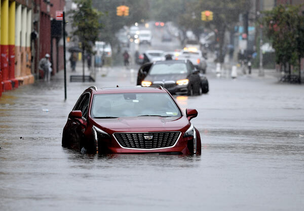
Abandoned cars on a flooded street in Brooklyn, NY.
Abandoned cars on a flooded street in Brooklyn, NY.Abandoned cars on a flooded street in the Gowanus neighborhood of Brooklyn, NY during a storm in 2023.
Abandoned cars on a flooded street in Brooklyn, NY.
Abandoned cars on a flooded street in Brooklyn, NY.Abandoned cars on a flooded street in the Gowanus neighborhood of Brooklyn, NY during a storm in 2023.
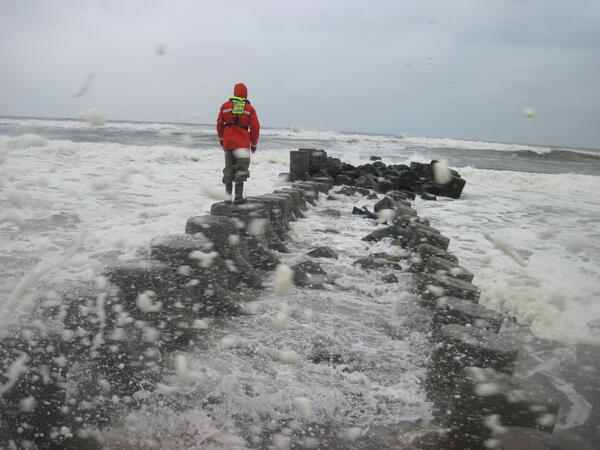
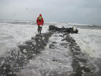
Measuring high water marks on a jetty into the Long Island Sound
Measuring high water marks on a jetty into the Long Island SoundUSGS scientist measuring high water marks on a jetty into the Long Island Sound during flooding in October of 2015.
Measuring high water marks on a jetty into the Long Island Sound
Measuring high water marks on a jetty into the Long Island SoundUSGS scientist measuring high water marks on a jetty into the Long Island Sound during flooding in October of 2015.

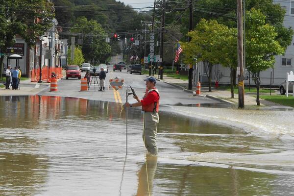
Flowtracker measurement during flooding in Ithaca, NY
Flowtracker measurement during flooding in Ithaca, NYUSGS NYWSC staffer making flowtracker measurement ona flooded street in Ithaca, NY
Flowtracker measurement during flooding in Ithaca, NY
Flowtracker measurement during flooding in Ithaca, NYUSGS NYWSC staffer making flowtracker measurement ona flooded street in Ithaca, NY
Compound flooding is flooding that results from a co-occurrence of multiple flood drivers. In this project we consider precipitation (pluvial flooding, overland flow of stormwater), coastal storm surge and tidal flooding (coastal flooding), and flooding that occurs as a shallow water table intersects the land surface or critical infrastructure (groundwater emergence flooding). These flooding hazards have forced communities to reconsider the ways they plan and manage coastal development, as well as when and where they choose to make investments.
Media
Sources/Usage: Public Domain. View Media Details
In 2021, the U.S. Geological Survey (USGS) began a study to assess the compound flood hazard associated with the flood drivers described above, under present-day and possible future hydrologic conditions. The project study area includes New York City and Long Island, and Long Island Sound Watersheds in Southeastern New York, Southern Connecticut, and Southwestern Rhode Island.
The planned outcomes for the study are:
- Displays of the potential (hazard rank) across the study area for precipitation, coastal, and groundwater emergence flooding on a web map application. Additional maps displaying flood influencing variables for the respective drivers as well as the extent of coastal area inundation and groundwater emergence flooding under current mean sea level and future mean sea level scenarios will also be available at higher resolution.
- Analysis of how often flood drivers co-occurred in the past and the likelihood of future compound, or co-occurring, events.
- Development of a fully coupled model framework, at a set of locations, to represent the hydraulic connections between coastal, groundwater and subterranean infrastructure systems. The fully coupled modeling framework will be developed to model processes at the appropriate local scale (e.g., over a watershed or sewershed). The coupled model framework will be applied to study compound flood processes for flood mitigation scenarios under different hydrologic conditions.
Compound Flooding Hazard Assessment application
Compound Flooding Hazard Assessment application
Compound Flood Hazard Assessment Mapper Webinar
Compound Flood Hazard Assessment Mapper Webinar
Media
Flooded front yard of a house near the Wading River after a massive winter storm in January 2024.
Sources/Usage: Public Domain. View Media Details
Media
Flooding after the winter storm of January 12th, 2024, in Wading River along Creek Road and Sound Road.
Sources/Usage: Public Domain. View Media Details
Media
USGS NYWSC staffer making flowtracker measurement ona flooded street in Ithaca, NY
Sources/Usage: Public Domain. View Media Details
Media
Abandoned cars on a flooded street in the Gowanus neighborhood of Brooklyn, NY during a storm in 2023.
Sources/Usage: Public Domain. View Media Details
Understanding Compound Flood Hazards
A poster presenting the interactive online web application on the Compound Flood Hazards topic
A poster presenting the interactive online web application on the Compound Flood Hazards topic
Wading River flooding after a massive winter storm
Wading River flooding after a massive winter stormFlooded front yard of a house near the Wading River after a massive winter storm in January 2024.
Wading River flooding after a massive winter storm
Wading River flooding after a massive winter stormFlooded front yard of a house near the Wading River after a massive winter storm in January 2024.
Wading River Flooding
Flooding after the winter storm of January 12th, 2024, in Wading River along Creek Road and Sound Road.
Flooding after the winter storm of January 12th, 2024, in Wading River along Creek Road and Sound Road.
Abandoned cars on a flooded street in Brooklyn, NY.
Abandoned cars on a flooded street in Brooklyn, NY.Abandoned cars on a flooded street in the Gowanus neighborhood of Brooklyn, NY during a storm in 2023.
Abandoned cars on a flooded street in Brooklyn, NY.
Abandoned cars on a flooded street in Brooklyn, NY.Abandoned cars on a flooded street in the Gowanus neighborhood of Brooklyn, NY during a storm in 2023.
Measuring high water marks on a jetty into the Long Island Sound
Measuring high water marks on a jetty into the Long Island SoundUSGS scientist measuring high water marks on a jetty into the Long Island Sound during flooding in October of 2015.
Measuring high water marks on a jetty into the Long Island Sound
Measuring high water marks on a jetty into the Long Island SoundUSGS scientist measuring high water marks on a jetty into the Long Island Sound during flooding in October of 2015.
Flowtracker measurement during flooding in Ithaca, NY
Flowtracker measurement during flooding in Ithaca, NYUSGS NYWSC staffer making flowtracker measurement ona flooded street in Ithaca, NY
Flowtracker measurement during flooding in Ithaca, NY
Flowtracker measurement during flooding in Ithaca, NYUSGS NYWSC staffer making flowtracker measurement ona flooded street in Ithaca, NY