



A small rockslide occurred today on the south wall of Halema‘uma‘u, sending boulders into the water at the bottom of the crater. USGS video by M. Patrick.
Videos
Kīlauea videos of eruptive activity, field work, and more.
Filter Total Items: 840
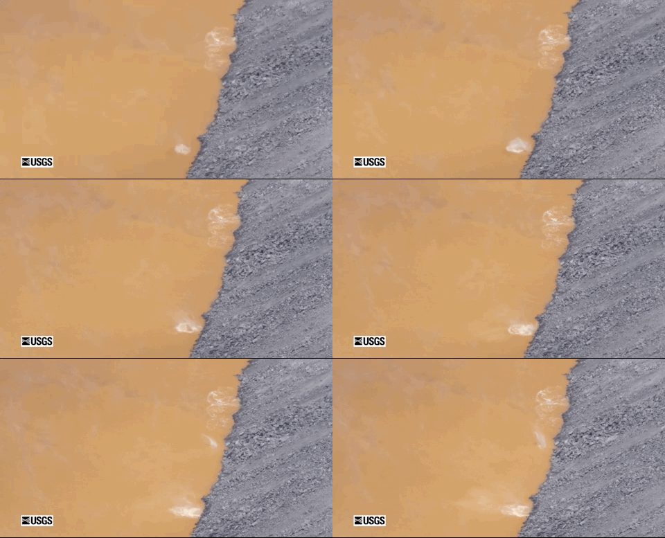
Halema‘uma‘u rockslide on May 11, 2020
A small rockslide occurred today on the south wall of Halema‘uma‘u, sending boulders into the water at the bottom of the crater. USGS video by M. Patrick.

Timelapse of water rising in Halema‘uma‘u
This timelapse sequence shows the water pond in Halema‘uma‘u Crater, at Kīlauea's summit, between November 1, 2019, and March 26, 2020. Over this time the water level rose approximately 14 meters (46 feet), equivalent to 67 cm (about 2 feet) per week. The timelapse shows one image per day (with a few cloudy images removed), and is looped several times.
This timelapse sequence shows the water pond in Halema‘uma‘u Crater, at Kīlauea's summit, between November 1, 2019, and March 26, 2020. Over this time the water level rose approximately 14 meters (46 feet), equivalent to 67 cm (about 2 feet) per week. The timelapse shows one image per day (with a few cloudy images removed), and is looped several times.

Seismicity of the 2018 Kīlauea Volcano eruption
The 2018 Kīlauea eruption produced unprecedented levels of seismicity in the volcano’s instrumented history. The USGS Hawaiian Volcano Observatory documented about 80,000 earthquakes during the three-month-long eruption, starting with the dramatic collapse of the Puʻu ʻŌʻō cone on April 30 and ending with the final Kīlauea summit caldera collapse event on August 5.
The 2018 Kīlauea eruption produced unprecedented levels of seismicity in the volcano’s instrumented history. The USGS Hawaiian Volcano Observatory documented about 80,000 earthquakes during the three-month-long eruption, starting with the dramatic collapse of the Puʻu ʻŌʻō cone on April 30 and ending with the final Kīlauea summit caldera collapse event on August 5.
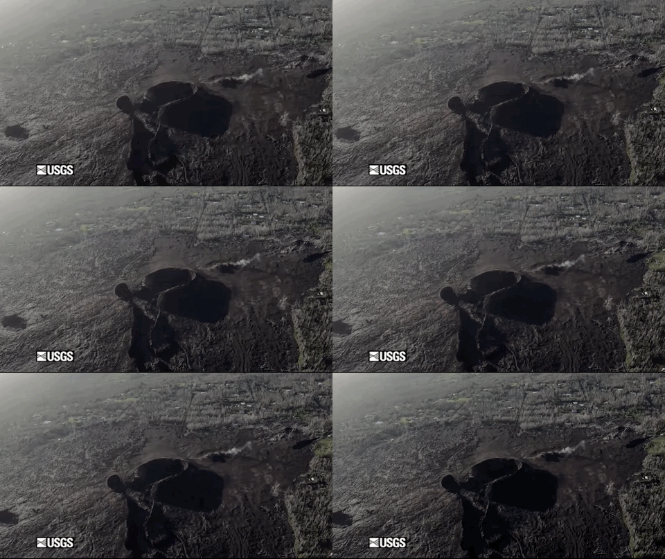
Video of Fissure 8 flyover on January 21, 2020
This video clip shows a flyover of fissure 8 on Jan. 21. During the 2018 eruption, lava spilled out from the cone into a channel that extended towards the north. Lava traveled approximately 13 km (8 miles) to reach the ocean at Kapoho Bay. USGS video by M. Patrick.
This video clip shows a flyover of fissure 8 on Jan. 21. During the 2018 eruption, lava spilled out from the cone into a channel that extended towards the north. Lava traveled approximately 13 km (8 miles) to reach the ocean at Kapoho Bay. USGS video by M. Patrick.

Kīlauea Lower East Rift Zone 2019: Quiet but insightful
Kīlauea Lower East Rift Zone 2019: Quiet but insightfulIn the year since Kīlauea Volcano’s notable 2018 eruption ended, the lower East Rift Zone has been relatively quiet. But USGS Hawaiian Volcano Observatory scientists continue to gain insight into the eruption through ongoing research and monitoring. Some of the many questions asked by island residents include, Why did the fissures erupt along a linear pattern?
Kīlauea Lower East Rift Zone 2019: Quiet but insightful
Kīlauea Lower East Rift Zone 2019: Quiet but insightfulIn the year since Kīlauea Volcano’s notable 2018 eruption ended, the lower East Rift Zone has been relatively quiet. But USGS Hawaiian Volcano Observatory scientists continue to gain insight into the eruption through ongoing research and monitoring. Some of the many questions asked by island residents include, Why did the fissures erupt along a linear pattern?

Thermal video of fissure 8 on January 21, 2020
This thermal video of the fissure 8 cone shows that small areas of higher temperatures (greater than 100 degrees Celsius, or 212 degrees Fahrenheit) are present on the cone. Those hotter areas likely represent residual heat in the cone and the underlying fissure. USGS video by M. Patrick.
This thermal video of the fissure 8 cone shows that small areas of higher temperatures (greater than 100 degrees Celsius, or 212 degrees Fahrenheit) are present on the cone. Those hotter areas likely represent residual heat in the cone and the underlying fissure. USGS video by M. Patrick.

What can lava tell us? Deciphering Kīlauea’s 2018 eruption
What can lava tell us? Deciphering Kīlauea’s 2018 eruptionThe 2018 eruption on Kīlauea’s lower East Rift Zone spewed around a billion cubic yards of lava into Puna. From the moment the eruption began, samples of lava were collected and rapidly analyzed by a team of USGS Hawaiian Volcano Observatory and University of Hawaiʻi at Hilo scientists.
What can lava tell us? Deciphering Kīlauea’s 2018 eruption
What can lava tell us? Deciphering Kīlauea’s 2018 eruptionThe 2018 eruption on Kīlauea’s lower East Rift Zone spewed around a billion cubic yards of lava into Puna. From the moment the eruption began, samples of lava were collected and rapidly analyzed by a team of USGS Hawaiian Volcano Observatory and University of Hawaiʻi at Hilo scientists.

What’s happening at Kīlauea Volcano’s summit?
Kīlauea Volcano's summit has been in an eruptive pause since the 2018 events ended over a year ago. Nevertheless, it remains a dynamic place. Ongoing inflation and seismicity indicate that the summit magma chamber is gradually recharging.
Kīlauea Volcano's summit has been in an eruptive pause since the 2018 events ended over a year ago. Nevertheless, it remains a dynamic place. Ongoing inflation and seismicity indicate that the summit magma chamber is gradually recharging.

Living with Earthquakes in Hawaii
Tens of thousands of earthquakes occur each year in Hawaii, making it one of the most seismically active places in the United States.
Tens of thousands of earthquakes occur each year in Hawaii, making it one of the most seismically active places in the United States.

Transitions: What's next for HVO and the volcanoes it monitors?
Transitions: What's next for HVO and the volcanoes it monitors?2018 and 2019 were years of profound change at Kīlauea Volcano and the USGS Hawaiian Volcano Observatory. Devastation caused by the largest lower East Rift Zone eruption and summit collapse in at least 200 years resulted in many transitions for island residents, including HVO.
Transitions: What's next for HVO and the volcanoes it monitors?
Transitions: What's next for HVO and the volcanoes it monitors?2018 and 2019 were years of profound change at Kīlauea Volcano and the USGS Hawaiian Volcano Observatory. Devastation caused by the largest lower East Rift Zone eruption and summit collapse in at least 200 years resulted in many transitions for island residents, including HVO.
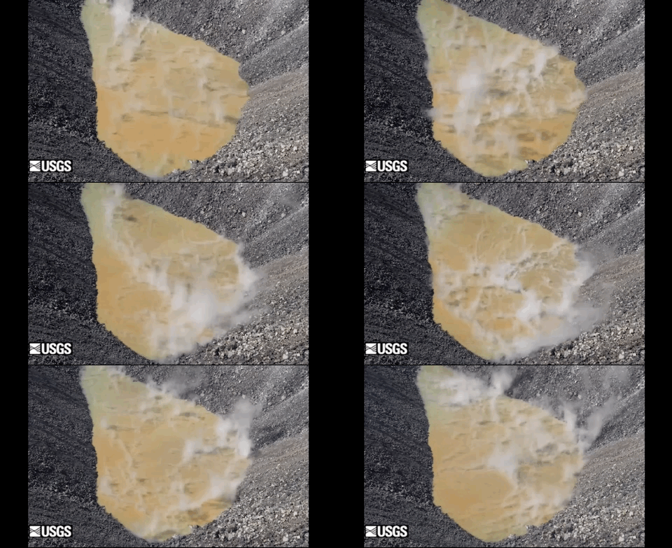
Timelapse video of the water pond at Kīlauea summit
Timelapse video of the water pond at Kīlauea summitThis timelapse sequence shows two hours of activity at the water pond in Halema‘uma‘u, at Kīlauea's summit. Flow is evident along the sharp orange color boundary in the center of the pond, as well as along portions of the shoreline. The pond is 189 m (650 ft) long. The vido was taken on the eastern rim.
Timelapse video of the water pond at Kīlauea summit
Timelapse video of the water pond at Kīlauea summitThis timelapse sequence shows two hours of activity at the water pond in Halema‘uma‘u, at Kīlauea's summit. Flow is evident along the sharp orange color boundary in the center of the pond, as well as along portions of the shoreline. The pond is 189 m (650 ft) long. The vido was taken on the eastern rim.
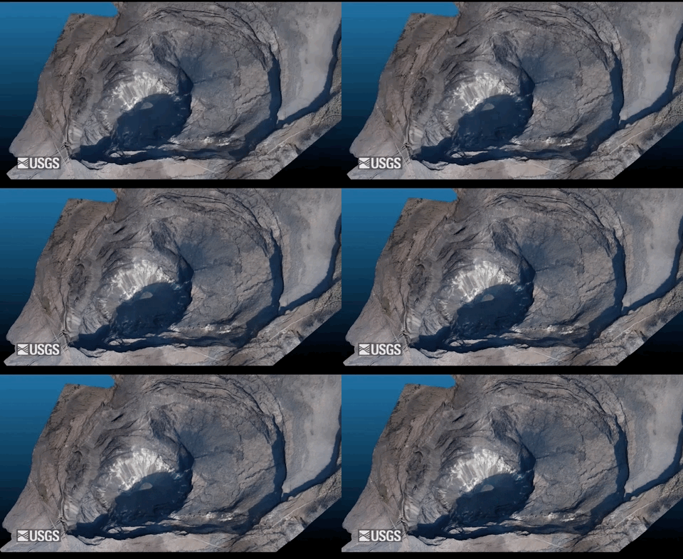
Virtual flyover of Kīlauea summit
An overflight on December 18 provided aerial photographs of Kīlauea caldera, which were used to construct a 3D model. The water pond is visible in the deepest portion of Halema‘uma‘u crater. For scale, the water pond is 189 m (650 ft) long and approximately 600 m (1970 ft) below the western caldera rim.
An overflight on December 18 provided aerial photographs of Kīlauea caldera, which were used to construct a 3D model. The water pond is visible in the deepest portion of Halema‘uma‘u crater. For scale, the water pond is 189 m (650 ft) long and approximately 600 m (1970 ft) below the western caldera rim.

Sampling the water in Halema‘uma‘u - Kīlauea Volcano
Sampling the water in Halema‘uma‘u - Kīlauea VolcanoUSGS Hawaiian Volcano Observatory scientists Frank Younger and Patricia Nadeau talk about sampling the water at the bottom of Halemaʻumaʻu, a crater at the summit of Kīlauea Volcano. The water appeared in July 2019 and has steadily risen since then.
Sampling the water in Halema‘uma‘u - Kīlauea Volcano
Sampling the water in Halema‘uma‘u - Kīlauea VolcanoUSGS Hawaiian Volcano Observatory scientists Frank Younger and Patricia Nadeau talk about sampling the water at the bottom of Halemaʻumaʻu, a crater at the summit of Kīlauea Volcano. The water appeared in July 2019 and has steadily risen since then.

Video of the October 26 Halema‘uma‘u water sampling mission
Video of the October 26 Halema‘uma‘u water sampling missionThis video was captured by the unmanned aircraft system (UAS) as it collected a water sample in Halema‘uma‘u, at Kīlauea's summit. Limited UAS flights in this area are conducted with permission and coordination with Hawai‘i Volcanoes National Park.
Video of the October 26 Halema‘uma‘u water sampling mission
Video of the October 26 Halema‘uma‘u water sampling missionThis video was captured by the unmanned aircraft system (UAS) as it collected a water sample in Halema‘uma‘u, at Kīlauea's summit. Limited UAS flights in this area are conducted with permission and coordination with Hawai‘i Volcanoes National Park.

Reconnaissance video taken prior to October 26 water sampling mission
Reconnaissance video taken prior to October 26 water sampling missionThe Unoccupied Aircraft System (UAS) that collected water from the crater lake in Halema‘uma‘u on October 26 was outfitted with both visual and infrared (thermal) cameras. This reconnaissance video shows fumarolic activity on the walls of the crater. Fumaroles appear light in color (yellow and white) in the visual imagery due to alteration of the crater wall rock.
Reconnaissance video taken prior to October 26 water sampling mission
Reconnaissance video taken prior to October 26 water sampling missionThe Unoccupied Aircraft System (UAS) that collected water from the crater lake in Halema‘uma‘u on October 26 was outfitted with both visual and infrared (thermal) cameras. This reconnaissance video shows fumarolic activity on the walls of the crater. Fumaroles appear light in color (yellow and white) in the visual imagery due to alteration of the crater wall rock.

Reconnaissance video taken prior to October 26 water sampling mission
Reconnaissance video taken prior to October 26 water sampling missionIn this October 26 reconnaissance survey, the Unoccupied Aircraft System (UAS) reaches the northeast part of the Halema‘uma‘u crater lake, where large rocks at the lake margin are often used to visually track the rising water level. Taken over a period of about 5.5 minutes, the survey is shown at 3 times the speed it was filmed.
Reconnaissance video taken prior to October 26 water sampling mission
Reconnaissance video taken prior to October 26 water sampling missionIn this October 26 reconnaissance survey, the Unoccupied Aircraft System (UAS) reaches the northeast part of the Halema‘uma‘u crater lake, where large rocks at the lake margin are often used to visually track the rising water level. Taken over a period of about 5.5 minutes, the survey is shown at 3 times the speed it was filmed.

Video of UAS water sampling, Kīlauea summit
This video shows a close-up of the unmanned aircraft system collecting a water sample in Halema‘uma‘u. USGS video by M. Patrick, 26 Oct 2019.
This video shows a close-up of the unmanned aircraft system collecting a water sample in Halema‘uma‘u. USGS video by M. Patrick, 26 Oct 2019.

Reconnaissance video taken prior to October 26 water sampling mission
Reconnaissance video taken prior to October 26 water sampling missionPrior to the Unoccupied Aircraft System (UAS) mission that collected a water sample from Halema‘uma‘u at Kīlauea's summit on October 26, reconnaissance UAS missions were flown. This video, taken over a period of 15 minutes, has been sped up 7 times to show the UAS as it approaches Halema‘uma‘u from the southwest.
Reconnaissance video taken prior to October 26 water sampling mission
Reconnaissance video taken prior to October 26 water sampling missionPrior to the Unoccupied Aircraft System (UAS) mission that collected a water sample from Halema‘uma‘u at Kīlauea's summit on October 26, reconnaissance UAS missions were flown. This video, taken over a period of 15 minutes, has been sped up 7 times to show the UAS as it approaches Halema‘uma‘u from the southwest.

Thermal video of the October 26 Halema‘uma‘u water sampling mission
Thermal video of the October 26 Halema‘uma‘u water sampling missionThis thermal video was captured by the UAS as it collected a water sample in Halema‘uma‘u, at Kīlauea's summit.
Thermal video of the October 26 Halema‘uma‘u water sampling mission
Thermal video of the October 26 Halema‘uma‘u water sampling missionThis thermal video was captured by the UAS as it collected a water sample in Halema‘uma‘u, at Kīlauea's summit.

Video of UAS water sampling, Kīlauea summit
This video shows the unmanned aircraft system (UAS) collecting a water sample from Halema‘uma‘u. This wider view shows the scale of the UAS relative to the water pond. USGS video by M. Patrick, 26 Oct 2019.
This video shows the unmanned aircraft system (UAS) collecting a water sample from Halema‘uma‘u. This wider view shows the scale of the UAS relative to the water pond. USGS video by M. Patrick, 26 Oct 2019.

Video of UAS water sampling, Kīlauea summit
This video shows another view of the unmanned aircraft system sampling water from Halema‘uma‘u. USGS video by C. Parcheta, 26 Oct 2019.
This video shows another view of the unmanned aircraft system sampling water from Halema‘uma‘u. USGS video by C. Parcheta, 26 Oct 2019.