An official website of the United States government
Here's how you know
Official websites use .gov
A .gov website belongs to an official government organization in the United States.
Secure .gov websites use HTTPS
A lock () or https:// means you’ve safely connected to the .gov website. Share sensitive information only on official, secure websites.
The flow front remains active, with continued slow advancement towards the northeast over the weekend. The flow front today was 1.1 km (0.7 miles) upslope from Apa‘a St. and 2.2 km (1.4 miles) from Pāhoa Village Road, as measured along a straight line. This photo, looking down flow and taken at a low altitude, shows the flow front direction relative to the transfer station and Pāhoa.
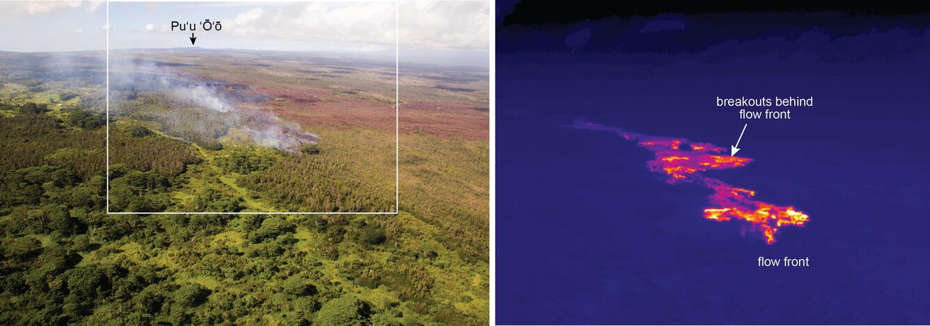
A view of the flow front from a normal camera (left) as well as from a thermal camera (right). The white box shows the extent of the thermal image. The thermal image shows that breakouts are active at the leading tip of the flow, and are also scattered upslope from the flow front.
Active breakouts are also scattered around the area that lava first entered ground cracks. The smoke plumes mark spots where individual breakouts are burning vegetation.
Activity in Pu‘u ‘Ō‘ō today remains similar to what we have observed during recent weeks. Several pits on the crater floor had small incandescent holes, and there appeared to be a small lava pond in the southern pit.