



Benjamin F. Loomis Historical Photograph Collection: Lassen Peak showing new lava flow on summit and large mudflows on slopes. Photo courtesy of NPS.
Images
Images related to Lassen Volcanic Center.
Filter Total Items: 27

Lava and mudflows from Lassen Peak, May 22, 1915
Benjamin F. Loomis Historical Photograph Collection: Lassen Peak showing new lava flow on summit and large mudflows on slopes. Photo courtesy of NPS.

Mudflows in Lost Creek, Lassen, May 22 1915
Benjamin F. Loomis Historical Photograph Collection: Lost Creek drainage area covered in mud, rocks, and debris from a mudflow off Lassen Peak. Photo courtesy of NPS.
Benjamin F. Loomis Historical Photograph Collection: Lost Creek drainage area covered in mud, rocks, and debris from a mudflow off Lassen Peak. Photo courtesy of NPS.
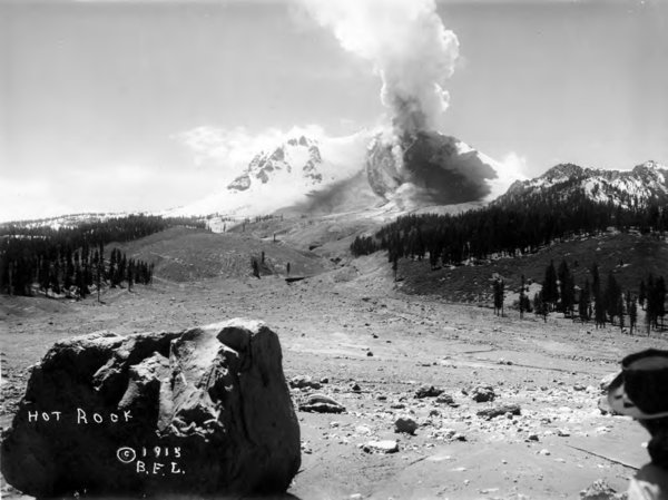
Benjamin Loomis photograph of Lassen Peak and the Devastated Area, May 22, 1915
Benjamin Loomis photograph of Lassen Peak and the Devastated Area, May 22, 1915Steam issuing from summit of Lassen Peak from head of Lost Creek following mudflow. "Hot Rock"(large boulder) in foreground. Photographs taken a few hours prior to second major eruption and hot blast.
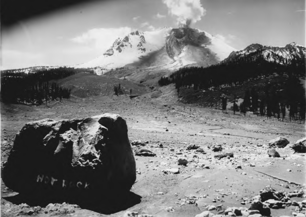
Historical photograph of Lassen Peak by Benjamin Loomis, May 22, 1915
Historical photograph of Lassen Peak by Benjamin Loomis, May 22, 1915A second view of Lassen Peak and the Deveastated Area following an explosive eruption and mudflowk. The crater of the volcano is visible, revealing that a lava dome which had previously been growing there was destroyed by the explosion. Subsequently, a lava flow began refilling the crater, and was mistakenly thought to have created the mudflow.

Lassen Peak photographed from the Devastated Area prior to 1914-191...
Lassen Peak photographed from the Devastated Area prior to 1914-191...Lassen Peak photographed from the Devastated Area prior to the 1914-1915 eruption that changed the landscape.
Lassen Peak photographed from the Devastated Area prior to 1914-191...
Lassen Peak photographed from the Devastated Area prior to 1914-191...Lassen Peak photographed from the Devastated Area prior to the 1914-1915 eruption that changed the landscape.
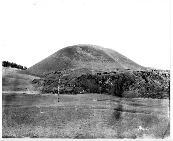
Cinder Cone volcano in the Lassen Volcanic Center
This photo of the Cinder Cone scoria cone volcano north of Lassen Peak was taken in 1889 by Joseph Diller, an early USGS and National Parks geologist. Photo courtesy of the National Park Service.
This photo of the Cinder Cone scoria cone volcano north of Lassen Peak was taken in 1889 by Joseph Diller, an early USGS and National Parks geologist. Photo courtesy of the National Park Service.