
Images
Images of Yellowstone.
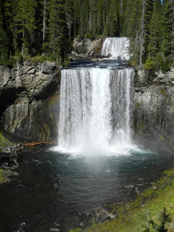
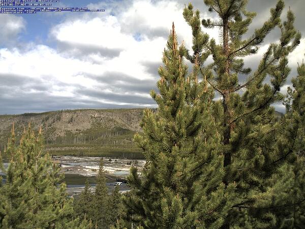
Image of Biscuit Basin (visible between the trees) captured by the YVO mobile webcam on June 17, 2012
Image of Biscuit Basin (visible between the trees) captured by the YVO mobile webcam on June 17, 2012Image of Biscuit Basin (visible between the trees) captured by the YVO mobile webcam on June 17, 2012, when it was positioned on a hill just east of the basin.

View north along U.S. Route 20 from near Ashton, ID, at the margin of the Huckleberry Ridge Tuff in the distance
View north along U.S. Route 20 from near Ashton, ID, at the margin of the Huckleberry Ridge Tuff in the distanceGoogle maps photo taken just north of Ashton, ID, along U.S. Route 20. The photo was taken looking north towards Island Park, ID. The forested ridge in the distance marks the margin of a caldera that formed 2.08 million years ago, when the Huckleberry Ridge Tuff erupted.
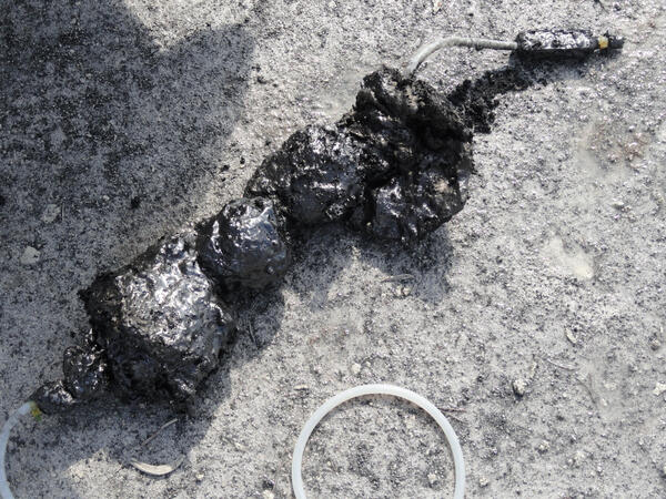
Sulfur “cinder” from Cinder Pool in Norris Geyser Basin, Yellowstone National Park
Sulfur “cinder” from Cinder Pool in Norris Geyser Basin, Yellowstone National ParkSulfur “cinder” attached to a sampling tube that was extracted from Cinder Pool in Norris Geyser Basin. The “cinder” is sulfur that existed as a molten layer at the bottom of the pool and was carried upward by gas and solidified. The black color is due to the presence of finely dispersed pyrite.

Steam rises from the Mud Geyser fumarole on the northeast side of the Mud Volcano thermal area in Yellowstone National Park. Gas that discharges from Mud Geyser has the most magmatic character of any sampled feature in Yellowstone.
Steam rises from the Mud Geyser fumarole on the northeast side of the Mud Volcano thermal area in Yellowstone National Park. Gas that discharges from Mud Geyser has the most magmatic character of any sampled feature in Yellowstone.
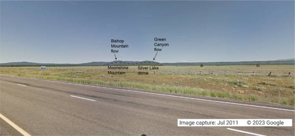
Looking west from the intersection of U.S. Route 20 and Old Hwy 47, in Idaho, at lava flows associated with the Henrys Fork caldera
Looking west from the intersection of U.S. Route 20 and Old Hwy 47, in Idaho, at lava flows associated with the Henrys Fork calderaGoogle Maps photo taken at the intersection of U.S. Route 20 and Old Hwy 47 in Idaho, looking west. The tops of Moonshine Mountain and Silver Lake dome, rhyolite lava flows located inside the caldera, are indicated with a dashed black line.

USGS employees deploys a water conductivity/temperature/depth probe...
USGS employees deploys a water conductivity/temperature/depth probe...USGS employees deploys a water conductivity/temperature/depth probe (AquaTroll) for a temporary study along the Madison River, Yellowstone.
USGS employees deploys a water conductivity/temperature/depth probe...
USGS employees deploys a water conductivity/temperature/depth probe...USGS employees deploys a water conductivity/temperature/depth probe (AquaTroll) for a temporary study along the Madison River, Yellowstone.

Helicorder for Plate Boundary Observatory borehole seismometer B207...
Helicorder for Plate Boundary Observatory borehole seismometer B207...Seismicity is shown for January 17, 2010 through the Feb 8, 2010. Borehole seismometer B207 is located about 7 miles (12 km) northeast of the 2010 swarm. Seismic data are provided by the National Science Foundation funded Plate Boundary Observatory operated by UNAVCO.

YVO's mobile webcam system as deployed in Sep. 2010 near Lake Butte.
YVO's mobile webcam system as deployed in Sep. 2010 near Lake Butte.YVO's mobile webcam system as deployed in September 2010 near Lake Butte.
YVO's mobile webcam system as deployed in Sep. 2010 near Lake Butte.
YVO's mobile webcam system as deployed in Sep. 2010 near Lake Butte.YVO's mobile webcam system as deployed in September 2010 near Lake Butte.

NPS inspects Plate Boundary Observatory strainmeter/seismometer
NPS inspects Plate Boundary Observatory strainmeter/seismometerNational Park Service employee inspects a Plate Boundary Observatory strainmeter/seismometer station.
NPS inspects Plate Boundary Observatory strainmeter/seismometer
NPS inspects Plate Boundary Observatory strainmeter/seismometerNational Park Service employee inspects a Plate Boundary Observatory strainmeter/seismometer station.
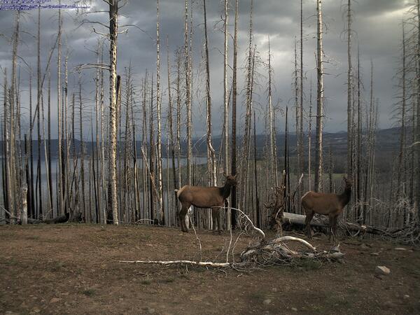
Image of elk captured by the YVO mobile webcam on June 25, 2010
Image of elk captured by the YVO mobile webcam on June 25, 2010Image of elk captured by the YVO mobile webcam on June 25, 2010, when it was positioned atop Lake Butte with a view of the north side of Yellowstone Lake.
Image of elk captured by the YVO mobile webcam on June 25, 2010
Image of elk captured by the YVO mobile webcam on June 25, 2010Image of elk captured by the YVO mobile webcam on June 25, 2010, when it was positioned atop Lake Butte with a view of the north side of Yellowstone Lake.

Cross section through the trunk of a Yellowstone lodgepole pine
Cross section through the trunk of a Yellowstone lodgepole pineCross section through the trunk of a lodgepole pine tree from Cooking Hillside near Mud Volcano, Yellowstone National Park. The earliest date for this tree is 1916 and it died in 1990. Spongy white-gray areas are foam insulation that was injected into the sample to reinforce the structure of the wood.

Temperature data is collected from this data logger that is placed ...
Temperature data is collected from this data logger that is placed ...Data are collected every two minutes and sent by radio once per day to a server where values are plotted and released to the public internet.
Temperature data is collected from this data logger that is placed ...
Temperature data is collected from this data logger that is placed ...Data are collected every two minutes and sent by radio once per day to a server where values are plotted and released to the public internet.

Grey’s Landing Ignimbrite in Idaho part of Yellowstone Hotspot
Grey’s Landing Ignimbrite in Idaho part of Yellowstone HotspotThe Grey’s Landing Ignimbrite in Idaho (Dr. Thomas Knott, of the University of Leicester, England, gives the scale of the cliff). The entire cliff (and more not seen!) would have been deposited in a matter of moments as it welded to the land surface during a super eruption about 8.7 million years ago.

Geysers on the south pole of Saturn's moon Enceladus
Geysers on the south pole of Saturn's moon EnceladusThis two-image mosaic is one of the highest resolution views acquired by the Cassini spacecraft during its imaging survey of the geyser basin capping the southern hemisphere of Saturn's moon Enceladus.

Overview of central West Thumb Geyser Basin. USGS photo by Pat Shanks, 2009.
Overview of central West Thumb Geyser Basin. USGS photo by Pat Shanks, 2009.

Photo of the Madison Museum, Yellowstone National Park
Photo of the Madison Museum, Yellowstone National ParkPhoto of the Madison Museum, built in 1930 and designed by Herbert Maier. This structure exemplifies the National Park Rustic style, using natural materials and artisan craftmanship that are intended to blend buildings into the surrounding environment, “suggesting the smallness of man in relation to nature” (Herbert Maier).
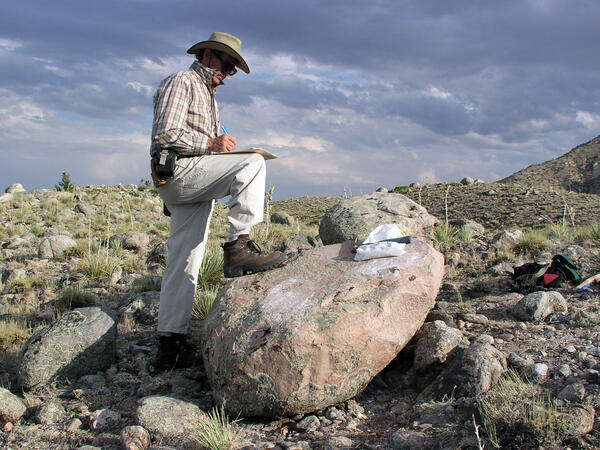
Ken Pierce in the field with large glacial erratic
Ken Pierce in the field with large glacial erraticKen Pierce in the field with a large glacial erratic in the Clarks Fork moraines taking detailed notes and annotating a map in progress.
Ken Pierce in the field with large glacial erratic
Ken Pierce in the field with large glacial erraticKen Pierce in the field with a large glacial erratic in the Clarks Fork moraines taking detailed notes and annotating a map in progress.

Bob Fournier measuring the gas-to-water ratio (gas/steam) at drill site Y2 in Yellowstone National Park
Bob Fournier measuring the gas-to-water ratio (gas/steam) at drill site Y2 in Yellowstone National ParkBob Fournier measuring the gas-to-water ratio (gas/steam) at drill site Y2, near Hot Lake on Firehole Lake Drive in Lower Geyser Basin, Yellowstone National Park, in the late 1960s. USGS Photo.

Yellowstone caldera viewed from Mount Washburn. The caldera is the low-lying area extending from the foothills of Mount Washburn in the foreground to the rugged mountains on the horizon. The incised valley of the Yellowstone River stretches from left to right in the middle distance. Steep valley walls are illuminated by sunlight in the center. 
Yellowstone caldera viewed from Mount Washburn. The caldera is the low-lying area extending from the foothills of Mount Washburn in the foreground to the rugged mountains on the horizon. The incised valley of the Yellowstone River stretches from left to right in the middle distance. Steep valley walls are illuminated by sunlight in the center. 

Hydrothermal explosion at Biscuit Basin in YNP. These types of even...
Hydrothermal explosion at Biscuit Basin in YNP. These types of even...Hydrothermal explosion at Biscuit Basin in Yellowstone National Park. These types of events are the most likely explosive hazard from the Yellowstone Volcano.
Hydrothermal explosion at Biscuit Basin in YNP. These types of even...
Hydrothermal explosion at Biscuit Basin in YNP. These types of even...Hydrothermal explosion at Biscuit Basin in Yellowstone National Park. These types of events are the most likely explosive hazard from the Yellowstone Volcano.