U.S. flag

An official website of the United States government

Multimedia

Images

Plot of size versus annual probability for hydrothermal explosion craters in Yellowstone National Park

Plot of size versus annual probability for hydrothermal explosion craters in Yellowstone National Park. The line is a model based on the energy required to form a crater of a specific size, and it is fit to known hydrothermal explosion craters in Yellowstone National Park.

Plot of size versus annual probability for hydrothermal explosion craters in Yellowstone National Park. The line is a model based on the energy required to form a crater of a specific size, and it is fit to known hydrothermal explosion craters in Yellowstone National Park.

Graph showing explosions recorded at Black Diamond Pool in Biscuit Basin, Yellowstone National Park, during 2006 through 2016

Graph showing explosions recorded at Black Diamond Pool in Biscuit Basin, Yellowstone National Park, during 2006 through 2016. Confirmed events refer to eruptions that were witnessed, recorded by temperature loggers, or inferred from their aftermath. Unconfirmed events refer to eruptions that were questionable or might have been misattributed to Black Diamond.

Graph showing explosions recorded at Black Diamond Pool in Biscuit Basin, Yellowstone National Park, during 2006 through 2016. Confirmed events refer to eruptions that were witnessed, recorded by temperature loggers, or inferred from their aftermath. Unconfirmed events refer to eruptions that were questionable or might have been misattributed to Black Diamond.

Photomicrograph showing a quartz-hosted embayment from the Mesa Falls Tuff, accompanied by a map showing the location of the tuff in eastern Idaho.
Quartz-hosted embayment from the Mesa Falls Tuff

(A) Photomicrograph of a quartz-hosted embayment from the Mesa Falls Tuff. “MI” indicates a glassy inclusion of melt within the crystal. (B) Thickness (in centimeters) and extent of the Mesa Falls ash flow deposit (pink areas) and its source, Henrys Fork Caldera (dashed line).  Figure by Kenneth Befus, University of Texas at Austin.

(A) Photomicrograph of a quartz-hosted embayment from the Mesa Falls Tuff. “MI” indicates a glassy inclusion of melt within the crystal. (B) Thickness (in centimeters) and extent of the Mesa Falls ash flow deposit (pink areas) and its source, Henrys Fork Caldera (dashed line).  Figure by Kenneth Befus, University of Texas at Austin.

Photomicrograph showing water distribution in a quartz-hosted embayment, with greater concentrations at the embayment mouth. Includes a plot showing that the temperature in which the water circulated must have been about 500 degrees Celsius.
Water distribution in a quartz-hosted embayment from the Mesa Falls Tuff

(A) Water distribution in a quartz-hosted embayment measured with synchrotron Fourier Transform Infrared spectroscopy. Warmer colors indicate higher concentrations of water.  Dashed line shows a transect of water content that is modeled in panel (B) to indicate that the emplacement temperature of the ash flow deposit must have been about 500 °C (930 °F).

(A) Water distribution in a quartz-hosted embayment measured with synchrotron Fourier Transform Infrared spectroscopy. Warmer colors indicate higher concentrations of water.  Dashed line shows a transect of water content that is modeled in panel (B) to indicate that the emplacement temperature of the ash flow deposit must have been about 500 °C (930 °F).

Shaded relief location map for the East Gallatin-Reese Creek fault system in northwest Yellowstone National Park

Shaded relief location map for the East Gallatin-Reese Creek fault system (EGRCFS) in northwest Yellowstone National Park (YNP). The location of the EGRCFS is shown as mapped in the U.S.

Shaded relief location map for the East Gallatin-Reese Creek fault system (EGRCFS) in northwest Yellowstone National Park (YNP). The location of the EGRCFS is shown as mapped in the U.S.

Lidar hillshade maps of fault scarps that offset Pinedale glacial till along the East Gallatin-Reese Creek fault system, Yellowstone National Park

Lidar hillshade maps of fault scarps that offset Pinedale glacial till along the East Gallatin-Reese Creek fault system (EGRCFS) near Fawn Creek (A) and Panther Creek (B). Fault scarps are visible as darker lineaments in the hillshade and are marked by the black arrows. Red rectangles on inset maps show location along the EGRCFS.

Lidar hillshade maps of fault scarps that offset Pinedale glacial till along the East Gallatin-Reese Creek fault system (EGRCFS) near Fawn Creek (A) and Panther Creek (B). Fault scarps are visible as darker lineaments in the hillshade and are marked by the black arrows. Red rectangles on inset maps show location along the EGRCFS.

Videos

Is there oil in Yellowstone? Is there oil in Yellowstone? (Yellowstone Monthly Update - September 2024)
Is there oil in Yellowstone? (Yellowstone Monthly Update - September 2024)

Is it true that there's oil in Yellowstone? Watch this month's Yellowstone Monthly update and find out.

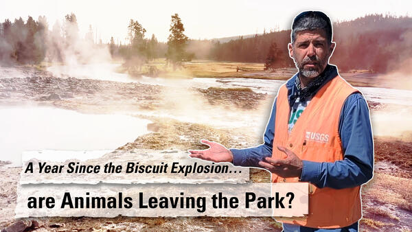
Update Biscuit Basin Biscuit Basin Update; 65th Anniversary — M7.3 Hebgen Lake Quake (Yellowstone Monthly Update - Aug 2024)
Biscuit Basin Update; 65th Anniversary — M7.3 Hebgen Lake Quake (Yellowstone Monthly Update - Aug 2024)

In this month's video, we update you on the Biscuit Basin explosion on July 23, 2024, and discuss the 65th anniversary of the M7.3 Hegben Lake earthquake. 
 

Large cloud of smoke and rock rising from the air. Hydrothermal Explosion in Yellowstone's Biscuit Basin (July 23, 2024)
Hydrothermal Explosion in Yellowstone's Biscuit Basin (July 23, 2024)

What just happened at Biscuit Basin in Yellowstone National Park? Kaboom! Visitors witnessed a towering plume of steam, rock and mud rise several hundred feet into the air. The brief July 23 event was a classic example of a hydrothermal explosion, not a volcanic eruption.

What just happened at Biscuit Basin in Yellowstone National Park? Kaboom! Visitors witnessed a towering plume of steam, rock and mud rise several hundred feet into the air. The brief July 23 event was a classic example of a hydrothermal explosion, not a volcanic eruption.

Morning Glory Pool Was Blue? Morning Glory Pool Was Blue? (Yellowstone Monthly Update - July 2024)
Morning Glory Pool Was Blue? (Yellowstone Monthly Update - July 2024)

The beautiful Morning Glory pool is located near Old Faithful. However, it has changed over time because of people and  past climate. But how? 

The beautiful Morning Glory pool is located near Old Faithful. However, it has changed over time because of people and  past climate. But how? 

Swimming Pools at Yellowstone? Swimming Pools at Yellowstone? (Yellowstone Monthly Update - June 2024)
Swimming Pools at Yellowstone? (Yellowstone Monthly Update - June 2024)

Up until the 1950s, visitors to the Old Faithful area could take a dip. Not at a geyser, but in a real swimming pool. The full story is in this month’s video update. 

Up until the 1950s, visitors to the Old Faithful area could take a dip. Not at a geyser, but in a real swimming pool. The full story is in this month’s video update. 

Mount St. Helens vs. Yellowstone Mount St. Helens VS Yellowstone (Yellowstone Monthly Update - May 2024)
Mount St. Helens VS Yellowstone (Yellowstone Monthly Update - May 2024)

Mount St. Helens and Yellowstone are two of the most well-known volcanoes in the United States. They have some pretty obvious differences, but they have some similarities as well. So, just how similar are Mount St. Helens and Yellowstone?

Mount St. Helens and Yellowstone are two of the most well-known volcanoes in the United States. They have some pretty obvious differences, but they have some similarities as well. So, just how similar are Mount St. Helens and Yellowstone?

Audio

Sounds of Yellowstone, Steamboat Geyser
Thumbnail for Steamboat Geyser in the Sounds of Yellowstone podcast
Steamboat Geyser — Sounds of Yellowstone (ASMR, Sleep, Concentration)
Sounds of Yellowstone, Steamboat Geyser
Thumbnail for Steamboat Geyser in the Sounds of Yellowstone podcast
Steamboat Geyser — Sounds of Yellowstone (ASMR, Sleep, Concentration)

Need time to concentrate or relax? Then listen to the gurgling and bubbly sounds of Steamboat Geyser in Yellowstone National Park, Wyoming. "Steamboat Geyser is the world’s tallest active geyser. It showers watchers and drenches the walkway. Days, months, or years pass between the major eruptions of Steamboat Geyser.

Need time to concentrate or relax? Then listen to the gurgling and bubbly sounds of Steamboat Geyser in Yellowstone National Park, Wyoming. "Steamboat Geyser is the world’s tallest active geyser. It showers watchers and drenches the walkway. Days, months, or years pass between the major eruptions of Steamboat Geyser.

USGS CoreCast
USGS CoreCast Series
Is Something Brewing in Yellowstone?
USGS CoreCast
USGS CoreCast Series
Is Something Brewing in Yellowstone?

Yellowstone National Park has experienced several hundred small earthquakes in the past few weeks. So what's going on?

Dr. Jake Lowenstern, USGS Scientist-In-Charge at the Yellowstone Volcano Observatory, tells us what's happening and how scientists monitor volcano and earthquake activity at Yellowstone.

Webcams

Overlooking forest and lake
Webcam at Yellowstone Lake

The camera view is south-southeast over Yellowstone Lake from the cell phone tower near Fishing Bridge. Stevenson Island is visible within the lake on the right. The view extends down the Southeast Arm between the Promontory (low ridge rising from the lake) and the eastern shore.

The camera view is south-southeast over Yellowstone Lake from the cell phone tower near Fishing Bridge. Stevenson Island is visible within the lake on the right. The view extends down the Southeast Arm between the Promontory (low ridge rising from the lake) and the eastern shore.

View of Old Faithful geyser from a distance
Old Faithful Live-streaming

View of the Old Faithful geyser live-streaming webcam provided by the National Park Service.

View of the Old Faithful geyser live-streaming webcam provided by the National Park Service.

Was this page helpful?