
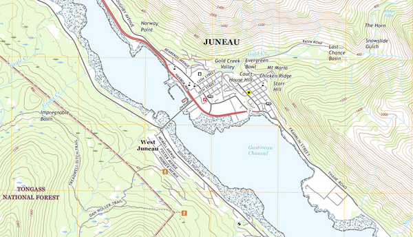
topoBuilder
Create custom USGS topographic maps on demand using the best available data from The National Map
Create custom USGS topographic maps on demand using the best available data from The National Map
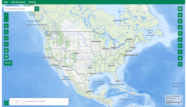
The National Map - Data Delivery
This site offers applications, web services, data downloads, topographic maps and other tools dedicated to delivering topographic information for the Nation. Users can access geographic information system (GIS) data and topographic maps related to elevation, hydrography, geographic names, governmental boundaries, structures and transportation.
Access The National Map through various applications and visualizations
Media
Sources/Usage: Public Domain. View Media Details
News
New Training Video: Overview of the National Map Viewer Application
New Training Video: Overview of the National Map Viewer Application
Regional View, Reliable Data: Introducing the USGS 250K Topo
Regional View, Reliable Data: Introducing the USGS 250K Topo
Adventure awaits: USGS releases detailed topographic maps designed for recreational use
Adventure awaits: USGS releases detailed topographic maps designed for recreational use
Publications
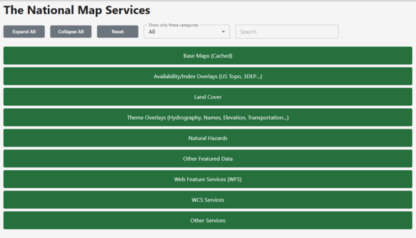
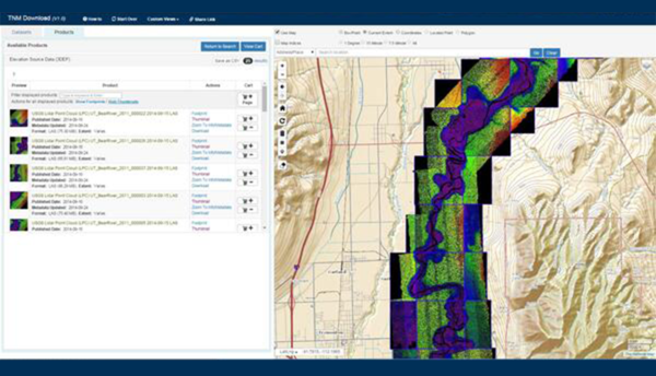
The National Map—New data delivery homepage, advanced viewer, lidar visualization The National Map—New data delivery homepage, advanced viewer, lidar visualization
As one of the cornerstones of the U.S. Geological Survey’s (USGS) National Geospatial Program, The National Map is a collaborative effort among the USGS and other Federal, State, and local partners to improve and deliver topographic information for the Nation. The National Map is featuring direct links to new and improved GIS data access utilities on a refreshed data delivery homepage at...