
Topographic Map Access Points
topoBuilder
Create custom USGS topographic maps on demand using the best available data from The National Map
Download Topo Maps from The National Map Downloader
Or Search, Download, and Visualize 3DEP Lidar and DEM Data
Browse, download, or purchase current and historical topographic maps of the United States.
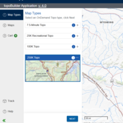
Create an OnDemand Topo
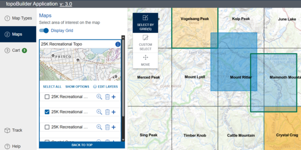
Build a USGS topographic map with choice of format, area of interest, scale, and National Map content.
Historical Topo Map Collection

topoView highlights one of the USGS's most important and useful products, the topographic map
Buy a Printed Map

Use the Map Locator Tool or search by keyword to purchase historical topos, US Topos, and more.
USGS Topographic Maps
Past, present, & next generation USGS topographic maps are available as a part of The National Map.
Visit Topographic Maps for more information on historical topographic maps, US Topo, and OnDemand Topos.
Accessing Topographic Maps
The table below shows how each type of topographic map may be found, with links to USGS web pages for more information across the top and direct application links in the left-hand column.
| USGS Topographic Map Products and Applications | Historical Topos | US Topo | OnDemand Topos | Other Maps |
| topoView | X | X | ||
| The National Map Downloader | X | X | ||
| USGS Store | X | X | X | |
| topoBuilder | X | |||
| The National Map Viewer | X* | |||
| US Topo Availability Web Service | X** | |||
| TNM Staged Products Directory | X | X | ||
| TNM Access API | X | X |
* Add US Topo Availability Service from Layer List and download from 'cloud_url' field
** Enable pop-ups or open attribute table to access download link in 'cloud_url' field
How do I decide which application to use?
There are several ways to access USGS topographic maps, each with their own unique advantages and interfaces.
- topoView has additional file formats (geospatial PDF, geoTIFF, JPEG, & KMZ) and is ideal for browsing and downloading individual historical topographic maps or US Topos.
- The National Map Downloader may be used to export up to 5000 historical topographic maps or US Topos at once and provides access to other TNM product downloads.
- The USGS Store is the only USGS website for purchasing printed historical topographic maps or US Topos. Many other maps are available to browse or order.
- topoBuilder is where custom topographic maps (OnDemand Topos) may be requested.
- The National Map Viewer allows users to explore National Map data through web services, including access to the most current US Topo Maps.
- The US Topo Availability Service enables the latest US Topos to be accessed from GIS applications.
- TNM Staged Products Directory contains all the same offerings as TNM Downloader without a map interface.
- TNM Access Application Programming Interface (API) provides developers with programmatic access to historical topographic maps and US Topo as well as other geospatial data products of The National Map.
Additional Resources
Topographic Maps Home
Topographic Map Training Videos
Access Lists of All Versions of US Topo & Historical Topographic Maps
Topographic Map Standards and Specifications

US Topo: Maps for America US Topo: Maps for America
topoBuilder topoBuilder
