
About
The U.S. Geological Survey, California Water Science Center (CAWSC) provides reliable, impartial, foundational data and scientific analysis to address water issues facing California today.

California's History of Large Storms & Floods California's History of Large Storms & Floods
California's largest storms, such as the atmospheric river events happening now, unleash torrential rain and intense winds, posing significant challenges to infrastructure and triggering widespread flooding. Photos in carousal above by Travis Apo, hydrologist and Anthony Smith, physical scientist
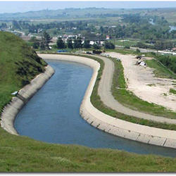
Central Valley Regional Overview Central Valley Regional Overview
The Central Valley, also known as the Great Valley of California, covers about 20,000 square miles and is one of the more notable structural depressions in the world. Occupying a central position in California, it is bounded by the Cascade Range to the north, the Sierra Nevada to the east, the Tehachapi Mountains to the south, and the Coast Ranges and San Francisco Bay to the west.

Central Valley Programs Central Valley Programs
Competition for water resources is growing throughout California, particularly in the Central Valley. Since 1980, the Central Valley's population has nearly doubled to 3.8 million people. Population growth, along with other factors, have created an intense demand for water. USGS Tools and information can be used to help manage the Central Valley aquifer system.

What We Do What We Do
We conduct hydrologic monitoring and investigative studies in partnership with Federal, State, and local agencies to assist them in managing California's water resources.

Partnering with Us Partnering with Us
Local, state, and federal agencies partner with the USGS through cooperative agreements to gain understanding of a variety of hydrogeologic issues that have broad public relevance.

Message from the Director Message from the Director
Thanks for visiting our USGS California Water Science Center website.