
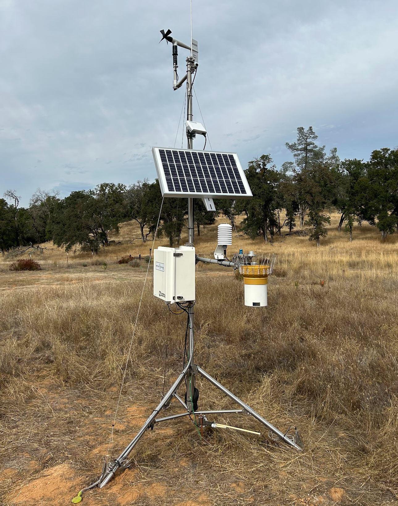
Modeling Climate, Water, and Land Conditions Around California Department of Fish and Wildlife Sentinel Sites
The California Department of Fish and Wildlife (CDFW) installed more than 40 climate and biodiversity monitoring stations, called sentinel sites, on public lands across the state. These sites collect detailed data on things like temperature, precipitation, soil moisture, and more to track how the environment is changing. Each site is meant to reflect conditions in the surrounding area, but sometimes the data doesn't match what's happening across the full landscape. To help solve this, USGS California Water Science Center scientists built high-resolution computer models that show how water moves through the land, and how plants are affected by climate, and how conditions change over time. These models use data from the stations and other sources to give a clearer picture of local and regional patterns. This helps land managers make decisions about conservation, restoration, and climate resilience on CDFW lands.

Problem Description
Data from monitoring stations is valuable, but they each represent a small area. Land managers often need information at a broader scale to guide restoration and conservation work. Because of differences in climate, soil, vegetation, and elevation across CDFW lands, a single station's data may not reflect nearby areas. Models are useful for connecting station data to surrounding landscapes and show how conditions vary over time and space.
Study Objectives
This study will combine data from the CDFW's sentinel sites with high-resolution watershed models. The goal is to better understand water balance, land conditions, and long-term climate trends around each site. These models will help managers see how the environment has changed in the past, and support future planning for restoration, biodiversity, and climate adaptation.
Study Approach
Scientists will build detailed watershed models using real-time data from the station, as well as climate records, elevation, soil properties, vegetation, and streamflow data. These Basin Characterization Models will simulate how water moves through the land, helping to explain local and regional patterns. Results will be shared through interactive tool [insert site Dam is building] and used to guide land and water management on CDFW properties.
The California Department of Fish and Wildlife (CDFW) installed more than 40 climate and biodiversity monitoring stations, called sentinel sites, on public lands across the state. These sites collect detailed data on things like temperature, precipitation, soil moisture, and more to track how the environment is changing. Each site is meant to reflect conditions in the surrounding area, but sometimes the data doesn't match what's happening across the full landscape. To help solve this, USGS California Water Science Center scientists built high-resolution computer models that show how water moves through the land, and how plants are affected by climate, and how conditions change over time. These models use data from the stations and other sources to give a clearer picture of local and regional patterns. This helps land managers make decisions about conservation, restoration, and climate resilience on CDFW lands.
Problem Description
Data from monitoring stations is valuable, but they each represent a small area. Land managers often need information at a broader scale to guide restoration and conservation work. Because of differences in climate, soil, vegetation, and elevation across CDFW lands, a single station's data may not reflect nearby areas. Models are useful for connecting station data to surrounding landscapes and show how conditions vary over time and space.
Study Objectives
This study will combine data from the CDFW's sentinel sites with high-resolution watershed models. The goal is to better understand water balance, land conditions, and long-term climate trends around each site. These models will help managers see how the environment has changed in the past, and support future planning for restoration, biodiversity, and climate adaptation.
Study Approach
Scientists will build detailed watershed models using real-time data from the station, as well as climate records, elevation, soil properties, vegetation, and streamflow data. These Basin Characterization Models will simulate how water moves through the land, helping to explain local and regional patterns. Results will be shared through interactive tool [insert site Dam is building] and used to guide land and water management on CDFW properties.