
Hydrology Monitoring Tools
The U.S. Geological Survey provides local and national web-based tools so that policy makers and the public can easily access the information they need to enhance preparedness, response, and resilience.
Local Monitoring Tools
Water Level and Salinity Analysis Mapper

This website is designed to provide automated statistical and graphical analyses on water-level and salinity data collected from sites monitored by the U.S. Geological Survey (USGS) in South Florida. Water level and salinity analyses were conducted, and tables and graphs of chloride and specific conductance data were produced using the R programming language. Data were retrieved from the USGS Water Services website (U.S. Geological Survey, 2018b) using the R language "dataRetrieval" package (Hirsch and De Cicco, 2015).
Hydrologic Conditions of Selected Reservoirs in Puerto Rico

This page provides current water surface elevations above NGVD 1929 in selected reservoirs, and water surface elevations for selected drought years. The purpose of these graphs is to compare current water surface elevations with water surface elevations observed during documented droughts.
Groundwater Levels of Selected Observation Wells in the South Coast of Puerto Rico
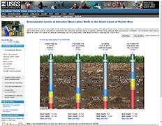
Depth-to-water is measured periodically to evaluate hydrologic conditions at important aquifers throughout Puerto Rico. The schematic below shows depth-to-water information for selected continuous recording observation wells along the South Coast aquifer, Puerto Rico.
Everglades Depth Estimation Network (EDEN)
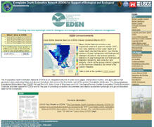
The Everglades Depth Estimation Network (EDEN) is an integrated network of water-level gages, interpolation models, and applications that generates daily water-level data and derived hydrologic data across the freshwater part of the greater Everglades landscape.
National Monitoring Tools
National Water Information System: Mapper
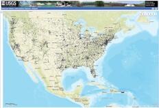
This interface provides a map view of the locations of sites with USGS water data.
USGS Water Data for the Nation

These pages provide access to water-resources data collected at approximately 1.9 million sites in all 50 States, the District of Columbia, Puerto Rico, the Virgin Islands, Guam, American Samoa and the Commonwealth of the Northern Mariana Islands. Online access to this
The USGS investigates the occurrence, quantity, quality, distribution, and movement of surface and underground waters and disseminates the data to the public, State and local governments, public and private utilities, and other Federal agencies involved with managing our water resources.
WaterAlert
The U.S. Geological Survey WaterAlert service sends e-mail or text (SMS) messages when certain parameters, as measured by a USGS real-time data-collection station, exceed user-definable thresholds. The development and maintenance of the WaterAlert system is supported by the USGS and its partners, including numerous federal, state, and local agencies.
Real-time data from USGS gages are transmitted via satellite or other telemetry to USGS offices at various intervals; in most cases, once every hour. Emergency transmissions, such as during floods, may be more frequent. Notifications will be based on the data received at these site-dependent intervals.
WaterWatch
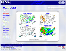
WaterWatch (http://waterwatch.usgs.gov) is a U.S. Geological Survey (USGS) World Wide Web site that displays maps, graphs, and tables describing real-time, recent, and past streamflow conditions for the United States. The real-time information generally is updated on an hourly basis. WaterWatch provides streamgage-based maps that show the location of more than 3,000 long-term (30 years or more) USGS streamgages; use colors to represent streamflow conditions compared to historical streamflow; feature a point-and-click interface allowing users to retrieve graphs of stream stage (water elevation) and flow; and highlight locations where extreme hydrologic events, such as floods and droughts, are occurring. more..
WaterNow
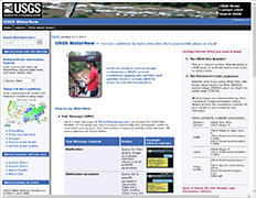
USGS WaterNow – Current-conditions for water data directly to your mobile phone or email.
Send an email or text message containing a USGS current-conditions gaging site number and quickly receive a reply with its most recent observation(s).
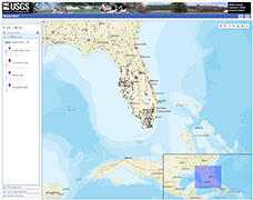
Gulf of Mexico Dashboard
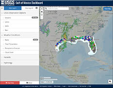
This map viewer is designed to show real-time water data collected at USGS observation stations in context with weather-related data from other public sources.
The U.S. Geological Survey provides local and national web-based tools so that policy makers and the public can easily access the information they need to enhance preparedness, response, and resilience.
Local Monitoring Tools
Water Level and Salinity Analysis Mapper
This website is designed to provide automated statistical and graphical analyses on water-level and salinity data collected from sites monitored by the U.S. Geological Survey (USGS) in South Florida. Water level and salinity analyses were conducted, and tables and graphs of chloride and specific conductance data were produced using the R programming language. Data were retrieved from the USGS Water Services website (U.S. Geological Survey, 2018b) using the R language "dataRetrieval" package (Hirsch and De Cicco, 2015).
Hydrologic Conditions of Selected Reservoirs in Puerto Rico
This page provides current water surface elevations above NGVD 1929 in selected reservoirs, and water surface elevations for selected drought years. The purpose of these graphs is to compare current water surface elevations with water surface elevations observed during documented droughts.
Groundwater Levels of Selected Observation Wells in the South Coast of Puerto Rico
Depth-to-water is measured periodically to evaluate hydrologic conditions at important aquifers throughout Puerto Rico. The schematic below shows depth-to-water information for selected continuous recording observation wells along the South Coast aquifer, Puerto Rico.
Everglades Depth Estimation Network (EDEN)
The Everglades Depth Estimation Network (EDEN) is an integrated network of water-level gages, interpolation models, and applications that generates daily water-level data and derived hydrologic data across the freshwater part of the greater Everglades landscape.
National Monitoring Tools
National Water Information System: Mapper
This interface provides a map view of the locations of sites with USGS water data.
USGS Water Data for the Nation
These pages provide access to water-resources data collected at approximately 1.9 million sites in all 50 States, the District of Columbia, Puerto Rico, the Virgin Islands, Guam, American Samoa and the Commonwealth of the Northern Mariana Islands. Online access to this
The USGS investigates the occurrence, quantity, quality, distribution, and movement of surface and underground waters and disseminates the data to the public, State and local governments, public and private utilities, and other Federal agencies involved with managing our water resources.
WaterAlert
The U.S. Geological Survey WaterAlert service sends e-mail or text (SMS) messages when certain parameters, as measured by a USGS real-time data-collection station, exceed user-definable thresholds. The development and maintenance of the WaterAlert system is supported by the USGS and its partners, including numerous federal, state, and local agencies.
Real-time data from USGS gages are transmitted via satellite or other telemetry to USGS offices at various intervals; in most cases, once every hour. Emergency transmissions, such as during floods, may be more frequent. Notifications will be based on the data received at these site-dependent intervals.
WaterWatch
WaterWatch (http://waterwatch.usgs.gov) is a U.S. Geological Survey (USGS) World Wide Web site that displays maps, graphs, and tables describing real-time, recent, and past streamflow conditions for the United States. The real-time information generally is updated on an hourly basis. WaterWatch provides streamgage-based maps that show the location of more than 3,000 long-term (30 years or more) USGS streamgages; use colors to represent streamflow conditions compared to historical streamflow; feature a point-and-click interface allowing users to retrieve graphs of stream stage (water elevation) and flow; and highlight locations where extreme hydrologic events, such as floods and droughts, are occurring. more..
WaterNow
USGS WaterNow – Current-conditions for water data directly to your mobile phone or email.
Send an email or text message containing a USGS current-conditions gaging site number and quickly receive a reply with its most recent observation(s).
Gulf of Mexico Dashboard
This map viewer is designed to show real-time water data collected at USGS observation stations in context with weather-related data from other public sources.