
Sea Level Rise and Climate: Impacts on the Greater Everglades Ecosystem and Restoration
The Greater Everglades Ecosystem covers much of south Florida, and the highest areas are only a few meters above sea level. Predictions of sea level rise and changes in storm intensity for the 21st century are particularly concerning to the urban population of Miami and the east coast, but also represent a challenge to Everglades National Park and Biscayne National Park resource managers. The Greater Everglades Ecosystem is undergoing a large-scale restoration effort and decisions need to be made that will affect the system for the next 20 to 30 years. Our project is designed to examine responses of the ecosystem to past sea level and climate changes to better understand coastal resiliency.

Project Lead: G. Lynn Wingard
FBGC Project Members: Miriam Jones, Bethany Stackhouse, Sarah Bergstresser, Kristen Hoefke, Bryan Landacre, Christopher Bernhardt
Other USGS Project Members: Andre Daniels, Marci Marot
Collaborator: Anna Wachnicka (FIU / SFWMD)
The urban and natural landscapes of south Florida are vulnerable to flooding from sea level rise and coastal storm surges for several reasons, including low elevation, lack of topographic relief to promote drainage, and a water table that is at or very close to the land surface. With the current rate of relative sea level rise in south Florida estimated to be between 2.4-3.7 mm/year and rising, it is vital for urban planners and resource managers to understand how vulnerable the coast is to retreat and inundation.
Understanding how the natural (pre-human alteration) environment of south Florida has responded to previous changes in sea level and climate variability is an important first step to predicting what will happen over the next century. What factors make the coast more resilient? What are the most important drivers of coastal change? What is the role of mangroves and coastal vegetation in coastal resiliency? The answers to these questions can be found by studying the record preserved in sediment cores collected throughout south Florida. The layers in the cores are analyzed for physical and biological clues that tell us how the environment has changed over time. The sequence of changes seen in the cores provides information about the factors that drive these changes, such as fluctuations in storm frequency or strength, increased or decreased sea level, or loss of key species such as mangroves and sea grass beds.

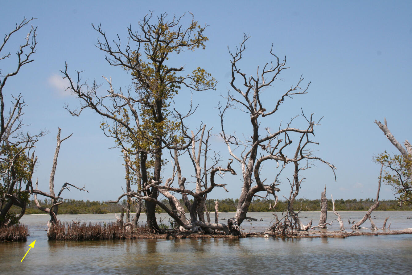
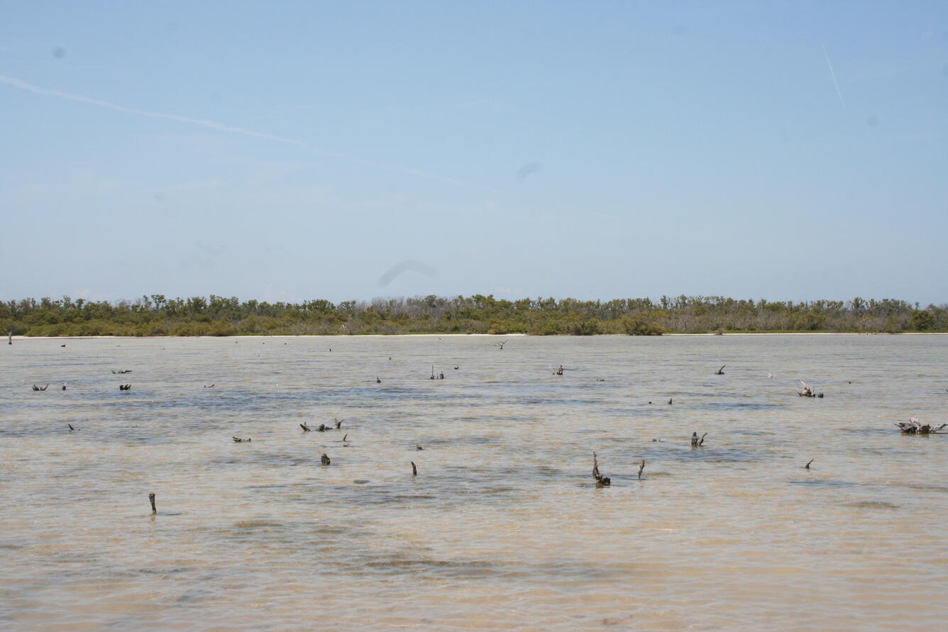
An important part of interpreting past environmental history in cores is understanding how physical and biological processes interact in the present and what are the ecological requirements of key species. By studying the present, we are better able to interpret the past record in the cores, which in turn can give us insights into what the future will look like. An especially important factor in coastal change in south Florida are hurricanes, and since 1888 twenty-one major hurricanes (category 3 or above on the Saffir-Simpson scale) have made landfall within an approximately 100-mile radius of Florida Bay, where many of our cores are located. Detailed scientific investigations have been conducted following a few of these storms, and this information provides us with a means to look at the decadal-scale impacts of storms on the coastline. In September 2017, Hurricane Irma passed just west of our field sites, giving us a first-hand look at the immediate impact of storms on the mangrove coastline. By combining our observations of ongoing changes in the coastline with the 3000 to 5000 year record preserved in our cores, we are providing resource managers and urban planners with a better understanding of the natural processes of coastal change, the rates of response of the system to these changes, and what factors contribute to coastal resiliency.


The Greater Everglades Ecosystem covers much of south Florida, and the highest areas are only a few meters above sea level. Predictions of sea level rise and changes in storm intensity for the 21st century are particularly concerning to the urban population of Miami and the east coast, but also represent a challenge to Everglades National Park and Biscayne National Park resource managers. The Greater Everglades Ecosystem is undergoing a large-scale restoration effort and decisions need to be made that will affect the system for the next 20 to 30 years. Our project is designed to examine responses of the ecosystem to past sea level and climate changes to better understand coastal resiliency.
Project Lead: G. Lynn Wingard
FBGC Project Members: Miriam Jones, Bethany Stackhouse, Sarah Bergstresser, Kristen Hoefke, Bryan Landacre, Christopher Bernhardt
Other USGS Project Members: Andre Daniels, Marci Marot
Collaborator: Anna Wachnicka (FIU / SFWMD)
The urban and natural landscapes of south Florida are vulnerable to flooding from sea level rise and coastal storm surges for several reasons, including low elevation, lack of topographic relief to promote drainage, and a water table that is at or very close to the land surface. With the current rate of relative sea level rise in south Florida estimated to be between 2.4-3.7 mm/year and rising, it is vital for urban planners and resource managers to understand how vulnerable the coast is to retreat and inundation.
Understanding how the natural (pre-human alteration) environment of south Florida has responded to previous changes in sea level and climate variability is an important first step to predicting what will happen over the next century. What factors make the coast more resilient? What are the most important drivers of coastal change? What is the role of mangroves and coastal vegetation in coastal resiliency? The answers to these questions can be found by studying the record preserved in sediment cores collected throughout south Florida. The layers in the cores are analyzed for physical and biological clues that tell us how the environment has changed over time. The sequence of changes seen in the cores provides information about the factors that drive these changes, such as fluctuations in storm frequency or strength, increased or decreased sea level, or loss of key species such as mangroves and sea grass beds.
An important part of interpreting past environmental history in cores is understanding how physical and biological processes interact in the present and what are the ecological requirements of key species. By studying the present, we are better able to interpret the past record in the cores, which in turn can give us insights into what the future will look like. An especially important factor in coastal change in south Florida are hurricanes, and since 1888 twenty-one major hurricanes (category 3 or above on the Saffir-Simpson scale) have made landfall within an approximately 100-mile radius of Florida Bay, where many of our cores are located. Detailed scientific investigations have been conducted following a few of these storms, and this information provides us with a means to look at the decadal-scale impacts of storms on the coastline. In September 2017, Hurricane Irma passed just west of our field sites, giving us a first-hand look at the immediate impact of storms on the mangrove coastline. By combining our observations of ongoing changes in the coastline with the 3000 to 5000 year record preserved in our cores, we are providing resource managers and urban planners with a better understanding of the natural processes of coastal change, the rates of response of the system to these changes, and what factors contribute to coastal resiliency.