
At the Idaho National Laboratory Project Office (INLPO), our drilling team employs advanced downhole video cameras to capture both vertical and horizontal views of boreholes. This technology enables us to assess borehole integrity prior to the installation of water well casing, well screens, and submersible pumps. Hydrologists and geologists analyze these images to validate geophysical data, including changes in rock type, geological structures, rock fractures, and groundwater movement.
Our scientists utilize wireline geophysical techniques to gather data that characterize subsurface rock types, sediments, and fluids. The geophysical data collected for each well are systematically recorded, interpreted, and presented as geophysical logs using specialized software such as WellCAD™. These logs are essential for engineers and well drillers, facilitating informed decision-making regarding well construction, including the design and placement of well casing, screens, and pumps. Additionally, hydrologists, geologists, and other specialists use these logs to address complex groundwater hydrology issues. Access to geophysical log data is available through the USGS GeoLog Locator.
Downhole Video
The use of downhole video offers several advantages:
- Efficiency: Quick and cost-effective data collection.
- Real-Time Viewing: Output can be viewed in real-time in the field.
- No Additional Processing: Eliminates the need for plotting and processing.
- Digital Transmission: Digital files can be transmitted directly from the field.
Recent technological advancements have enhanced our downhole video capabilities, including the integration of a digital water well inspection system. This system features a digital recording setup, improved operator controls, and enhanced video editing capabilities. Video recordings are available in MPEG-4 format.
Dual-View Video from USGS 131A
This short clip demonstrates how we utilize our dual-view video camera to identify fractures within the aquifer. For more video content, refer to Twining and others, 2010.
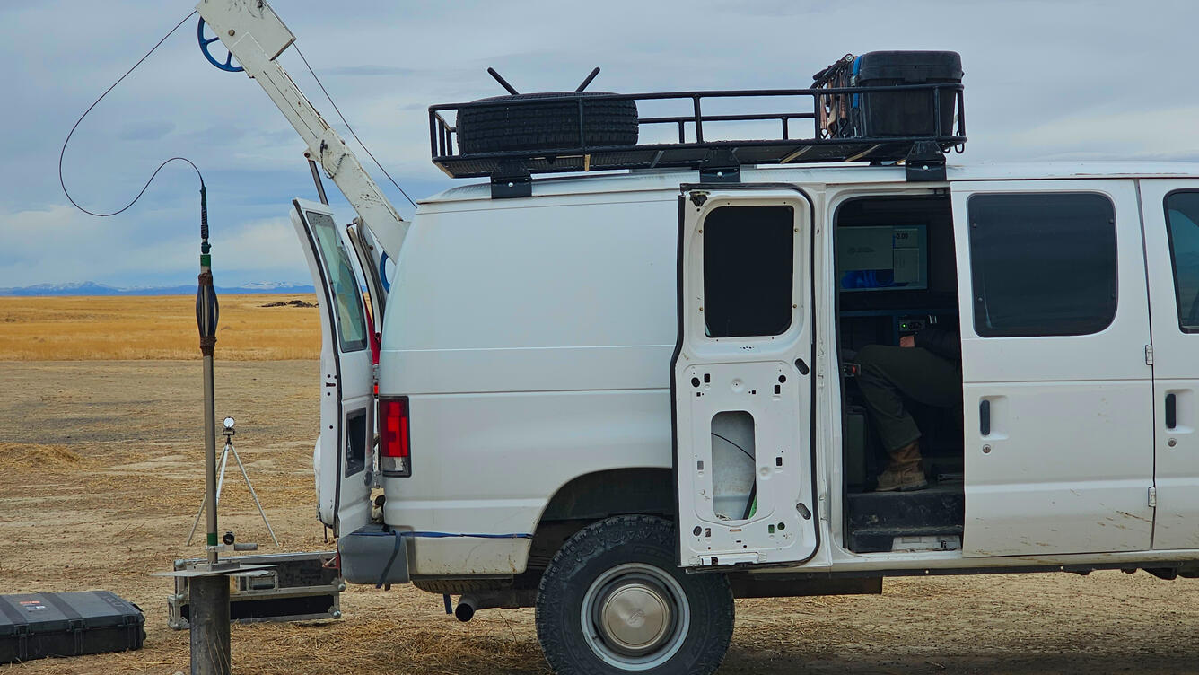
Geophysical Logging Equipment
Our geophysical logging system has a depth capacity of 3,200 feet and incorporates multiple sensors to collect comprehensive data. Each sensor's response is transmitted to logging equipment at the surface, where it is recorded and plotted to produce a log trace. Variations in sensor responses along the well's depth provide valuable insights into subsurface conditions. Our staff possesses extensive experience in collecting and interpreting geophysical data in both fractured rock and sediment aquifer systems.
Key Geophysical Logging Tools and Their Applications:
- Natural Gamma: Measures changes in background gamma activity for stratigraphic correlation and lithology.
Logging Tools: 9057, 9055, 0024, 9042, 9074, 9041, 9055, 9095
Specifications: NaI scintillation detector - Neutron: Measures neutron flux attenuation for saturated porosity and moisture content.
Logging Tools: 9057, 9055
Specifications: He3 detector, 1.0 Curie, Am-241/Be source - Gamma Gamma: Measures omni-directional density for apparent density changes and lithology.
Logging Tools: 0024
Specifications: Requires 0.2 Curie Cs-137 source - Flow: Measures vertical borehole flow to identify entry and exit points.
Logging Tools: 9721
Specifications: EM flowmeter - Temperature: Measures borehole fluid temperature and specific conductance.
Logging Tools: 9042, 9057, 9721 - Normal Resistivity: Measures formation resistivity for lithology and porosity.
Logging Tools: 9057 - Spontaneous Potential: Measures electrical potential between the borehole and grounded surface voltage.
Logging Tools: 9057, 9055 - Single-Point Resistance: Measures resistance of rock and saturating fluid for lithology and water-quality.
Logging Tools: 9057, 9055 - Fluid Resistivity: Measures borehole fluid resistivity for flow and water-quality changes.
Logging Tools: 9042, 9721 - Mechanical Caliper: Measures borehole diameter for fracture identification and volume calculations.
Logging Tools: 9074, 8074, 9065 - Gyroscope Borehole Deviation: Measures horizontal deviation from vertical.
Logging Tools: 9095 - Downhole Fluid Sampler: Collects groundwater samples at pre-selected depths.
Logging Tools: 9750 - Acoustic Televiewer: Measures strike and dip of bedding and characterizes fractures.
Logging Tools: 9804
At the Idaho National Laboratory Project Office (INLPO), our drilling team employs advanced downhole video cameras to capture both vertical and horizontal views of boreholes. This technology enables us to assess borehole integrity prior to the installation of water well casing, well screens, and submersible pumps. Hydrologists and geologists analyze these images to validate geophysical data, including changes in rock type, geological structures, rock fractures, and groundwater movement.
Our scientists utilize wireline geophysical techniques to gather data that characterize subsurface rock types, sediments, and fluids. The geophysical data collected for each well are systematically recorded, interpreted, and presented as geophysical logs using specialized software such as WellCAD™. These logs are essential for engineers and well drillers, facilitating informed decision-making regarding well construction, including the design and placement of well casing, screens, and pumps. Additionally, hydrologists, geologists, and other specialists use these logs to address complex groundwater hydrology issues. Access to geophysical log data is available through the USGS GeoLog Locator.
Downhole Video
The use of downhole video offers several advantages:
- Efficiency: Quick and cost-effective data collection.
- Real-Time Viewing: Output can be viewed in real-time in the field.
- No Additional Processing: Eliminates the need for plotting and processing.
- Digital Transmission: Digital files can be transmitted directly from the field.
Recent technological advancements have enhanced our downhole video capabilities, including the integration of a digital water well inspection system. This system features a digital recording setup, improved operator controls, and enhanced video editing capabilities. Video recordings are available in MPEG-4 format.
Dual-View Video from USGS 131A
This short clip demonstrates how we utilize our dual-view video camera to identify fractures within the aquifer. For more video content, refer to Twining and others, 2010.
Geophysical Logging Equipment
Our geophysical logging system has a depth capacity of 3,200 feet and incorporates multiple sensors to collect comprehensive data. Each sensor's response is transmitted to logging equipment at the surface, where it is recorded and plotted to produce a log trace. Variations in sensor responses along the well's depth provide valuable insights into subsurface conditions. Our staff possesses extensive experience in collecting and interpreting geophysical data in both fractured rock and sediment aquifer systems.
Key Geophysical Logging Tools and Their Applications:
- Natural Gamma: Measures changes in background gamma activity for stratigraphic correlation and lithology.
Logging Tools: 9057, 9055, 0024, 9042, 9074, 9041, 9055, 9095
Specifications: NaI scintillation detector - Neutron: Measures neutron flux attenuation for saturated porosity and moisture content.
Logging Tools: 9057, 9055
Specifications: He3 detector, 1.0 Curie, Am-241/Be source - Gamma Gamma: Measures omni-directional density for apparent density changes and lithology.
Logging Tools: 0024
Specifications: Requires 0.2 Curie Cs-137 source - Flow: Measures vertical borehole flow to identify entry and exit points.
Logging Tools: 9721
Specifications: EM flowmeter - Temperature: Measures borehole fluid temperature and specific conductance.
Logging Tools: 9042, 9057, 9721 - Normal Resistivity: Measures formation resistivity for lithology and porosity.
Logging Tools: 9057 - Spontaneous Potential: Measures electrical potential between the borehole and grounded surface voltage.
Logging Tools: 9057, 9055 - Single-Point Resistance: Measures resistance of rock and saturating fluid for lithology and water-quality.
Logging Tools: 9057, 9055 - Fluid Resistivity: Measures borehole fluid resistivity for flow and water-quality changes.
Logging Tools: 9042, 9721 - Mechanical Caliper: Measures borehole diameter for fracture identification and volume calculations.
Logging Tools: 9074, 8074, 9065 - Gyroscope Borehole Deviation: Measures horizontal deviation from vertical.
Logging Tools: 9095 - Downhole Fluid Sampler: Collects groundwater samples at pre-selected depths.
Logging Tools: 9750 - Acoustic Televiewer: Measures strike and dip of bedding and characterizes fractures.
Logging Tools: 9804