
Brian V Twining
Brian Twining is the Chief of the USGS Idaho Water Science Center's Idaho National Laboratory Project Office in Idaho Falls, Idaho.
Brian has served with the USGS Idaho National Laboratory Project Office since 1998. Prior to becoming the project office chief, he led the geotechnical drilling and geophysical logging programs. His scientific research involves groundwater monitoring systems, aquifer testing, geophysical logging and data analysis, and project management and coordination.
Science and Products
INLPO Publications

INLPO Drilling and Coring
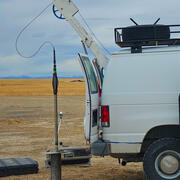
INLPO Geophysical and Video Logging
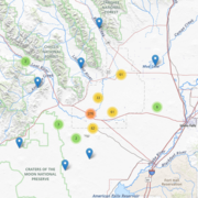
INLPO Monitoring Networks
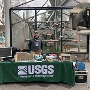
INLPO Outreach
Idaho National Laboratory Project Office (INLPO)
Science and Products
INLPO Publications
INLPO Drilling and Coring
INLPO Geophysical and Video Logging
INLPO Monitoring Networks
INLPO Outreach
Idaho National Laboratory Project Office (INLPO)
*Disclaimer: Listing outside positions with professional scientific organizations on this Staff Profile are for informational purposes only and do not constitute an endorsement of those professional scientific organizations or their activities by the USGS, Department of the Interior, or U.S. Government