
USGS Captures Critical Data During New England Flood
U.S. Geological Survey (USGS) is collecting record-breaking streamflow measurements in the days following a powerful two-day storm that dropped up to 9 inches of rain in parts of Vermont this week.

The storm’s intense rainfall caused extreme flooding in towns and cities, including the capital city of Montpelier, damaging homes and businesses and isolating residents.
The USGS New England Water Science Center collects and analyzes groundwater and surface water levels (also known as stage), river discharge, precipitation amounts and water-quality information. Flood crews were dispatched to streamgaging sites to measure flood waters in Vermont, New Hampshire and Massachusetts.
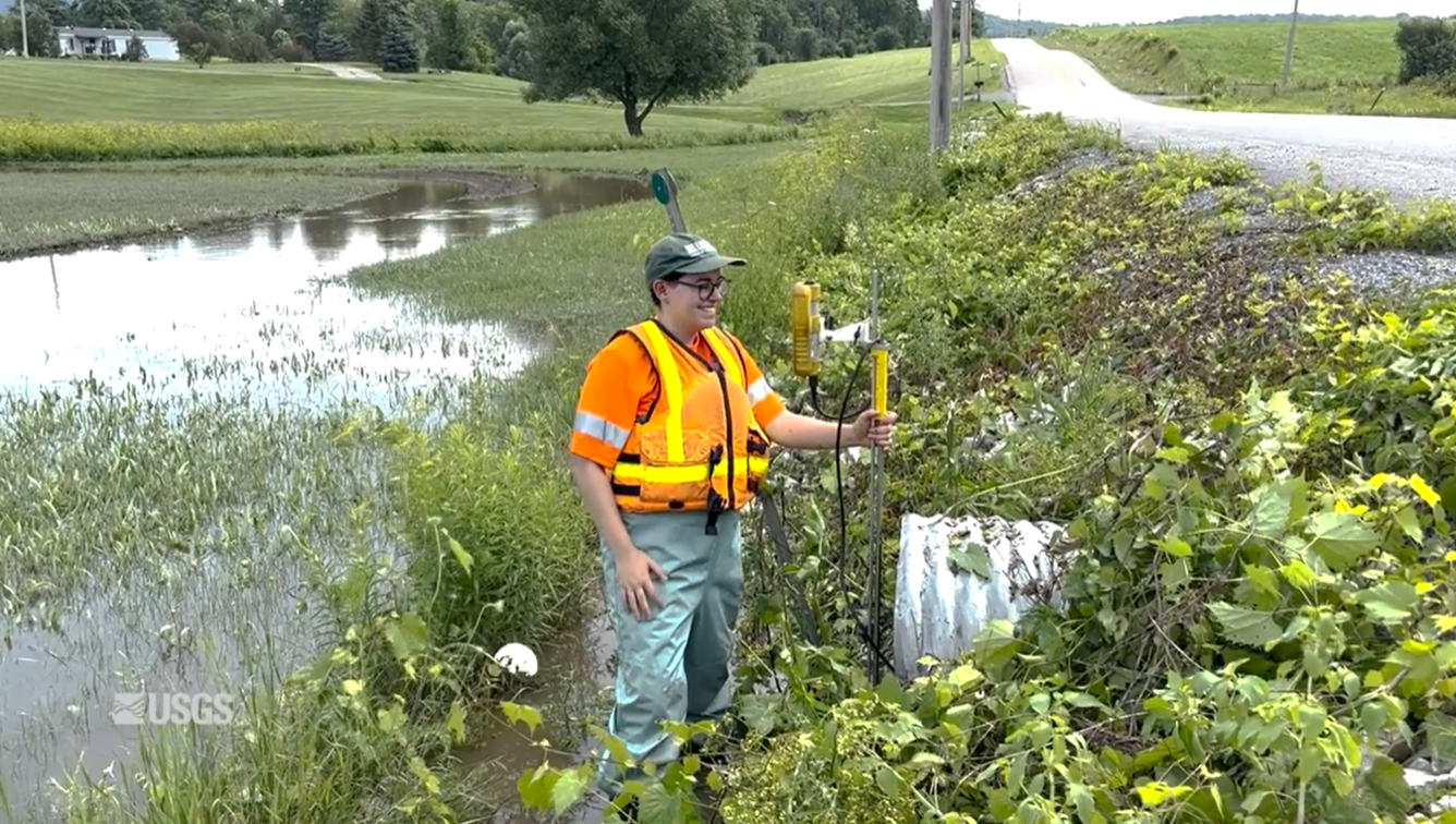
During a flood event, the discharge measurement, or the amount of water flowing in a river over a period of time, is the most important parameter. Capturing the maximum rate of discharge during a flood event is called peak streamflow. Manually measuring streamflows in person and comparing these numbers against the recorded measurements taken at nearby streamgages is a way to validate, or confirm, that the real-time data is accurate.
“Peak streamflows are one of the most important datasets produced by USGS, and validation, when opportunity presents itself, is critical to our mission,” said Supervisory Hydrologic Technician Richard Kiah.
According to preliminary data, discharge measurements taken at long-term streamgages during the flood event broke long-standing records at two sites in New Hampshire and four in Vermont. Seven sites in Vermont reached water levels over National Weather Service’s major flood level designations, the provisional data indicated.
“The measurements can be quite challenging due to the high stage, the turbulent water and the rate of flow,” said hydrologic technician Eric Harris, who collected data this week in Massachusetts.
In such dangerous circumstances, discharge measurements are taken by a sonar instrument called an acoustic doppler current profiler attached to a small floating device that can be towed off a bridge or behind a boat, pulled across the river on a rope, or remotely controlled.
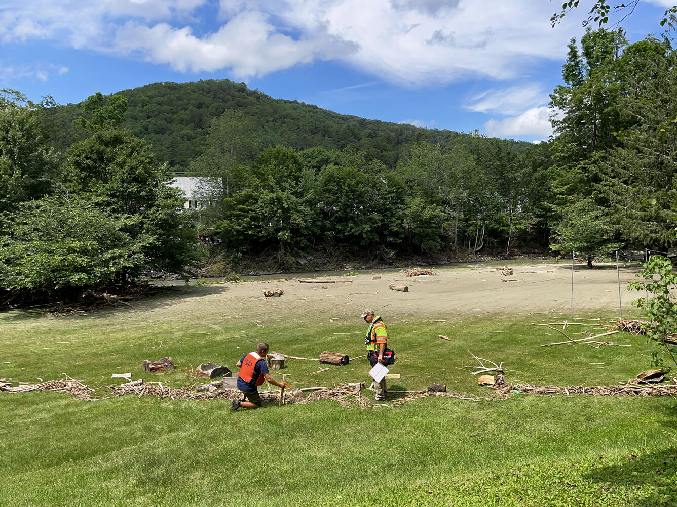
Flood crews also looked for evidence that indicated how high flood waters rose, called high-water marks, at each streamgage site. Examples of high-water marks include water stains on an object or a line of debris on the ground that defines where flood waters transported these items before receding.
In addition to the flood crews, the Federal Emergency Management Agency (FEMA) tasked USGS with collecting high-water marks in Vermont and 15 additional hydrologic technicians were sent around the state. USGS will continue to gather high-water mark information into early next week with a goal of collecting 500 water marks for the agency. When determining where to measure high-water marks, USGS targets stream reaches that have previously experienced a 100-year flood event, or a flood that has a 1% chance of occurring in any given year. These areas include parts of Williams River, Black River and Lamoille River, as well as other watersheds. USGS uses this high-water mark information to develop more accurate flood maps for FEMA, which are used to advise floodplain management and risk assessment.
USGS will continue to gather streamflow and high-water mark data as the flood waters move downstream. Visit our page on New England flood information to learn how the USGS New England Water Science Center responds to flood events and collects data to mitigate the effects of flooding.


Related

New England Flood Information

Otter Creek Flooding in Center Rutland, Vermont
A USGS Hydrologic Technician manually measures the water level of Otter Creek in Center Rutland, Vermont one day after a torrential storm that led to devastating flash flooding in the state. Measurements were taken near streamgage station 04282000.
Related
New England Flood Information
Otter Creek Flooding in Center Rutland, Vermont
A USGS Hydrologic Technician manually measures the water level of Otter Creek in Center Rutland, Vermont one day after a torrential storm that led to devastating flash flooding in the state. Measurements were taken near streamgage station 04282000.