



Long-term Networks
Long-term Networks
Filter Total Items: 17

Long-term Water Monitoring Networks in New Jersey
The accurate, long-term monitoring networks of New Jersey Water Science Center provide valuable data in real-time and historical perspective to compare that data to. The longer a monitoring location is in operation, the more valuable it becomes, since more statistical comparisons can be performed. Our field technicians continuously make field measurements and maintain these networks.

New Jersey Water Science Center Imagery Network
Static webcams have been installed at a number of real-time stream-gaging locations in New Jersey to allow you to view the current river-stage conditions. These webcams provide valuable information to the National Weather Service, emergency managers, and area residents to evaluate real-time conditions in river and coastal environments during storms.

The New Jersey Water Quality Networks
The water quality of New Jersey's water bodies is monitored by the USGS New Jersey Water Science Center to characterize waters, identify trends over time, identify emerging problems, determine whether pollution control programs are working, help direct pollution control efforts to where they are most needed, and respond to emergencies such as floods and spills.

The New Jersey Streamgaging Network
The USGS New Jersey Water Science Center streamgage program is part of the nationwide program that provides streamflow information for a variety of purposes—including the protection of life and property, infrastructure design, recreational usage, and long-term trend assessment. This information is critical to resource managers, farmers, fishermen, kayakers, land-use planners, engineers...

New Jersey Groundwater Network
Groundwater is the sole source of water supply for many people in New Jersey. Large-scale groundwater pumpage, installation of sanitary- and storm-sewer systems, and frequent variations in precipitation all have significant effects on regional groundwater levels and aquifer storage. To properly manage this resource, a consistent dataset of hydrologic data available for water managers and scientist...
New Jersey Precipitation and Weather Networks
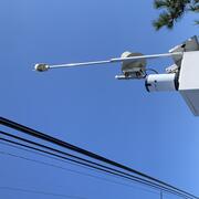
The New Jersey Water Science Center provides valuable data augmentation to many locations for: Precipitation, Water and Air Temperature, and even Wind Speed and Direction at some of our coastal sites. Our technicians continuously make field measurements and maintain these networks to ensure the accuracy of these data.

Flow Photo Explorer (FPE) Project in New Jersey
The Flow Photo Explorer (FPE) is a database, machine learning, and data visualization platform using timelapse images to develop new approaches for collecting hydrologic data in streams and other waterbodies where traditional monitoring methods are not feasible or cost-prohibitive. The Musconetcong River was chosen to participate in the early study, and we are expanding the work to other rivers.

Low-Flow Characteristics
Streamflow data collection and analysis are a necessary component of effective water resource management and planning. Low-flow statistics are needed to safely allow withdrawals from and discharges to surface waters in the State of New Jersey. Operating streamflow gaging stations at every water use location would be ideal but is cost prohibitive. Statistics help extend the utility of available...

New Jersey Subbasin Paired Air & Stream Water Temperature Networks
The temperature, water quality, and channel connectivity along headwater stream networks often show highly dynamic spatiotemporal patterns that are tied to localized hydrogeologic and landcover controls. Groundwater exchanges exert a spatially discontinuous influence on streams that reflect, in part, the preferential nature of groundwater discharge as controlled by recharge, topography, and...

Current Period Statistics
The Current Period Streamflow Statistics project is computing low flow statistics for both a historic (1950-1979) and more recent (1990-2019) 30-year period. The computed statistics will provide information about streamflow changes over time and an evaluation of more recent streamflow conditions. The project will also present land-use changes, precipitation patterns, and water use in the...

New Jersey Ambient Groundwater-Quality Monitoring Network
The USGS, in cooperation with the New Jersey Department of Environmental Protection, New Jersey Geological and Water Survey, operates the Ambient Groundwater-Quality Monitoring Network (AGWQMN), which is designed to characterize the status of unconfined groundwater quality as a function of land use. Shallow groundwater is typically the first part of the groundwater system to be affected by human...
StreamStats in New Jersey
StreamStats is a web application (Web Tool) for water-resources planning and engineering purposes. The map-based user interface can be used to delineate drainage areas for user-selected sites on streams, generate basin characteristics and estimate flow statistics for the selected sites. Users also can select the locations of USGS data-collection stations, shown as triangles on the StreamStats map...