
The U.S. Geological Survey is working with the Oregon Department of Transportation (ODOT) and Federal Highway Administration (FHWA) to revolutionize bridge scour monitoring using real-time sonar data collection and bathymetric surveying to remotely monitor sites, collect long-term data for evaluation, and develop and improve hydraulic models that predict scour.
Overview:
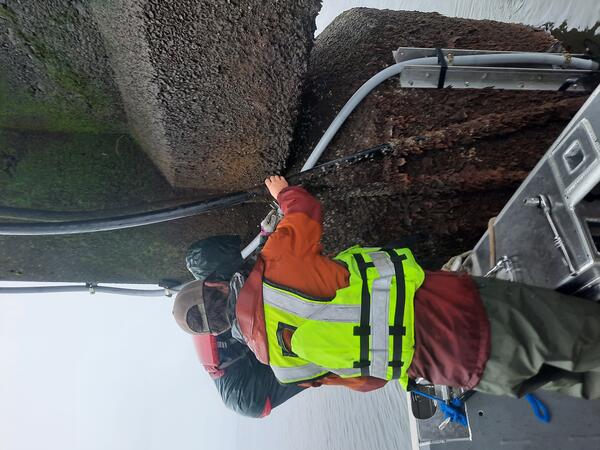
Scour (erosion around bridge foundations) is the leading cause of bridge failures in the United States. Traditional bridge scour monitoring methods are time-consuming, labor-intensive, sometimes inaccurate, and dangerous during storms. With nearly 900 scour-critical bridges in Oregon, it is unrealistic to manually monitor all of them. A real-time, remote monitoring system could improve safety, efficiency, and accuracy while providing early warnings for potential failures.
This project aims to:
- Develop an automated, real-time monitoring system that can detect early signs of scour safely and efficiently.
- Use real-time data to improve bridge design by developing and refining hydraulic models that predict scour, making design, construction, and repairs more cost-effective.
- Create a strategic plan to stratify this technology across Oregon’s scour-critical bridges, that have differing bridge foundation type, size, shape, load rating, climate, hydrology, slope, stream characteristics, surrounding terrain, catchment basin, streambed material, and high scour probability.
What is scour and why it matters
- Scour occurs when water moving past a bridge creates turbulence, increasing the force on the riverbed, eroding sediment from around the foundation.
- Scour is the leading cause of bridge failures in the U.S.
- Precipitation intensity and flooding are expected to worsen scour conditions.
- ODOT is required to monitor scour and implement countermeasures by the Federal Highway Administration (FHWA).
Benefits of real-time monitoring
- Improved Safety: Crews won’t have to inspect bridges in dangerous conditions, and real-time data will help assess bridge integrity more accurately.
- Cost Savings: Some bridges listed as "scour critical" may not actually need expensive countermeasures if real-time and discrete data shows minimal risk.
- Better Accuracy & Innovation: Traditional scour prediction models rely on outdated lab-based equations. Real-world data can improve hydraulic models, leading to better informed bridge design and maintenance.
The USGS, ODOT, and FHWA are collaborating to develop and deploy the monitoring system. If successful, these methods may be integrated into ODOT’s Hydraulics Manual and shared through reports, journal articles, and conferences.
| Mary's River Above Woods Creek near Philomath |
| Tualatin River at I-5 near Durham |
| Luckiamute River near Parker |
| North Santiam River at Mehama |
| Youngs Bay at Astoria |

Related science web pages.

Real-Time Pier Scour Monitoring and Evaluation
The U.S. Geological Survey is working with the Oregon Department of Transportation (ODOT) and Federal Highway Administration (FHWA) to revolutionize bridge scour monitoring using real-time sonar data collection and bathymetric surveying to remotely monitor sites, collect long-term data for evaluation, and develop and improve hydraulic models that predict scour.
Overview:
Scour (erosion around bridge foundations) is the leading cause of bridge failures in the United States. Traditional bridge scour monitoring methods are time-consuming, labor-intensive, sometimes inaccurate, and dangerous during storms. With nearly 900 scour-critical bridges in Oregon, it is unrealistic to manually monitor all of them. A real-time, remote monitoring system could improve safety, efficiency, and accuracy while providing early warnings for potential failures.
This project aims to:
- Develop an automated, real-time monitoring system that can detect early signs of scour safely and efficiently.
- Use real-time data to improve bridge design by developing and refining hydraulic models that predict scour, making design, construction, and repairs more cost-effective.
- Create a strategic plan to stratify this technology across Oregon’s scour-critical bridges, that have differing bridge foundation type, size, shape, load rating, climate, hydrology, slope, stream characteristics, surrounding terrain, catchment basin, streambed material, and high scour probability.
What is scour and why it matters
- Scour occurs when water moving past a bridge creates turbulence, increasing the force on the riverbed, eroding sediment from around the foundation.
- Scour is the leading cause of bridge failures in the U.S.
- Precipitation intensity and flooding are expected to worsen scour conditions.
- ODOT is required to monitor scour and implement countermeasures by the Federal Highway Administration (FHWA).
Benefits of real-time monitoring
- Improved Safety: Crews won’t have to inspect bridges in dangerous conditions, and real-time data will help assess bridge integrity more accurately.
- Cost Savings: Some bridges listed as "scour critical" may not actually need expensive countermeasures if real-time and discrete data shows minimal risk.
- Better Accuracy & Innovation: Traditional scour prediction models rely on outdated lab-based equations. Real-world data can improve hydraulic models, leading to better informed bridge design and maintenance.
The USGS, ODOT, and FHWA are collaborating to develop and deploy the monitoring system. If successful, these methods may be integrated into ODOT’s Hydraulics Manual and shared through reports, journal articles, and conferences.
| Mary's River Above Woods Creek near Philomath |
| Tualatin River at I-5 near Durham |
| Luckiamute River near Parker |
| North Santiam River at Mehama |
| Youngs Bay at Astoria |
Related science web pages.