



Decades of satellite imagery show how groins reshape California beaches
Long-term satellite observations show how human-built coastal structures influence the movement and buildup of sand along three Southern California beaches: Ventura, Santa Monica and Newport Beach.
For decades, coastal communities have used groins—structures built from rock or concrete that extend from the beach into the ocean—to help manage erosion and retain sand. But while the structures can protect individual stretches of shoreline, they can also alter the natural movement of sediment along the coast.
In a new USGS-led study, researchers analyze nearly four decades of satellite imagery to examine how groin fields influence shoreline behavior at three California beaches, revealing distinct patterns of sand accumulation and erosion around the structures.
The study focused on shorelines at Ventura, Santa Monica and Newport Beach from 1984 through 2022. Each location contains groin fields with different numbers and lengths of structures, allowing researchers to compare how the size and arrangement of groins affect shoreline dynamics.
Sand “steps” up on one side of groins
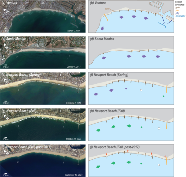
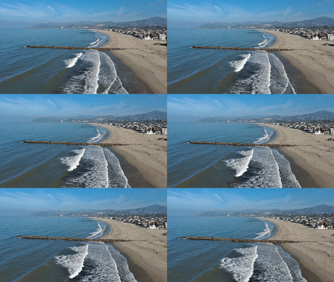
Groins are designed to interrupt the movement of sand along the shoreline, known as longshore sediment transport. Waves approaching the coast at an angle can move sand parallel to the beach. When that movement encounters a groin, sediment can accumulate on one side of the structure while the beach on the other side may become narrower or lower.
Researchers found offsets, or “steps,” in the shoreline across the groins, where the beach position on one side of a structure differed from the position on the other. These offsets provide a visible indication of how sediment is being redistributed by longshore transport.
The researchers measured the size and behavior of these shoreline steps using satellite-derived shoreline techniques and found that average shoreline offsets were commonly related to groin length. In other words, longer groins tended to be associated with larger differences in shoreline position across the structures.
The study also used Péclet numbers (a dimensionless parameter that helps define both transport direction and type) to characterize the variability of longshore sediment transport within and between the three study areas. The metric helped researchers compare the relative importance and variability of sediment movement with observed shoreline changes.
Seasonal changes linked to influence of waves
The satellite record also showed that shoreline offsets do not remain constant throughout the year. With repeated observations over many years, researchers were able to distinguish seasonal patterns from longer-term shoreline trends.
Some of the most pronounced seasonal patterns occurred at Newport Beach, where researchers found that changes in shoreline offsets were linked to seasonal shifts in wave direction and longshore sediment transport.
As wave conditions change throughout the year, the direction and strength of sediment movement along the beach can change as well. The resulting fluctuations can cause the shoreline to advance or retreat differently on either side of a groin.
A powerful tool to study engineered shorelines
Understanding how groins affect beaches is increasingly important as coastal communities contend with erosion, rising sea levels and growing pressure to protect infrastructure and development along the coast.
Traditional measurements of shoreline position often rely on field surveys or aerial imagery collected at relatively limited intervals. Satellite imagery, by contrast, provides a consistent source of observations across large areas and over multiple decades.
“Satellite imagery gives us a remarkable opportunity to see how shorelines respond to coastal structures over decades, including patterns that would be difficult to capture with occasional field surveys alone,” said USGS Physical Scientist Catherine Janda, lead author of the study.
The study shows that Landsat and Sentinel-2 imagery can be used to characterize shoreline behavior even in complicated settings where numerous coastal structures interact with waves and sediment movement.
The researchers conclude that satellite-derived shoreline techniques offer a useful way to investigate how groin fields influence beach dynamics—and potentially to evaluate how engineered shorelines respond to changing wave and sediment-transport conditions in the future.
Read the study, Shoreline Behavior at California Groin Fields from Satellite-Based Measurements, in Remote Sensing.
Related

Remote Sensing Coastal Change
Related