
Mapping ecohydrological headwater refugia
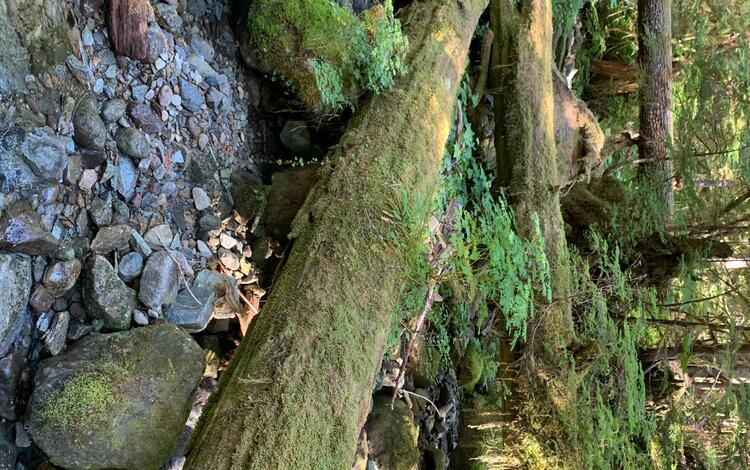
The Issue: Forests in the Pacific Northwest have changed substantially over the past hundred years because of logging, changing forest management methods, and climate change. These forests contain a dense network of small headwater streams that supply cold, clean water and support 52 amphibian species. These amphibians live both in the cold streams and in the cool, moist areas nearby. Natural resource managers are developing strategies to protect amphibians at risk of extinction.
How USGS will help: The USGS and partners will map amphibian habitat in headwater stream ecosystems and study how climate change impacts the availability of refugia habitat for key species of amphibians. We will look at key environmental and climatic factors that might help species persist in place and find habitat refugia. This will inform how changes in water availability may influence the functional connectivity between habitats.
Problem
For decades, scientists have raised concern over the rapid, global decline in amphibian populations. Direct and indirect stressors including habitat loss and degradation, disease, and invasive species contribute to the decline. In the Pacific Northwest, these threats have greatly impacted stream-associated amphibians. Of particular concern are habitat alteration from broad-scale forest management practices and the synergistic effects of climate change on species’ habitat and physiology. Amphibians have limited dispersal capacity meaning that they cannot move very far. This will require most species to adapt to changing conditions in place.
Resource managers aim to enhance species’ adaptive capacity which is the ability to cope with or adjust to climate change. To do so, they must identify and prioritize climate change refugia, which are environments that are relatively buffered from climate change. These areas can act as 'slow lanes' for resident species that are embedded within faster climatic changes occurring in the broader landscape. Climate refugia can facilitate species’ evolutionary adaptive capacity and maintain critical ecosystem functions and may be particularly important for dispersal-limited species like amphibians.
Our focus is on the diverse assemblage of amphibian species living in headwater stream ecosystems. Of the 52 amphibian species native to headwater ecosystems of the Pacific Northwest, 32 (62%) are considered species of conservation concern at the state, county, or federal level in the U.S.

Objectives
Our objective is to characterize and map current and future ecohydrological refugia for headwater stream-associated amphibians.
Relevance and Benefits
This work will help regional resource managers evaluate climate change impacts on headwater ecosystems and stream-associated amphibians and provide guidance on potential adaptation strategies. We will provide insights into the capacity for headwater ecosystems to support a diverse amphibian community into the future. In addition to refugia mapping, we will provide a literature review of climate change impacts on headwater ecosystems, including a compilation and annotation of existing and emerging spatial datasets to support future modeling efforts.


Approach
We will produce a map of the current condition and distribution of headwater ecosystems, including in-stream habitats and associated riparian forests, of western Oregon and Washington. This map will serve as the baseline for an analysis of ecohydrological refugia under multiple, plausible future climate scenarios. Mapping and analysis will be conducted in conjunction with field-site visits, in partnership with Washington Department of Fish and Wildlife (WDFW) staff, to validate modeled outputs and refine model parameters. The map of ecohydrological refugia, targeted for headwater stream-associated amphibian species, will be developed to support climate-informed conservation planning needs for priority species and habitats in Washington and Oregon. Our particular focus is on supporting ongoing State Wildlife Action Plan revisions and the identification of Conservation Opportunity Areas where diverse conservation goals would best be met. This project will complement a series of planned, multi-ecosystem refugia mapping efforts with other WDFW partners.
This project will be completed in a phased approach, described below:
PHASE 1 (Year 1) –
Partner Engagement & Data Compilation: Upon initiation of the project, we will host our first quarterly partner meeting to refine project goals and discuss the timeline and opportunities for participation.
If you are interested in participating in this study, please contact Nick Sutfin.
PHASE 2 (Years 1 & 2) –
Analysis & Modeling: Once datasets are compiled, we will examine and evaluate the data. During partner check-ins, we will discuss modeling approaches and request input on additional data sources and project deliverables. Basic statistics, including variability in coverage and resolution of datasets across the geographic area of interest, cross-correlations between variables, and unsupervised cluster analysis will also be used to refine the final selection of appropriate variables.
PHASE 3 (Year 2 & 3) –
Field Validation: Meetings with partners in year 2 will be conducted to determine the most useful representation of the model output, begin development of the webtool application, and design field surveys of habitat conditions and occupancy of amphibian species to validate the model. Methods for a rapid assessment of field-validated metrics used in the model (e.g., channel and valley width, presence of large instream wood, canopy cover) will be developed with partner input based on the final variables used.
PHASE 4 (Year 2 & 3) –
Tool Development & Delivery: Uncertainty in mapped refugia habitat will be estimated using Montecarlo simulation and random sampling of current observed habitat. The web-based, exploratory mapping tool of ecohydrological refugia for headwater stream ecosystems (plus associated tutorial and annotated list of available spatial datasets) will be finalized in year 3.
Funding for this project is provided by the USGS Northwest Climate Adaptation Center.
The Issue: Forests in the Pacific Northwest have changed substantially over the past hundred years because of logging, changing forest management methods, and climate change. These forests contain a dense network of small headwater streams that supply cold, clean water and support 52 amphibian species. These amphibians live both in the cold streams and in the cool, moist areas nearby. Natural resource managers are developing strategies to protect amphibians at risk of extinction.
How USGS will help: The USGS and partners will map amphibian habitat in headwater stream ecosystems and study how climate change impacts the availability of refugia habitat for key species of amphibians. We will look at key environmental and climatic factors that might help species persist in place and find habitat refugia. This will inform how changes in water availability may influence the functional connectivity between habitats.
Problem
For decades, scientists have raised concern over the rapid, global decline in amphibian populations. Direct and indirect stressors including habitat loss and degradation, disease, and invasive species contribute to the decline. In the Pacific Northwest, these threats have greatly impacted stream-associated amphibians. Of particular concern are habitat alteration from broad-scale forest management practices and the synergistic effects of climate change on species’ habitat and physiology. Amphibians have limited dispersal capacity meaning that they cannot move very far. This will require most species to adapt to changing conditions in place.
Resource managers aim to enhance species’ adaptive capacity which is the ability to cope with or adjust to climate change. To do so, they must identify and prioritize climate change refugia, which are environments that are relatively buffered from climate change. These areas can act as 'slow lanes' for resident species that are embedded within faster climatic changes occurring in the broader landscape. Climate refugia can facilitate species’ evolutionary adaptive capacity and maintain critical ecosystem functions and may be particularly important for dispersal-limited species like amphibians.
Our focus is on the diverse assemblage of amphibian species living in headwater stream ecosystems. Of the 52 amphibian species native to headwater ecosystems of the Pacific Northwest, 32 (62%) are considered species of conservation concern at the state, county, or federal level in the U.S.
Objectives
Our objective is to characterize and map current and future ecohydrological refugia for headwater stream-associated amphibians.
Relevance and Benefits
This work will help regional resource managers evaluate climate change impacts on headwater ecosystems and stream-associated amphibians and provide guidance on potential adaptation strategies. We will provide insights into the capacity for headwater ecosystems to support a diverse amphibian community into the future. In addition to refugia mapping, we will provide a literature review of climate change impacts on headwater ecosystems, including a compilation and annotation of existing and emerging spatial datasets to support future modeling efforts.
Approach
We will produce a map of the current condition and distribution of headwater ecosystems, including in-stream habitats and associated riparian forests, of western Oregon and Washington. This map will serve as the baseline for an analysis of ecohydrological refugia under multiple, plausible future climate scenarios. Mapping and analysis will be conducted in conjunction with field-site visits, in partnership with Washington Department of Fish and Wildlife (WDFW) staff, to validate modeled outputs and refine model parameters. The map of ecohydrological refugia, targeted for headwater stream-associated amphibian species, will be developed to support climate-informed conservation planning needs for priority species and habitats in Washington and Oregon. Our particular focus is on supporting ongoing State Wildlife Action Plan revisions and the identification of Conservation Opportunity Areas where diverse conservation goals would best be met. This project will complement a series of planned, multi-ecosystem refugia mapping efforts with other WDFW partners.
This project will be completed in a phased approach, described below:
PHASE 1 (Year 1) –
Partner Engagement & Data Compilation: Upon initiation of the project, we will host our first quarterly partner meeting to refine project goals and discuss the timeline and opportunities for participation.
If you are interested in participating in this study, please contact Nick Sutfin.
PHASE 2 (Years 1 & 2) –
Analysis & Modeling: Once datasets are compiled, we will examine and evaluate the data. During partner check-ins, we will discuss modeling approaches and request input on additional data sources and project deliverables. Basic statistics, including variability in coverage and resolution of datasets across the geographic area of interest, cross-correlations between variables, and unsupervised cluster analysis will also be used to refine the final selection of appropriate variables.
PHASE 3 (Year 2 & 3) –
Field Validation: Meetings with partners in year 2 will be conducted to determine the most useful representation of the model output, begin development of the webtool application, and design field surveys of habitat conditions and occupancy of amphibian species to validate the model. Methods for a rapid assessment of field-validated metrics used in the model (e.g., channel and valley width, presence of large instream wood, canopy cover) will be developed with partner input based on the final variables used.
PHASE 4 (Year 2 & 3) –
Tool Development & Delivery: Uncertainty in mapped refugia habitat will be estimated using Montecarlo simulation and random sampling of current observed habitat. The web-based, exploratory mapping tool of ecohydrological refugia for headwater stream ecosystems (plus associated tutorial and annotated list of available spatial datasets) will be finalized in year 3.
Funding for this project is provided by the USGS Northwest Climate Adaptation Center.