
U.S. flag

An official website of the United States government

FAQs

Frequently asked questions

Filter Total Items: 47

What is Lidar data and where can I download it? What is Lidar data and where can I download it?

Light Detection and Ranging ( lidar) is a technology used to create high-resolution models of ground elevation with a vertical accuracy of 10 centimeters (4 inches). Lidar equipment, which includes a laser scanner, a Global Positioning System (GPS), and an Inertial Navigation System (INS), is typically mounted on a small aircraft. The laser scanner transmits brief pulses of light to the ground...

What is Lidar data and where can I download it?

What is Lidar data and where can I download it?

Light Detection and Ranging ( lidar) is a technology used to create high-resolution models of ground elevation with a vertical accuracy of 10 centimeters (4 inches). Lidar equipment, which includes a laser scanner, a Global Positioning System (GPS), and an Inertial Navigation System (INS), is typically mounted on a small aircraft. The laser scanner transmits brief pulses of light to the ground...

Learn More

What is remote sensing and what is it used for? What is remote sensing and what is it used for?

Remote sensing is the process of detecting and monitoring the physical characteristics of an area by measuring its reflected and emitted radiation at a distance (typically from satellite or aircraft). Special cameras collect remotely sensed images, which help researchers "sense" things about the Earth. Some examples are: Cameras on satellites and airplanes take images of large areas on the Earth's...

What is remote sensing and what is it used for?

What is remote sensing and what is it used for?

Remote sensing is the process of detecting and monitoring the physical characteristics of an area by measuring its reflected and emitted radiation at a distance (typically from satellite or aircraft). Special cameras collect remotely sensed images, which help researchers "sense" things about the Earth. Some examples are: Cameras on satellites and airplanes take images of large areas on the Earth's...

Learn More

Why is the ocean salty? Why is the ocean salty?

Oceans cover about 70 percent of the Earth's surface and about 97 percent of all water on and in the Earth is saline—there's a lot of salty water on our planet. By some estimates, if the salt in the ocean could be removed and spread evenly over the Earth’s land surface it would form a layer more than 500 feet (166 meters) thick, about the height of a 40-story office building. But, where did all...
Why is the ocean salty?

Why is the ocean salty?

Oceans cover about 70 percent of the Earth's surface and about 97 percent of all water on and in the Earth is saline—there's a lot of salty water on our planet. By some estimates, if the salt in the ocean could be removed and spread evenly over the Earth’s land surface it would form a layer more than 500 feet (166 meters) thick, about the height of a 40-story office building. But, where did all...

Learn More

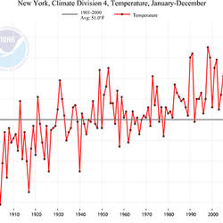
How do we know the climate is changing? How do we know the climate is changing?

The scientific community is certain that the Earth's climate is changing because of the trends that we see in the instrumented climate record and the changes that have been observed in physical and biological systems. The instrumental record of climate change is derived from thousands of temperature and precipitation recording stations around the world. We have very high confidence in these...

How do we know the climate is changing?

How do we know the climate is changing?

The scientific community is certain that the Earth's climate is changing because of the trends that we see in the instrumented climate record and the changes that have been observed in physical and biological systems. The instrumental record of climate change is derived from thousands of temperature and precipitation recording stations around the world. We have very high confidence in these...

Learn More

What is a geographic information system (GIS)? What is a geographic information system (GIS)?

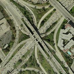
A Geographic Information System (GIS) is a computer system that analyzes and displays geographically referenced information. It uses data that is attached to a unique location. Most of the information we have about our world contains a location reference: Where are USGS streamgages located? Where was a rock sample collected? Exactly where are all of a city's fire hydrants? If, for example, a rare...
What is a geographic information system (GIS)?

What is a geographic information system (GIS)?

A Geographic Information System (GIS) is a computer system that analyzes and displays geographically referenced information. It uses data that is attached to a unique location. Most of the information we have about our world contains a location reference: Where are USGS streamgages located? Where was a rock sample collected? Exactly where are all of a city's fire hydrants? If, for example, a rare...

Learn More

How does carbon get into the atmosphere? How does carbon get into the atmosphere?

Atmospheric carbon dioxide comes from two primary sources—natural and human activities. Natural sources of carbon dioxide include most animals, which exhale carbon dioxide as a waste product. Human activities that lead to carbon dioxide emissions come primarily from energy production, including burning coal, oil, or natural gas. Learn more: Sources of Greenhouse Gas Emissions (EPA)

How does carbon get into the atmosphere?

How does carbon get into the atmosphere?

Atmospheric carbon dioxide comes from two primary sources—natural and human activities. Natural sources of carbon dioxide include most animals, which exhale carbon dioxide as a waste product. Human activities that lead to carbon dioxide emissions come primarily from energy production, including burning coal, oil, or natural gas. Learn more: Sources of Greenhouse Gas Emissions (EPA)

Learn More

What is carbon sequestration? What is carbon sequestration?

Carbon dioxide is the most commonly produced greenhouse gas. Carbon sequestration is the process of capturing and storing atmospheric carbon dioxide. It is one method of reducing the amount of carbon dioxide in the atmosphere with the goal of reducing global climate change. The USGS is conducting assessments on two major types of carbon sequestration: geologic and biologic.

What is carbon sequestration?

What is carbon sequestration?

Carbon dioxide is the most commonly produced greenhouse gas. Carbon sequestration is the process of capturing and storing atmospheric carbon dioxide. It is one method of reducing the amount of carbon dioxide in the atmosphere with the goal of reducing global climate change. The USGS is conducting assessments on two major types of carbon sequestration: geologic and biologic.

Learn More

What’s the difference between geologic and biologic carbon sequestration? What’s the difference between geologic and biologic carbon sequestration?

Geologic carbon sequestration is the process of storing carbon dioxide (CO2) in underground geologic formations. The CO2 is usually pressurized until it becomes a liquid, and then it is injected into porous rock formations in geologic basins. This method of carbon storage is also sometimes a part of enhanced oil recovery, otherwise known as tertiary recovery, because it is typically used later in...

What’s the difference between geologic and biologic carbon sequestration?

What’s the difference between geologic and biologic carbon sequestration?

Geologic carbon sequestration is the process of storing carbon dioxide (CO2) in underground geologic formations. The CO2 is usually pressurized until it becomes a liquid, and then it is injected into porous rock formations in geologic basins. This method of carbon storage is also sometimes a part of enhanced oil recovery, otherwise known as tertiary recovery, because it is typically used later in...

Learn More

Why is elevation data so important to forecasting hurricane impact? Why is elevation data so important to forecasting hurricane impact?

The fundamental lesson of Hurricane Sandy in 2012 (and prior catastrophic storms and hurricanes) was that storm vulnerability is first and foremost a consequence of elevation. The height at which infrastructure, resources, and communities sit in relation to average tides and water levels, storm waves, surge, and flood waters determines their exposure to overwhelmingly powerful damaging forces...

Why is elevation data so important to forecasting hurricane impact?

Why is elevation data so important to forecasting hurricane impact?

The fundamental lesson of Hurricane Sandy in 2012 (and prior catastrophic storms and hurricanes) was that storm vulnerability is first and foremost a consequence of elevation. The height at which infrastructure, resources, and communities sit in relation to average tides and water levels, storm waves, surge, and flood waters determines their exposure to overwhelmingly powerful damaging forces...

Learn More

Why are wetlands important? Why are wetlands important?

Wetlands provide habitat for thousands of species of aquatic and terrestrial plants and animals. Wetlands are valuable for flood protection, water quality improvement, shoreline erosion control, natural products, recreation, and aesthetics. Wetlands are among the most productive habitats on earth providing shelter and nursery areas for commercially and recreationally important animals like fish...

Why are wetlands important?

Why are wetlands important?

Wetlands provide habitat for thousands of species of aquatic and terrestrial plants and animals. Wetlands are valuable for flood protection, water quality improvement, shoreline erosion control, natural products, recreation, and aesthetics. Wetlands are among the most productive habitats on earth providing shelter and nursery areas for commercially and recreationally important animals like fish...

Learn More

What is chronic wasting disease? What is chronic wasting disease?

Chronic wasting disease (CWD) is a fatal, neurological illness occurring in North American cervids (members of the deer family), including white-tailed deer, mule deer, elk, and moose. Since its discovery in 1967, CWD has spread geographically and increased in prevalence locally. CWD is contagious; it can be transmitted freely within and among cervid populations. No treatments or vaccines are...

What is chronic wasting disease?

What is chronic wasting disease?

Chronic wasting disease (CWD) is a fatal, neurological illness occurring in North American cervids (members of the deer family), including white-tailed deer, mule deer, elk, and moose. Since its discovery in 1967, CWD has spread geographically and increased in prevalence locally. CWD is contagious; it can be transmitted freely within and among cervid populations. No treatments or vaccines are...

Learn More

What are the differences between endangered, threatened, imperiled, and at-risk species? What are the differences between endangered, threatened, imperiled, and at-risk species?

Under the Endangered Species Act (ESA), plant and animal species may be listed as either endangered or threatened. “Endangered” means a species is in danger of extinction throughout all or a significant portion of its range. “Threatened” means a species is likely to become endangered within the foreseeable future. States have their own ESA-type laws, so species can have different Threatened...

What are the differences between endangered, threatened, imperiled, and at-risk species?

What are the differences between endangered, threatened, imperiled, and at-risk species?

Under the Endangered Species Act (ESA), plant and animal species may be listed as either endangered or threatened. “Endangered” means a species is in danger of extinction throughout all or a significant portion of its range. “Threatened” means a species is likely to become endangered within the foreseeable future. States have their own ESA-type laws, so species can have different Threatened...

Learn More
Was this page helpful?