
Explore Global Coastal Research Using the COAWST Applications Catalog
Around the world, scientists are using the Coupled Ocean-Atmosphere-Waves-Sediment Transport (COAWST) Modeling System to better understand and forecast short-term changes in coastal conditions. To showcase the breadth of this work, the USGS developed the COAWST Applications Catalog—a collection of published COAWST-based studies spanning multiple countries, coastlines, and scientific questions.
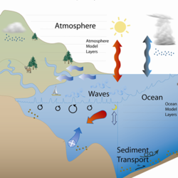
Storm-driven wind, waves, and currents can dramatically reshape coastlines, threatening lives, infrastructure, and natural and economic resources. Predicting coastal change requires a modeling system capable of simulating the complex interactions among the ocean, atmosphere, waves, and sediment transport.
To address this need, the USGS developed COAWST, a coupled modeling system designed to improve storm-path predictions, better evaluate coastal change, and support science-based decision‑making.
A Global Collection of Peer-Reviewed COAWST Studies
The COAWST Applications Catalog highlights how researchers worldwide are using this system to advance our understanding of coastal processes and create actionable knowledge for communities and stakeholders.
Each entry was identified through peer‑reviewed journal databases, ensuring the catalog represents high‑quality, rigorously vetted work. Countries associated with each study reflect the institutional affiliation of the first author at the time of publication, highlighting the widespread global engagement with COAWST.
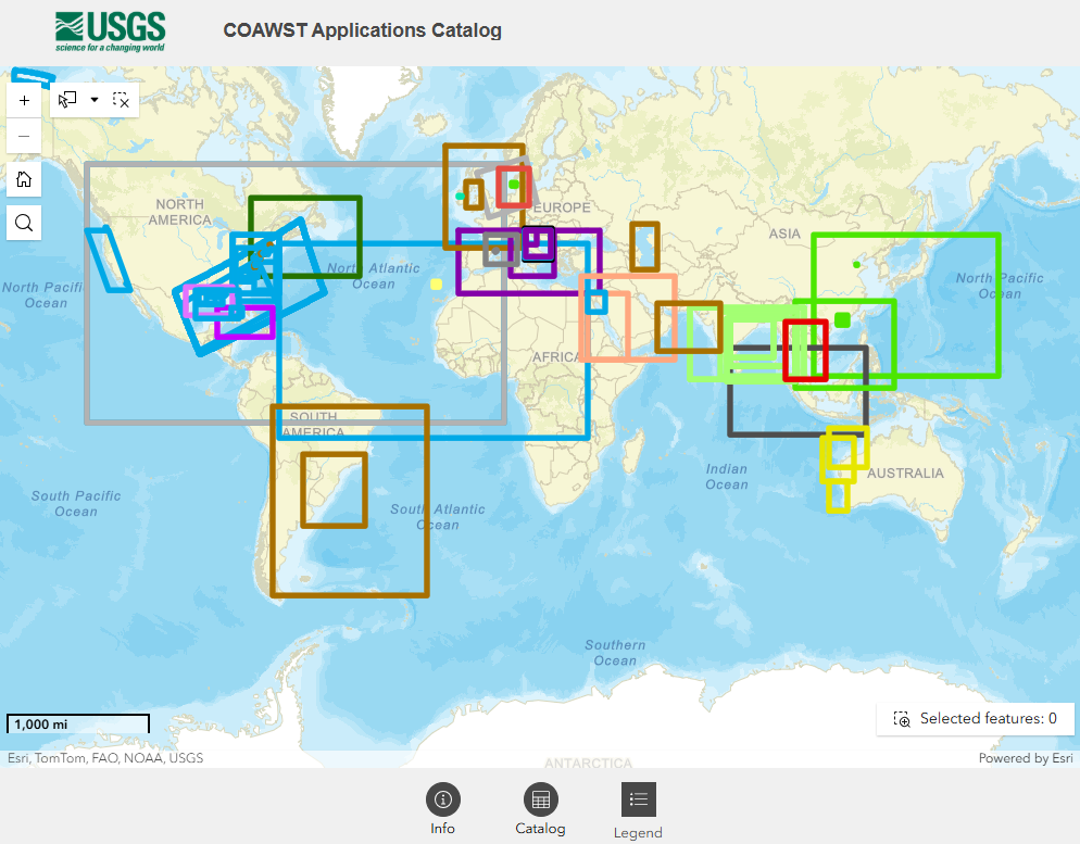
The map at the center of the catalog features geographic coverage boxes that illustrate the study area used in each application. These visual summaries help users quickly explore where COAWST has been applied—from estuaries and deltas to open-ocean.
The catalog is a living resource and will be updated with additional studies as they become available. Scientists who publish COAWST-based research are encouraged to submit their work for inclusion to John Warner (jcwarner@usgs.gov).
For more information on the COAWST Modeling System, visit the COAWST web page.
Related

COAWST: A Coupled-Ocean-Atmosphere-Wave-Sediment Transport Modeling System
COAWST Training Workshops

COAWST System Components
Related
COAWST: A Coupled-Ocean-Atmosphere-Wave-Sediment Transport Modeling System
COAWST Training Workshops