Unrestricted Restricted Area Points
The National Map Corps Recreation data (Campgrounds, Trailheads, and Visitor/Information Centers) located within the restricted areas boundaries falls under the purview of the listed agencies (BLM, USFWS, USFS, NPS), and is thus not the USGS’s responsibility to maintain.
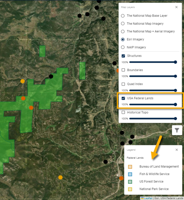
Recreation points that fall within the boundaries of federal lands as defined by the USA Federal Lands map layer in the TNMCorps editor cannot be edited by TNMCorps volunteers. Turn on the USA Federal Lands map layer and click the legend button to visualize the boundary extents of lands administered by each agency by color.
However, not all recreation features that should fall within federal lands boundaries have been tagged as such, so it is possible that a TNMCorps volunteer may be able to edit such points without triggering the restricted areas warning message.

So, if a recreation point is editable, how are you supposed to know if it's a federal land management agency point that shouldn’t be edited? Below are some tips for identifying these points. Be mindful that these data may be incomplete, and you should do a thorough search to include multiple resources.
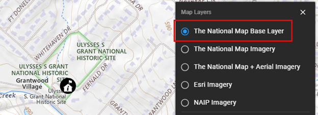
- Turn on The National Map Base Layer. This layer includes boundary data or governmental units that includes federal lands.
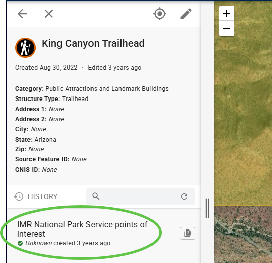
- Look at the history for the point. If the first entry has the name of one of the federal land management agencies, then that point shouldn’t be edited.
- If you are using a federal agency website from (BLM, USFWS, USFS, NPS), to verify information for a point, then that is your cue that you should not edit the point even if you are permitted to do so.
Help us help you
When you do come across these points, we appreciate it if you start taking note of them by saving the direct URL for each one. Then email us your list to nationalmapcorps@usgs.gov, so The National Map Corps team can manually add a Restricted Area tag. That way, the next time a volunteer tries to edit that point it will trigger an alert and prevent them from editing.
Recent Example
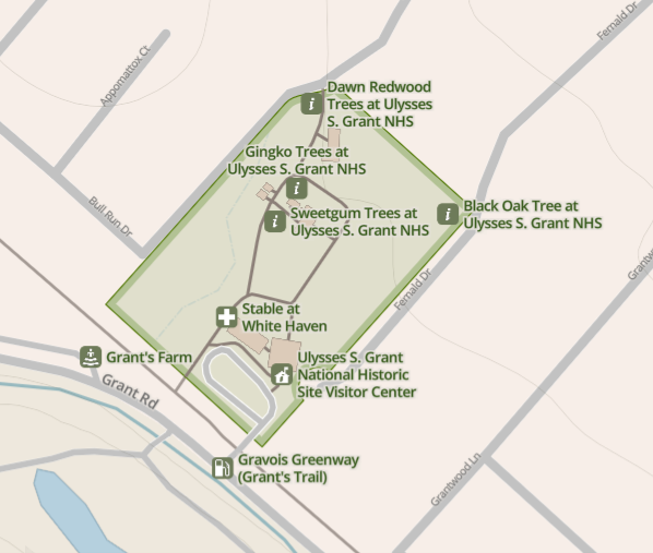
An example of a federal recreation point recently edited by a volunteer that should have been tagged as restricted.
Ulysses S Grant National Historic Site
The USA Federal Lands layer does not contain a polygon for the Ulysses S Grant National Historic Site boundary. So, the visitor center point was not marked as existing within a restricted area and was edited by a volunteer.
This point should not have been editable, so I used the National Park Service’s website to access the map above and turned on The National Map Base Layer below to confirm the extent of the historic site. I then added the U.S. National Park Service restricted area tag so that it is no longer editable.