
Protected Land for Wildlife Corridors
May 16, 2016
A 2016 research project used PAD-US version 1.3 to develop an extensive analysis of options for a large network of protected areas that could support wildlife migration. The following are excerpts from the PLOS ONE journal article on the project: Identifying Corridors among Large Protected Areas in the United States
Citation: Belote RT, Dietz MS, McRae BH, Theobald DM, McClure ML, Irwin GH, et al. (2016) Identifying Corridors among Large Protected Areas in the United States. PLoS ONE 11(4): e0154223. doi:10.1371/journal.pone.0154223
April 2016 – Authors: R. Travis Belote , Matthew S. Dietz, Brad H. McRae, David M. Theobald, Meredith L. McClure, G. Hugh Irwin, Peter S. McKinley, Josh A. Gage, Gregory H. Aplet
ABSTRACT:
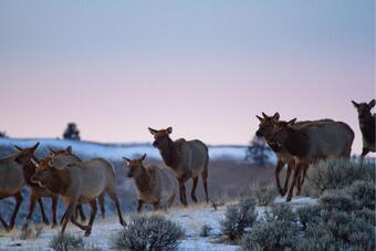
Conservation scientists emphasize the importance of maintaining a connected network of protected areas to prevent ecosystems and populations from becoming isolated, reduce the risk of extinction, and ultimately sustain biodiversity. Keeping protected areas connected in a network is increasingly recognized as a conservation priority in the current era of rapid climate change. Models that identify suitable linkages between core areas have been used to prioritize potentially important corridors for maintaining functional connectivity. Here, we identify the most “natural” (i.e., least human-modified) corridors between large protected areas in the contiguous Unites States. We aggregated results from multiple connectivity models to develop a composite map of corridors reflecting agreement of models run under different assumptions about how human modification of land may influence connectivity. To identify which land units are most important for sustaining structural connectivity, we used the composite map of corridors to evaluate connectivity priorities in two ways: (1) among land units outside of our pool of large core protected areas and (2) among units administratively protected as Inventoried Roadless (IRAs) or Wilderness Study Areas (WSAs). Corridor values varied substantially among classes of “unprotected” non-core land units, and land units of high connectivity value and priority represent diverse ownerships and existing levels of protections. We provide a ranking of IRAs and WSAs that should be prioritized for additional protection to maintain minimal human modification. Our results provide a coarse-scale assessment of connectivity priorities for maintaining a connected network of protected areas.
CONCLUSION:
Our results provide an initial identification of priorities to create a national connected network of large protected areas. As federal land agencies begin assessments of connectivity, the models presented here could serve as a coarse-filter assessment for evaluating regional connectivity priorities. They could also serve in the evaluation of individual land units and their potential role in maintaining connectivity among large core protected areas. Land units with high connectivity value could be prioritized for future protection to maintain potential large-scale connectivity. Maintaining such large-scale corridors between protected areas may ensure that protected cores are connected via a system of relatively natural lands. These lands may allow individual wide-ranging animals to disperse via corridors in the short-term [24], with potential for long-term migration and dispersal to take place by organisms with more limited dispersal abilities.