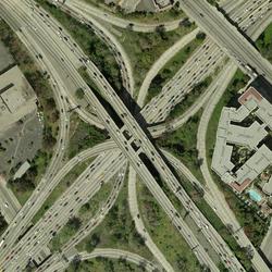
Scans of traditional aerial photography film products (air photos) are not georectified.
The USGS does, however, offer several orthoimagery (georectified aerial photograph) products:
- Digital Orthophoto Quadrangle (DOQ)
- High Resolution Orthoimagery (HRO)
- National Agriculture Imagery Program (NAIP, NAIP Plus)
NAIP orthoimagery has been collected for the entire conterminous United States every 3 years beginning in 2009. The USGS only serves NAIP orthoimagery. NAIP aerial photos that have NOT been georectified are available from the U.S. Department of Agriculture's Aerial Photography Field Office.
Related Content
How much area does an aerial photograph cover?
The area covered by an aerial photograph (air photo) depends on the scale of the imagery. Most air photos were taken on 9 x 9 inch film. The chart below reflects coverage for a variety of photographic scales.Scale1 inch = feet1 side (miles)Area (square miles)1:12,00010001.702.91:20,00016672.848.11:24,00020003.4111.61:40,00033335.6832.31:58,00048338.2367.731:63,36052809.0081.001:80,000666711.36129...
Is there a cost for aerial photograph products?
Download medium-resolution scans (400 dpi) of aerial photography products at no charge using EarthExplorer. We are working on high-resolution scans (25 micron or 1,000 dpi) that can also be downloaded at no charge. With over 8.4 million frames of imagery in our archive, scanning will take many years to complete, but about 80% of high-resolution scans are currently available. If you can't find a...
What do the different colors in a color-infrared aerial photograph represent?
Color-infrared (CIR) aerial photography--often called "false color" photography because it renders the scene in colors not normally seen by the human eye--is widely used for interpretation of natural resources. Atmospheric haze does not interfere with the acquisition of the image.Live vegetation is almost always associated with red tones. Very intense reds indicate dense, vigorously growing...
Will I be able to see my house in an aerial photograph? Will enlarging the image let me see more detail?
The ability to see specific items in an aerial image is mostly a function of scale and resolution. The following aerial photography products all have a resolution of 1 meter or better, so you should be able to see an object the size of a house: High Resolution Orthoimagery (HRO) National Agriculture Imagery Program (NAIP) imagery Digital Orthophoto Quadrangle (DOQ) Use EarthExplorer to search for...
What is a digital orthophoto quadrangle (DOQ) or orthoimage?
A digital orthophoto quadrangle (DOQ)--or any orthoimage--is a computer-generated image of an aerial photograph in which displacements (distortions) caused by terrain relief and camera tilts have been removed. It combines the image characteristics of a photograph with the geometric qualities of a map. Unlike an aerial photograph, an orthoimage has a uniform scale, so it can be used as a base map...
What does "georeferenced" mean?
Georeferencing means that the internal coordinate system of a digital map or aerial photo can be related to a ground system of geographic coordinates. A georeferenced digital map or image has been tied to a known Earth coordinate system, so users can determine where every point on the map or aerial photo is located on the Earth's surface. The relevant coordinate transforms are typically stored...
How do I download orthoimagery products and what are the available formats?
Download orthoimagery (georectified aerial photographs) using EarthExplorer, which has the full catalog of USGS orthoimagery and aerial photography, or The National Map downloader, which has NAIP orthoimagery only. EarthExplorer: Products Overview Format varies by type of orthoimagery: Native format, Georeferenced Tagged Image File Format (GeoTIFF), or compressed 10:1 JPEG2000 The National Map...
Digital orthoimagery base specification V1.0
Using digital photography to examine grazing in montane meadows
The National Map - Orthoimagery
Oblique Aerial Photography of the Arctic Coast of Alaska, Nulavik to Demarcation Point, August 7-10, 2006
Related Content
- FAQ
How much area does an aerial photograph cover?
The area covered by an aerial photograph (air photo) depends on the scale of the imagery. Most air photos were taken on 9 x 9 inch film. The chart below reflects coverage for a variety of photographic scales.Scale1 inch = feet1 side (miles)Area (square miles)1:12,00010001.702.91:20,00016672.848.11:24,00020003.4111.61:40,00033335.6832.31:58,00048338.2367.731:63,36052809.0081.001:80,000666711.36129...
Is there a cost for aerial photograph products?
Download medium-resolution scans (400 dpi) of aerial photography products at no charge using EarthExplorer. We are working on high-resolution scans (25 micron or 1,000 dpi) that can also be downloaded at no charge. With over 8.4 million frames of imagery in our archive, scanning will take many years to complete, but about 80% of high-resolution scans are currently available. If you can't find a...
What do the different colors in a color-infrared aerial photograph represent?
Color-infrared (CIR) aerial photography--often called "false color" photography because it renders the scene in colors not normally seen by the human eye--is widely used for interpretation of natural resources. Atmospheric haze does not interfere with the acquisition of the image.Live vegetation is almost always associated with red tones. Very intense reds indicate dense, vigorously growing...
Will I be able to see my house in an aerial photograph? Will enlarging the image let me see more detail?
The ability to see specific items in an aerial image is mostly a function of scale and resolution. The following aerial photography products all have a resolution of 1 meter or better, so you should be able to see an object the size of a house: High Resolution Orthoimagery (HRO) National Agriculture Imagery Program (NAIP) imagery Digital Orthophoto Quadrangle (DOQ) Use EarthExplorer to search for...
What is a digital orthophoto quadrangle (DOQ) or orthoimage?
A digital orthophoto quadrangle (DOQ)--or any orthoimage--is a computer-generated image of an aerial photograph in which displacements (distortions) caused by terrain relief and camera tilts have been removed. It combines the image characteristics of a photograph with the geometric qualities of a map. Unlike an aerial photograph, an orthoimage has a uniform scale, so it can be used as a base map...
What does "georeferenced" mean?
Georeferencing means that the internal coordinate system of a digital map or aerial photo can be related to a ground system of geographic coordinates. A georeferenced digital map or image has been tied to a known Earth coordinate system, so users can determine where every point on the map or aerial photo is located on the Earth's surface. The relevant coordinate transforms are typically stored...
How do I download orthoimagery products and what are the available formats?
Download orthoimagery (georectified aerial photographs) using EarthExplorer, which has the full catalog of USGS orthoimagery and aerial photography, or The National Map downloader, which has NAIP orthoimagery only. EarthExplorer: Products Overview Format varies by type of orthoimagery: Native format, Georeferenced Tagged Image File Format (GeoTIFF), or compressed 10:1 JPEG2000 The National Map...
- Multimedia
- Publications
Digital orthoimagery base specification V1.0
The resolution requirement for orthoimagery in support of the The National Map of the U.S. Geological Survey (USGS) is 1 meter. However, as the Office of Management and Budget A-16 designated Federal agency responsible for base orthoimagery, the USGS National Geospatial Program (NGP) has developed this base specification to include higher resolution orthoimagery. Many Federal, State, and local proAuthorsPhilip P. RufeUsing digital photography to examine grazing in montane meadows
Cattle (Bos taurus) numbers on national forests are allocated based on allotment grazing capacity, but spatial patterns of timing and density at smaller scales are difficult to assess. However, it is often in meadows or riparian areas that grazing may affect hydrology, biodiversity, and other important ecosystem characteristics. To explore real-time animal presence in montane meadows we distributeAuthorsSusan K. McIlroy, Barbara H. Allen-Diaz, Alexander C. BergThe National Map - Orthoimagery
Orthorectified digital aerial photographs and satellite images of 1-meter (m) pixel resolution or finer make up the orthoimagery component of The National Map. The process of orthorectification removes feature displacements and scale variations caused by terrain relief and sensor geometry. The result is a combination of the image characteristics of an aerial photograph or satellite image and the gAuthorsJames Mauck, Kim Brown, William J. CarswellOblique Aerial Photography of the Arctic Coast of Alaska, Nulavik to Demarcation Point, August 7-10, 2006
The Arctic Coastal Plain of northern Alaska, an area of strategic economic importance to the United States, is home to remote Native American communities and encompasses unique habitats of global significance. Coastal erosion along the Arctic coast is chronic and widespread; recent evidence suggests that erosion rates are among the highest in the world (up to ~16 m/yr) and may be accelerating. CoaAuthorsAnn E. Gibbs, Bruce M. Richmond - News