
Ocean Glossary
The USGS conducts research in many parts of the ocean from our coasts to the deep sea. Get familiar with the ocean’s geologic features in our Glossary.
A
Abyssal plain
Abyssal plain
An underwater plain on the deep ocean floor, usually lying between the foot of a continental rise and a mid-ocean ridge.

Anadromous
Anadromous
A fish that lives in the sea and migrates up fresh water rivers to spawn.
B

Back arcs
Back arcs
Back arcs are geological regions that form at a subduction zone when the overriding plate thins and begins to spread out

Benthic
Benthic
Anything associated with or occurring on the bottom of a body of water.
C

Carbonate budget
Carbonate budget
the balance between processes that control reef growth including carbonate production (how much coral skeleton is produced) and erosion (how much coral skeleton is lost)

Chemosynthetic
Chemosynthetic
Chemosynthesis is the process by which organisms produce food using energy released by inorganic chemical reactions. Chemosynthetic organisms thrive around deep-ocean environments such as hydrothermal vents or cold seeps.

Coastal zone
Coastal zone
The interface between the land and sea. USGS studies processes that shape this region and how this affect people, wildlife, and ecosystems.

Continental rise
Continental rise
An area that lies at the deepest part of a continental or island margin between the continental slope and the abyssal plain.

Continental shelf
Continental shelf
The submarine extension of an area’s landmass to the outer edge of the continental margin. Many ecologically and economically important habitats can be found in these areas, including coral reefs and kelp forests. USGS is involved in determining the extent of the U.S. Extended Continental Shelf to better protect, manage, and use the seabed resources contained therein.
Continental slope
Continental slope
The steep slope which descends from the edge of the continental shelf to the deep ocean. These areas are of great interest for determining the presence and threats of marine geohazards and unique chemistry such as underwater landslides and gas hydrates that can trigger tsunamis and support unique ecosystems.

Coral cover
Coral cover
the percentage of the reef that is inhabited by living coral

Coral restoration
Coral restoration
efforts by humans to help coral reefs recover from stressors and coral loss. This can involve planting nursery-grown corals back onto reefs, making sure habitat is suitable for natural coral growth, and building coral resilience to threats like climate change.
D

Deep-sea trench
Deep-sea trench
A long, narrow depression on the deep sea floor, related to tectonic plate movement, specifically subduction zones.
Deep-sea trenches
Deep-sea trenches
Long, narrow depressions on the deep sea floor, related to tectonic plate movement, specifically subduction zones.
E

Exclusive Economic Zone
Exclusive Economic Zone
The EEZ is the area of the ocean where a country has jurisdiction. The EEZ extends 200 nautical miles off the nation's coast.
Extended Continental Shelf
Extended Continental Shelf
The ESC is an area of the continental shelf that may extend beyond the Exclusive Economic Zone (EEZ) depending on the depth, shape, and geophysical characteristics of the seabed and sub-sea floor
F

Foram
Foram
A single-celled planktonic animal with a perforated chalky shell through which slender protrusions of protoplasm extend. Most kinds are marine, and when they die, their shells form thick, ocean-floor sediments.

Foraminifer
Foraminifer
A single-celled planktonic animal with a perforated chalky shell through which slender protrusions of protoplasm extend. Most kinds are marine, and when they die, their shells form thick, ocean-floor sediments.
Foraminifera
Foraminifera
A single-celled planktonic animal with a perforated chalky shell through which slender protrusions of protoplasm extend. Most kinds are marine, and when they die, their shells form thick, ocean-floor sediments.
Foraminifers
Foraminifers
Single-celled planktonic animals with a perforated chalky shell through which slender protrusions of protoplasm extend. Most kinds are marine, and when they die, their shells form thick, ocean-floor sediments.

Forams
Forams
Single-celled planktonic animals with a perforated chalky shell through which slender protrusions of protoplasm extend. Most kinds are marine, and when they die, their shells form thick, ocean-floor sediments.
G
Gas hydrate
Gas hydrate
Gas hydrate is an ice-like crystalline form of water and low molecular weight gas (e.g., methane, ethane, carbon dioxide).
Gas hydrates
Gas hydrates
Gas hydrates are ice-like crystalline form of water and low molecular weight gas (e.g., methane, ethane, carbon dioxide).
H

Holocene
Holocene
the current geological epoch, encompassing the last 11,700 years of Earth's history.

Hydrothermal vent
Hydrothermal vent
Structures on the seafloor through which materials related to volcanic activity are extruded. These often form tall, chimney-like structures and can support diverse chemosynthetic biota and associated communities.
Hydrothermal vents
Hydrothermal vents
Structures on the seafloor through which materials related to volcanic activity are extruded. These often form tall, chimney-like structures and can support diverse chemosynthetic biota and associated communities.
M

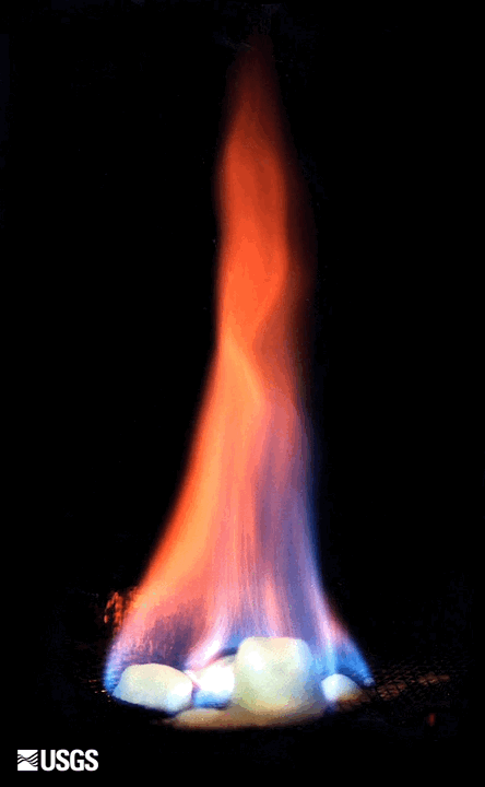
Magma
Magma
Magma is extremely hot liquid and semi-liquid rock located under the earth's surface.

Mid-ocean ridge
Mid-ocean ridge
The massive, continuous chain of deep-ocean volcanoes, occurring at spreading centers where tectonic plates are moving apart, allows new oceanic crust to reach the surface of the seafloor. The result is an extensive chain of underwater mountains. Average water depth to the top of a ridge is 2,500 meters (8,200 feet).
Mid-ocean ridges
Mid-ocean ridges
The massive, continuous chain of deep-ocean volcanoes, occurring at spreading centers where tectonic plates are moving apart, allows new oceanic crust to reach the surface of the seafloor. The result is an extensive chain of underwater mountains. Average water depth to the top of a ridge is 2,500 meters (8,200 feet).

Mid-piacenzian
Mid-piacenzian
The Piacenzian Age (Pliocene) represents a past climate interval within which frequency and magnitude of environmental changes during a period of past global warmth can be analyzed, climate models can be tested, and results can be placed in a context to better prepare for future change.
O

Ocean acidification
Ocean acidification
as carbon dioxide in the atmosphere is absorbed by the ocean, it causes the pH to lower. This can lead to dissolution of the shells and skeletons of many marine organisms.
Oceanic trench
Oceanic trench
A long, narrow depression on the deep sea floor, related to tectonic plate movement, specifically subduction zones.
Oceanic trenches
Oceanic trenches
Long, narrow depressions on the deep sea floor, related to tectonic plate movement, specifically subduction zones.
P
Paleoceanography
Paleoceanography
The study of oceanographic conditions and processes in the past (usually prior to development of instrumentation).
Paleoclimate
Paleoclimate
The study of Earth's climate conditions and processes in the past (usually prior to development of instrumentation).
Patch reefs
Patch reefs
small areas of coral reef that exist closer to shore than the main reef tract

Plateau
Plateau
A mound-like or ridge-like elevated area on the seafloor; it may have a modest-to-substantial extent. Although submerged, this feature can reach close to sea level.

Plateaus
Plateaus
Mound-like or ridge-like elevated areas on the seafloor; they may have a modest-to-substantial extent. Although submerged, these features can reach close to sea level.
S

Seamount
Seamount
An underwater mountain formed by volcanic activity.

Seamounts
Seamounts
Underwater mountains formed by volcanic activity.

Spreading centers
Spreading centers
Spreading centers occur at the boundary between two plates that are moving apart, called divergent plate boundaries.

Subduction zone
Subduction zone
In tectonics, a convergent plate boundary where the oceanic plate dives beneath another oceanic plate or a continental plate; typically expressed at the surface as a deep-sea, or oceanic, trench.
Subduction zones
Subduction zones
In tectonics, these are a convergent plate boundaries where the oceanic plate dives beneath another oceanic plate or a continental plate; typically expressed at the surface as a deep-sea, or oceanic, trench.

Submarine
Submarine
submarine simply means 'underwater' or 'under-sea'

Submarine canyon
Submarine canyon
an underwater canyon crossing the continental shelf and slope

Submarine canyons
Submarine canyons
underwater canyons crossing the continental shelf and slope
Substrate
Substrate
The underlying surface or material.
T

Tectonic plates
Tectonic plates
A tectonic plate (also called lithospheric plate) is a massive, irregularly shaped slab of solid rock, generally composed of both continental and oceanic lithosphere.

Tsunami
Tsunami
Tsunami is a Japanese word that means “harbor wave.” It is a large wave caused by movements in Earth's outer layer, or crust, which move ocean water; or by landslides near large bodies of water like a fjord or lake.

Tsunamis
Tsunamis
Tsunami is a Japanese word that means “harbor wave.” It is a large wave caused by movements in Earth's outer layer, or crust, which move ocean water; or by landslides near large bodies of water like a fjord or lake.
Turbidite
Turbidite
A flow of water down slope carrying a dense suspension of fluid mud or unconsolidated material.
V

Volcanic arcs
Volcanic arcs
Volcanic arcs are a chain of volcanoes, hundreds to thousands of miles long, that forms above a subduction zone.