
Map of hydrogen prospectivity for the contiguous United States, identifying regions with favorable conditions for hydrogen accumulation, which includes areas with potential hydrogen sources, porous reservoirs, and effective seals to trap the gas.
Multimedia
Images

Geologic Hydrogen web map
Map of hydrogen prospectivity for the contiguous United States, identifying regions with favorable conditions for hydrogen accumulation, which includes areas with potential hydrogen sources, porous reservoirs, and effective seals to trap the gas.
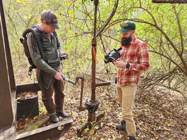
USGS and NETL scientists measuring methane emissions from an orphan well in Hillman State Park, PA
USGS and NETL scientists measuring methane emissions from an orphan well in Hillman State Park, PAUSGS and NETL scientists measuring methane emissions from an orphan well in Hillman State Park, PA. Photo Credit: Karl Haase
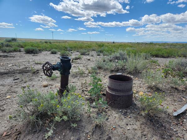
An orphan well sits open and exposed to the environment in Toole County, MT.
An orphan well sits open and exposed to the environment in Toole County, MT.An orphan well sits open and exposed to the environment in Toole County, MT. Photo credit: Nick Gianoutsos
An orphan well sits open and exposed to the environment in Toole County, MT.
An orphan well sits open and exposed to the environment in Toole County, MT.An orphan well sits open and exposed to the environment in Toole County, MT. Photo credit: Nick Gianoutsos
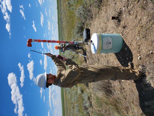
USGS scientist Karl Haase taking a methane reading from an orphan well in Toole County, MT, 1
USGS scientist Karl Haase taking a methane reading from an orphan well in Toole County, MT, 1USGS scientist Karl Haase taking a methane reading from an orphan well in Toole County, MT. Photo Credit: Nick Gianoutsos
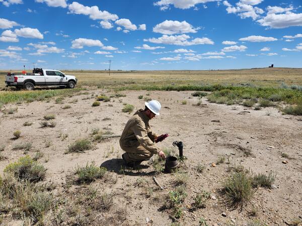
USGS scientist Karl Haase taking a methane reading from an orphan well in Toole County, MT
USGS scientist Karl Haase taking a methane reading from an orphan well in Toole County, MTUSGS scientist Karl Haase taking a methane reading from an orphan well in Toole County, MT. Photo Credit: Nick Gianoutsos

Overview of production test site (June 2023)
The installation of wells, which included two monitoring wells and two production wells, was completed on February 28, 2023, and test operations began on October 24, 2023.
The installation of wells, which included two monitoring wells and two production wells, was completed on February 28, 2023, and test operations began on October 24, 2023.
Videos

Drilling a Research Well in the Eagle Ford
USGS scientists drill a research well near Waco, Texas, as part of the assessment of oil and gas resources in the Eagle Ford Group. Cores like these provide information on the various rock layers, such as their make-up, their age, etc.
USGS scientists drill a research well near Waco, Texas, as part of the assessment of oil and gas resources in the Eagle Ford Group. Cores like these provide information on the various rock layers, such as their make-up, their age, etc.