
The U.S. Geological Survey (USGS) first characterized the water resources of the Idaho National Laboratory (INL) area prior to the establishment of nuclear reactor testing facilities in 1949. Since then, the USGS has maintained monitoring networks for groundwater quality and water levels at the INL. These efforts provide essential data on hydrologic trends and track the movement of radioactive and chemical wastes in both the unsaturated zone and the eastern Snake River Plain (ESRP) aquifer. The USGS mission focuses on assessing the quantity and quality of water resources through data collection and analysis, making this information accessible to the public.
Site and Constituent Selection
The selection of wells and the constituents to monitor in the water-level and water-quality monitoring networks is made with careful consideration of hydrologic conditions, spatial location, and both current and historical waste disposal practices. A subset of wells located upgradient of facility operations has been utilized to characterize background water-quality, particularly in the regional aquifer and in the tributary valleys that supply recharge water to the aquifer. Periodically, reports are published that provide an analysis of water-level and water-quality data collected from the USGS monitoring networks at INL (Treinen and others, 2024).
Water Quality Monitoring
Several key objectives of the groundwater-quality monitoring program at the INL are the following:
- Define the quality and availability of water for human consumption.
- Assess the usability of water for supporting facility construction, industrial purposes such as cooling systems, and diluting concentrated waste streams.
- Track the location and movement of contaminants in the ESRP aquifer.
- Identify sources of recharge to the aquifer.
- Establish an early detection network for contaminants migrating past the INL boundaries.
- Understand the processes controlling the origin and distribution of contaminants and naturally occurring constituents in the aquifer.
- Identify contaminant concentrations relative to state and federal standards.
The USGS-maintained water-quality monitoring program at the INL has historically included a network of up to 200 wells and several surface water sites. Over the years, these wells and surface water sites have been evaluated for a range of constituent concentrations, including but not limited to:
- Tritium
- Strontium-90
- Iodine-129
- Cesium-137
- Plutonium-238, 239+240
- Americium-241
- Gross alpha and beta radioactivity
- Uranium isotope composition
- Sodium
- Chloride
- Nitrate (as N)
- Chromium
- Fluoride
- Mercury
- Nutrients
- Trace metals
- Volatile organic compounds
- Total organic carbon
- Sulfate
- Alkalinity
- Stable isotopes
- CFCs and age-dating constituents
- pH
- Dissolved oxygen
- Specific conductivity
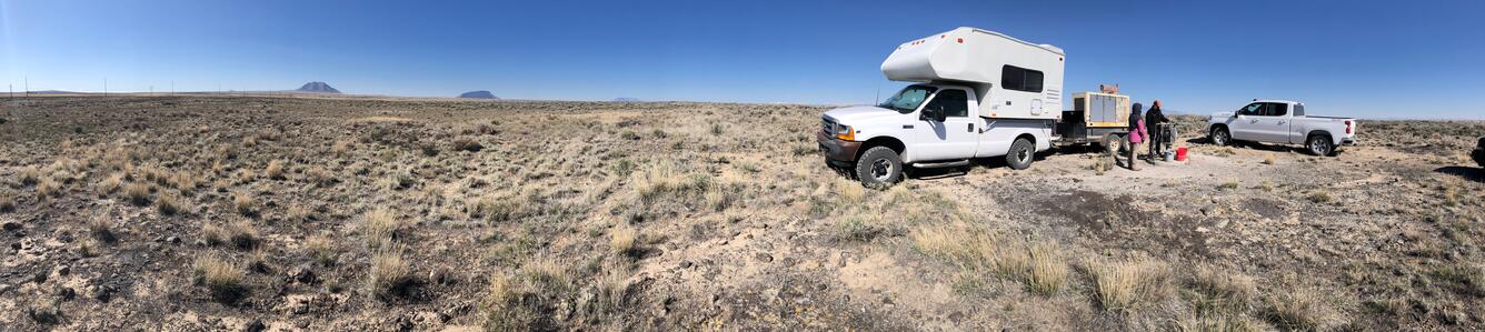
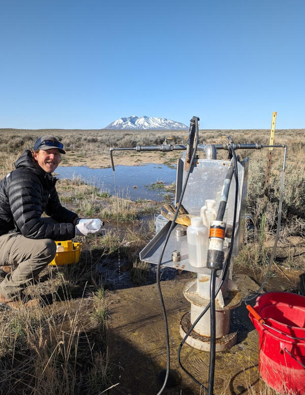
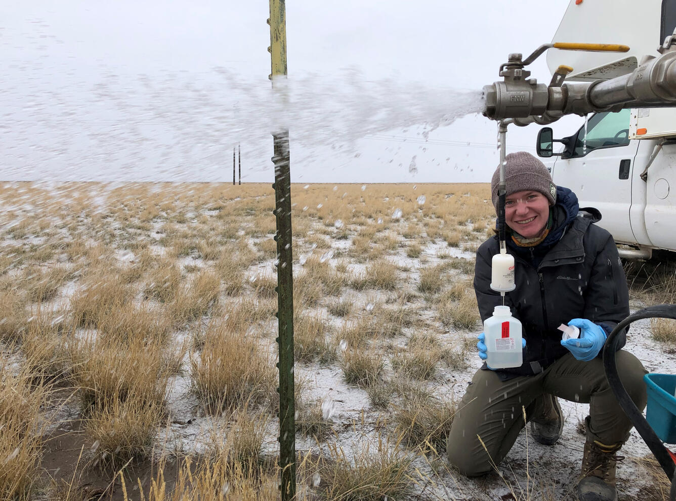
Environmental samples are collected from both groundwater and surface water sites, along with quality control samples—such as sequential replicates and field or equipment blanks—at a frequency of approximately 10-15%, following the procedures outlined in (Bartholomay and others, 2021). This extensive data collection provides valuable insights into hydrologic trends and the movement of radioactive and chemical wastes in the unsaturated zone, ESRP aquifer, and surface water. All water-quality data can be found here: Water Quality Portal or ScienceBase-INLPO.
Multilevel Monitoring Systems
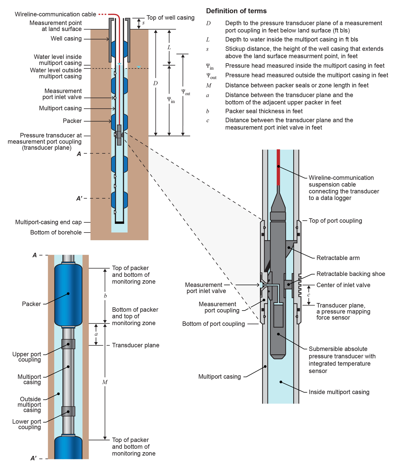
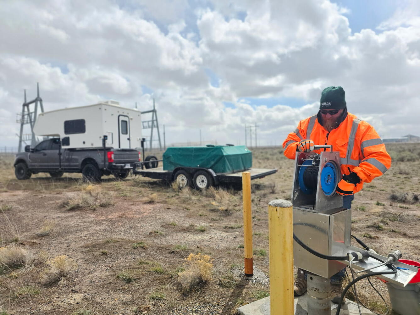
In 2006, the USGS established a multilevel well-monitoring network (MLMS) to describe the vertical movement and distribution of chemical constituents in the ESRP aquifer. This system consists of 12 wells equipped with multilevel Westbay™ packer sampling systems to acquire pressure, temperature, and water chemistry data at isolated depths (Fisher and Twining, 2011; Twining and Fisher, 2012). Recently, an R package, mlms, was developed to store and process MLMS data for wells in the USGS aquifer-monitoring network at the INL.
The multi-packer borehole completion system is designed to enable depth-specific monitoring of hydraulic head and groundwater quality within a borehole. It features a continuous string of water-tight casing that extends the entire length of the borehole. Monitoring zones are isolated by inflated packer bladders, ensuring hydraulic separation between zones. The system's modular design and variable casing lengths allow for strategic placement of sampling ports and packer bladders at virtually any desired depth within the borehole (Twining and others, 2021).
Most wells in the water-quality monitoring network were constructed as open-borehole wells, which allows access to the aquifer throughout their entire depth below the water table. While this construction is effective for maximizing water production rates and identifying the arrival times of contaminant plumes, it is less suitable for assessing the vertical distribution of contaminants and measuring pressure and temperature gradients within the borehole. All water-quality data can be found here: Water Quality Portal or ScienceBase-INLPO.
Water Level Monitoring
The USGS water-level monitoring program is designed to identify and document changes in water storage and the general direction of groundwater flow within the ESRP aquifer. The data collected have been used to:
- Determine changes in hydraulic gradient that affect the rate and direction of groundwater flow and waste constituent movement,
- Identify sources of recharge, and
- Measure the effects of that recharge on the aquifer.
The water-level monitoring network continues to expand as new wells are drilled.
The water-level monitoring network currently includes over 200 aquifer or perched wells. Water levels are measured annually, semi-annually, quarterly, monthly, or continuously. All wells are measured annually in either March or April. Monthly water-level measurements and continuous water-level measurements using data recorders at selected sites document water-level changes throughout the year. The USGS maintains 12 continuous groundwater data recorders at the INL. Two of these wells, USGS 1 and USGS 21, are instrumented with telemetry to transmit real-time water-level data. These data are used to develop and refine groundwater-flow and contaminant-transport models. All water-level data, including real-time data and data collected as part of USGS studies at the INL, can be found here: USGS Water Data for Idaho.
Naval Reactor Facility Monitoring
In 1989, the Idaho Branch Office (IBO) of the Pittsburgh Naval Reactors Office, U.S. DOE, requested that the USGS initiate a water-quality data collection program in the vicinity of the Naval Reactor Facility (NRF). The purpose of this data-collection program is to provide the IBO with a consistent set of data to evaluate the effects of NRF activities on the chemical characteristics of water in the ESRP aquifer. The water sampling program has continued through the years with an evolving suite of monitoring wells, constituents, and laboratories. Samples are collected twice a year in May and November. All water-quality data can be found here: Water Quality Portal or ScienceBase-INLPO.
Surface-water Monitoring Stations
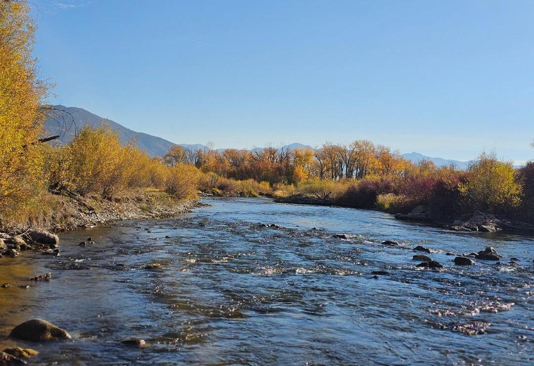
Surface water at and around the INL includes several key sources: the Big Lost River, Little Lost River, Birch Creek, Camas Creek, and Mud Lake. Water from these sources infiltrates into the eastern Snake River Plain aquifer. The Big Lost River is unique as it is the only source that flows through the INL before reaching its endpoint at the Big Lost River Sinks, where it infiltrates the channel bed and recharges the eastern Snake River Plain aquifer. Historically, the river maintained a consistent flow through the INL to the sinks; however, changes in upstream water use practices and a decrease in snow-water equivalents have transformed the river into an ephemeral stream beyond the reservoir, resulting in only short seasonal flows across the INL. Understanding the timing and volume of these flows is crucial for the USGS INL Project Office, as they significantly impact groundwater modeling, chemical transport, and aquifer recharge.
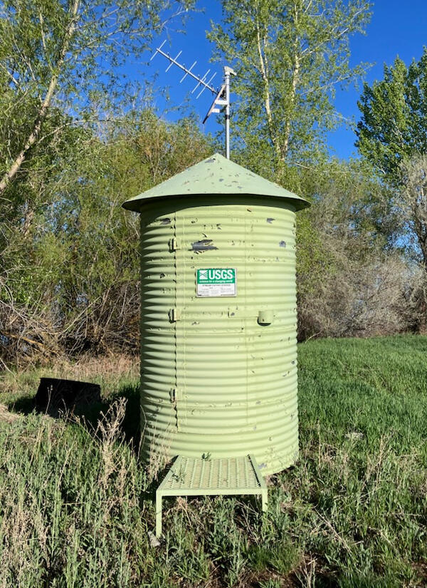
In collaboration with the Department of Energy (DOE), the USGS operates six surface water monitoring stations on the Big Lost River as it flows onto and through the INL, with additional monitoring stations established at each of the other surface water sources. These gaging stations are part of a nationwide network that provides real-time data on water quantity. Equipped with modern pressure transducers, the gages collect and transmit the height of the water in the river, which is then converted into discharge measurements (cubic feet per second) using a rating tool specific to each gage This data is available online to the public through the USGS Water Data for the Nation.
The U.S. Geological Survey (USGS) first characterized the water resources of the Idaho National Laboratory (INL) area prior to the establishment of nuclear reactor testing facilities in 1949. Since then, the USGS has maintained monitoring networks for groundwater quality and water levels at the INL. These efforts provide essential data on hydrologic trends and track the movement of radioactive and chemical wastes in both the unsaturated zone and the eastern Snake River Plain (ESRP) aquifer. The USGS mission focuses on assessing the quantity and quality of water resources through data collection and analysis, making this information accessible to the public.
Site and Constituent Selection
The selection of wells and the constituents to monitor in the water-level and water-quality monitoring networks is made with careful consideration of hydrologic conditions, spatial location, and both current and historical waste disposal practices. A subset of wells located upgradient of facility operations has been utilized to characterize background water-quality, particularly in the regional aquifer and in the tributary valleys that supply recharge water to the aquifer. Periodically, reports are published that provide an analysis of water-level and water-quality data collected from the USGS monitoring networks at INL (Treinen and others, 2024).
Water Quality Monitoring
Several key objectives of the groundwater-quality monitoring program at the INL are the following:
- Define the quality and availability of water for human consumption.
- Assess the usability of water for supporting facility construction, industrial purposes such as cooling systems, and diluting concentrated waste streams.
- Track the location and movement of contaminants in the ESRP aquifer.
- Identify sources of recharge to the aquifer.
- Establish an early detection network for contaminants migrating past the INL boundaries.
- Understand the processes controlling the origin and distribution of contaminants and naturally occurring constituents in the aquifer.
- Identify contaminant concentrations relative to state and federal standards.
The USGS-maintained water-quality monitoring program at the INL has historically included a network of up to 200 wells and several surface water sites. Over the years, these wells and surface water sites have been evaluated for a range of constituent concentrations, including but not limited to:
- Tritium
- Strontium-90
- Iodine-129
- Cesium-137
- Plutonium-238, 239+240
- Americium-241
- Gross alpha and beta radioactivity
- Uranium isotope composition
- Sodium
- Chloride
- Nitrate (as N)
- Chromium
- Fluoride
- Mercury
- Nutrients
- Trace metals
- Volatile organic compounds
- Total organic carbon
- Sulfate
- Alkalinity
- Stable isotopes
- CFCs and age-dating constituents
- pH
- Dissolved oxygen
- Specific conductivity
Environmental samples are collected from both groundwater and surface water sites, along with quality control samples—such as sequential replicates and field or equipment blanks—at a frequency of approximately 10-15%, following the procedures outlined in (Bartholomay and others, 2021). This extensive data collection provides valuable insights into hydrologic trends and the movement of radioactive and chemical wastes in the unsaturated zone, ESRP aquifer, and surface water. All water-quality data can be found here: Water Quality Portal or ScienceBase-INLPO.
Multilevel Monitoring Systems
In 2006, the USGS established a multilevel well-monitoring network (MLMS) to describe the vertical movement and distribution of chemical constituents in the ESRP aquifer. This system consists of 12 wells equipped with multilevel Westbay™ packer sampling systems to acquire pressure, temperature, and water chemistry data at isolated depths (Fisher and Twining, 2011; Twining and Fisher, 2012). Recently, an R package, mlms, was developed to store and process MLMS data for wells in the USGS aquifer-monitoring network at the INL.
The multi-packer borehole completion system is designed to enable depth-specific monitoring of hydraulic head and groundwater quality within a borehole. It features a continuous string of water-tight casing that extends the entire length of the borehole. Monitoring zones are isolated by inflated packer bladders, ensuring hydraulic separation between zones. The system's modular design and variable casing lengths allow for strategic placement of sampling ports and packer bladders at virtually any desired depth within the borehole (Twining and others, 2021).
Most wells in the water-quality monitoring network were constructed as open-borehole wells, which allows access to the aquifer throughout their entire depth below the water table. While this construction is effective for maximizing water production rates and identifying the arrival times of contaminant plumes, it is less suitable for assessing the vertical distribution of contaminants and measuring pressure and temperature gradients within the borehole. All water-quality data can be found here: Water Quality Portal or ScienceBase-INLPO.
Water Level Monitoring
The USGS water-level monitoring program is designed to identify and document changes in water storage and the general direction of groundwater flow within the ESRP aquifer. The data collected have been used to:
- Determine changes in hydraulic gradient that affect the rate and direction of groundwater flow and waste constituent movement,
- Identify sources of recharge, and
- Measure the effects of that recharge on the aquifer.
The water-level monitoring network continues to expand as new wells are drilled.
The water-level monitoring network currently includes over 200 aquifer or perched wells. Water levels are measured annually, semi-annually, quarterly, monthly, or continuously. All wells are measured annually in either March or April. Monthly water-level measurements and continuous water-level measurements using data recorders at selected sites document water-level changes throughout the year. The USGS maintains 12 continuous groundwater data recorders at the INL. Two of these wells, USGS 1 and USGS 21, are instrumented with telemetry to transmit real-time water-level data. These data are used to develop and refine groundwater-flow and contaminant-transport models. All water-level data, including real-time data and data collected as part of USGS studies at the INL, can be found here: USGS Water Data for Idaho.
Naval Reactor Facility Monitoring
In 1989, the Idaho Branch Office (IBO) of the Pittsburgh Naval Reactors Office, U.S. DOE, requested that the USGS initiate a water-quality data collection program in the vicinity of the Naval Reactor Facility (NRF). The purpose of this data-collection program is to provide the IBO with a consistent set of data to evaluate the effects of NRF activities on the chemical characteristics of water in the ESRP aquifer. The water sampling program has continued through the years with an evolving suite of monitoring wells, constituents, and laboratories. Samples are collected twice a year in May and November. All water-quality data can be found here: Water Quality Portal or ScienceBase-INLPO.
Surface-water Monitoring Stations
Surface water at and around the INL includes several key sources: the Big Lost River, Little Lost River, Birch Creek, Camas Creek, and Mud Lake. Water from these sources infiltrates into the eastern Snake River Plain aquifer. The Big Lost River is unique as it is the only source that flows through the INL before reaching its endpoint at the Big Lost River Sinks, where it infiltrates the channel bed and recharges the eastern Snake River Plain aquifer. Historically, the river maintained a consistent flow through the INL to the sinks; however, changes in upstream water use practices and a decrease in snow-water equivalents have transformed the river into an ephemeral stream beyond the reservoir, resulting in only short seasonal flows across the INL. Understanding the timing and volume of these flows is crucial for the USGS INL Project Office, as they significantly impact groundwater modeling, chemical transport, and aquifer recharge.
In collaboration with the Department of Energy (DOE), the USGS operates six surface water monitoring stations on the Big Lost River as it flows onto and through the INL, with additional monitoring stations established at each of the other surface water sources. These gaging stations are part of a nationwide network that provides real-time data on water quantity. Equipped with modern pressure transducers, the gages collect and transmit the height of the water in the river, which is then converted into discharge measurements (cubic feet per second) using a rating tool specific to each gage This data is available online to the public through the USGS Water Data for the Nation.