
Enhancing Water and Sewer Utility Mapping in Massachusetts
The U.S. Geological Survey (USGS), in cooperation with the Massachusetts Department of Environmental Protection (MassDEP) Water Utility Resilience Program (WURP), is assisting public water and wastewater utilities in transitioning their service infrastructure data to geographic information systems (GIS) and updating related statewide datasets and data visualization tools. Improving access to accurate spatial data will aid asset management and resiliency planning and mitigate risks to the water infrastructure.
In 2016, the MassDEP WURP began a collaborative effort to improve public water and wastewater utility mapping by providing technical assistance to local utilities to advance their GIS capabilities and to support the ongoing development of statewide water and wastewater service area extent layers. Improved access to spatial data can inform resiliency planning on a local level by allowing utilities to more efficiently locate system infrastructure for routine maintenance and repairs. On a state-level, the enhanced accessibility can guide preparedness by providing emergency managers with accurate mapping of critical infrastructure.
Since 2024, USGS has been supporting MassDEP on the following initiatives:
- transitioning public water and wastewater utilities to GIS by providing critical infrastructure mapping assistance that aids asset management and resilience planning
- developing and maintaining statewide service area delineations served by public water utilities or publicly owned wastewater utilities (Figure 1 and Figure 2)
- developing of critical infrastructure datasets that support resiliency planning
- identifying advanced data uses and applications for WURP datasets
- creating data visualization tools for screening level identification for resiliency or preparedness activities.
The data made available via USGS may not reflect the most current updates available for the statewide water and wastewater service area boundaries. Please refer to the WURP’s MassGIS page for the most up-to-date data release.
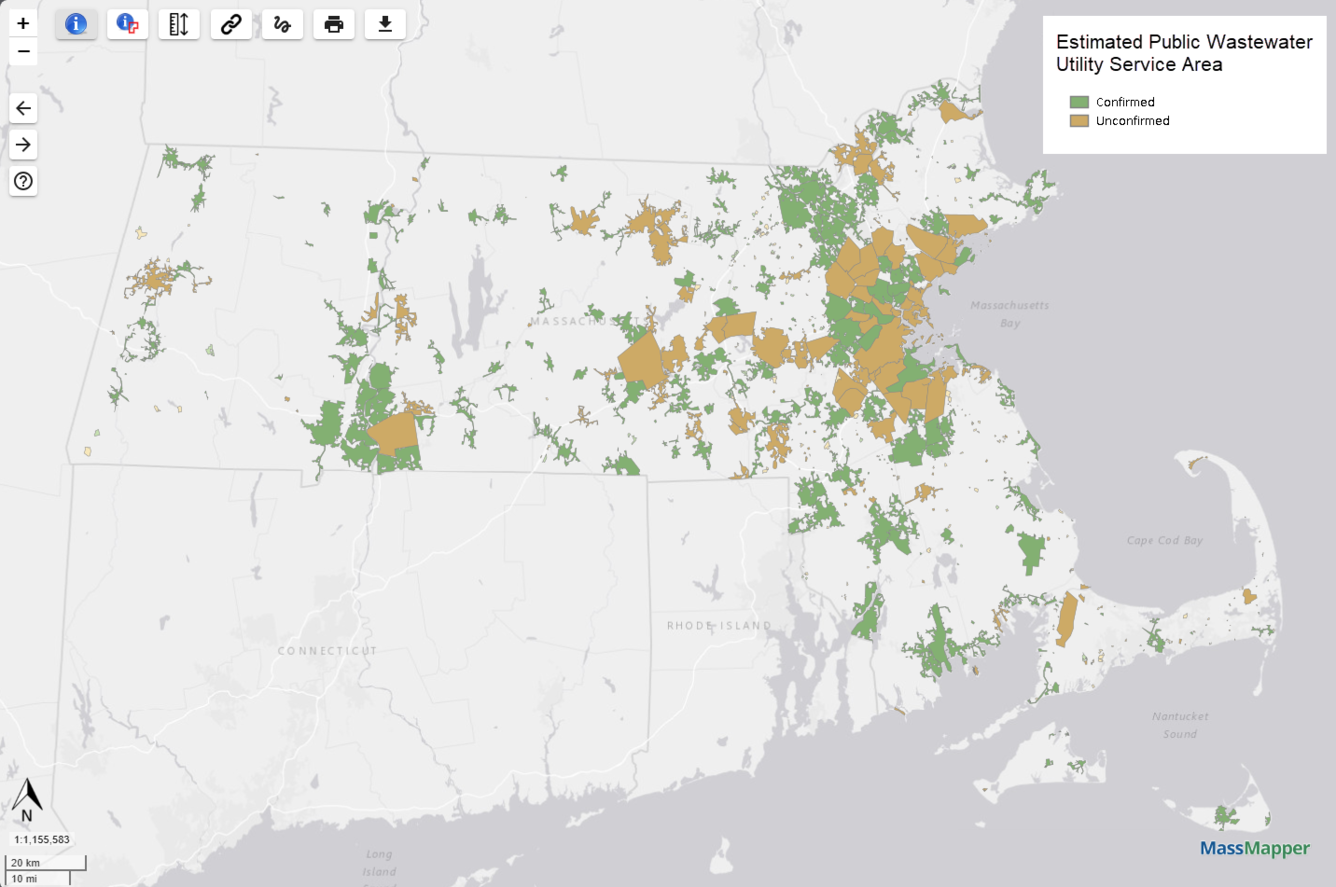
Figure 1. Map of public wastewater utility service area boundaries as they are shown in MassMapper. Green polygons show service area extents confirmed by the utility, and orange polygons show service areas that are in review and yet to be confirmed by the utility.
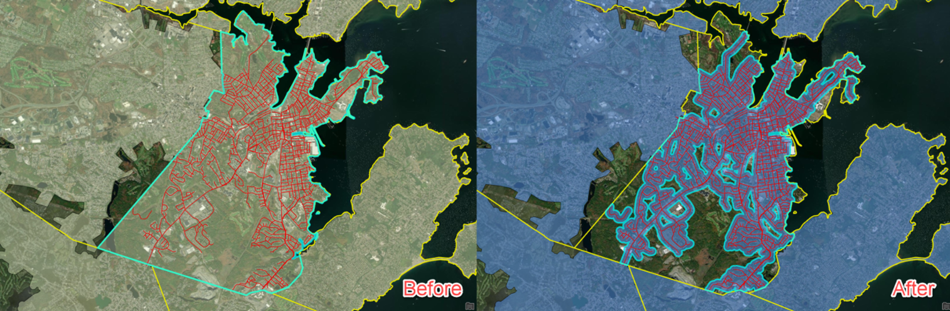
Figure 2. Side-by-side comparison of a public water utility’s draft service area boundary (left) and the refined boundary using utility feedback (right).
The U.S. Geological Survey (USGS), in cooperation with the Massachusetts Department of Environmental Protection (MassDEP) Water Utility Resilience Program (WURP), is assisting public water and wastewater utilities in transitioning their service infrastructure data to geographic information systems (GIS) and updating related statewide datasets and data visualization tools. Improving access to accurate spatial data will aid asset management and resiliency planning and mitigate risks to the water infrastructure.
In 2016, the MassDEP WURP began a collaborative effort to improve public water and wastewater utility mapping by providing technical assistance to local utilities to advance their GIS capabilities and to support the ongoing development of statewide water and wastewater service area extent layers. Improved access to spatial data can inform resiliency planning on a local level by allowing utilities to more efficiently locate system infrastructure for routine maintenance and repairs. On a state-level, the enhanced accessibility can guide preparedness by providing emergency managers with accurate mapping of critical infrastructure.
Since 2024, USGS has been supporting MassDEP on the following initiatives:
- transitioning public water and wastewater utilities to GIS by providing critical infrastructure mapping assistance that aids asset management and resilience planning
- developing and maintaining statewide service area delineations served by public water utilities or publicly owned wastewater utilities (Figure 1 and Figure 2)
- developing of critical infrastructure datasets that support resiliency planning
- identifying advanced data uses and applications for WURP datasets
- creating data visualization tools for screening level identification for resiliency or preparedness activities.
The data made available via USGS may not reflect the most current updates available for the statewide water and wastewater service area boundaries. Please refer to the WURP’s MassGIS page for the most up-to-date data release.
Figure 1. Map of public wastewater utility service area boundaries as they are shown in MassMapper. Green polygons show service area extents confirmed by the utility, and orange polygons show service areas that are in review and yet to be confirmed by the utility.
Figure 2. Side-by-side comparison of a public water utility’s draft service area boundary (left) and the refined boundary using utility feedback (right).