
Water is life: USGS remote sensing helps USFWS manage a precious resource
Desert bighorn sheep depend on free-standing water for survival. The USGS supports the US Fish and Wildlife Service at Cabeza Prieta National Wildlife Refuge in southern Arizona by providing remote sensing tools that assess how much water is stored in crucial cave-like, bedrock catchments, at any given time. This partnership enables the Refuge to preserve their desert bighorn sheep population.
The Cabeza Prieta National Wildlife Refuge (“Refuge”) stretches along the rugged Arizona-Mexico border, and at 1,000 square miles, it is the third largest national wildlife refuge in the continental United States.
Much of the Refuge is a designated wilderness area in a low elevation expanse of the Sonoran Desert. To the north lies the Barry M. Goldwater Air Force Range, and to the east are the Organ Pipe Cactus National Monument and Tohono O’odham Nation lands, further enhancing the area's remoteness and wilderness character.

Life in the Borderlands
This “green desert” has remarkable diversity of flora and fauna, with plants and animals that are sustained by the desert, and mountain ranges that punctuate the landscape. The Refuge was originally created in 1939 as a “game range to conserve and develop wildlife and other natural resources,” in part to protect one of its most iconic species, desert bighorn sheep (Ovis canadensis mexicana). This population of bighorn sheep is reliant upon water catchments called ‘tinajas’ for survival.


Tinajas and Water
The term "tinaja" translates to earthen or clay jar in Spanish, and refers to pools, pockets, or retention areas that are formed in bedrock by the erosive forces of sand and water. These natural features serve as critical sources of surface water storage in the desert, historically used by Native peoples and early travelers, and they remain an important water supply for animal desert dwellers today.
In the Refuge, tinajas, also called ‘tanks’ or ‘catchments,’ are either naturally occurring, improved or enlarged, or artificially constructed, and capture rainfall and runoff. Rainfall mainly happens during two seasons: winter storms and summer monsoons. However, since 1970, there has been a noticeable decline in annual rainfall alongside rising air temperatures. As a result, these tanks do not fill to their maximum water storage capacity or provide a consistent year-round water supply.

Protecting and Managing Wildlife
One of the US Fish and Wildlife Service resource management objectives at the Refuge is to sustain a population of 500 to 700 desert bighorn sheep. Water availability is particularly consequential during summer months when desert bighorn sheep most commonly visit managed water resources. Since declines in rainfall and increased evaporation have reduced water supplies, Refuge managers haul water by trucks and trailers to fill the tinajas.
Water hauling operations can be expensive and have effects on wildlife and designated wilderness, such as habitat disruption and increased erosion. In alignment with wilderness stewardship and the US Fish and Wildlife Service (USFWS) Comprehensive Conservation Plan, site visits are also intended to be kept to a minimum — only when absolutely needed.


Management decisions regarding how often and how much water is needed to fill the tinajas are determined by consistent monitoring and the volume of water currently in the tinajas. Refuge managers need to regularly assess water loss and recharge so that water is available for desert bighorn sheep, and the Refuge can meet its stewardship objectives. However, the tinajas’ complex cave-like geometries pose significant challenges for accurately calculating water volumes.


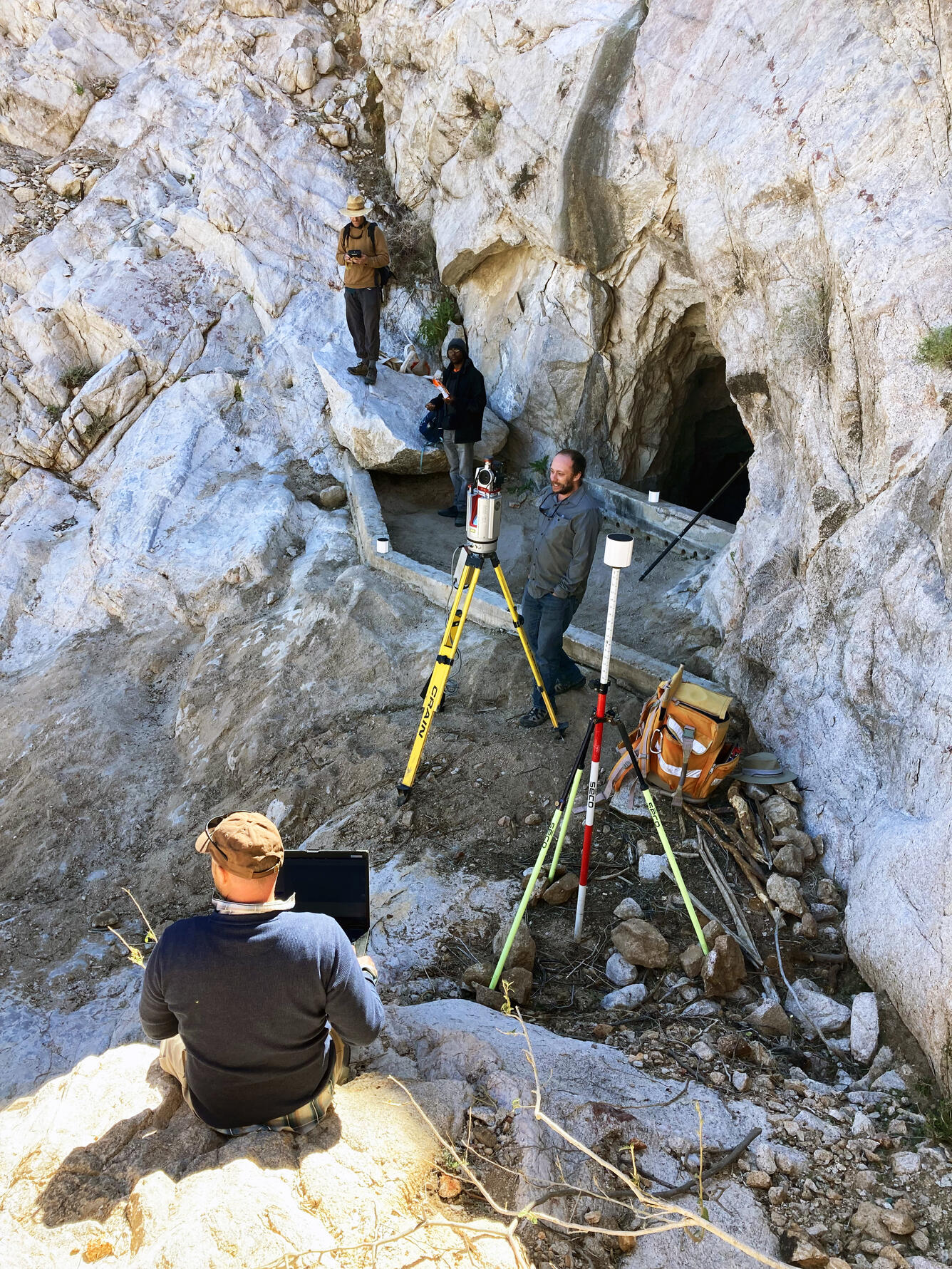
USGS Expertise
At the request and in cooperation with the US Fish and Wildlife Service, the USGS Southwest Biological Science Center (SBSC) employed ground-based light detection and ranging (lidar) remote sensing to help the Refuge meet two of its resource management objectives:
- To accurately document the geometry and storage capacity of three of the highest priority tinajas, and
- To develop a model that estimates water volumes from monitoring and observations of the water surface levels in each tinaja.

Ground-based lidar remote sensing is an efficient and accurate survey tool to measure complex topography and geologic structures like these bedrock catchments, without the need to simplify surface geometry into common three-dimensional shapes, such as cylinders.
In addition to providing estimates for tinaja fill volumes, the SBSC also calculated the volume of sediment that was collected by retention dams above the catchments that when full, spill over into the tinaja and can reduce the amount of space for water storage.


SBSC’s work allows the Refuge to:
- Easily estimate water available for wildlife at any point in time,
- Make decisions about sediment removal for greater water storage,
- Interpret tinaja recharge volume after rainstorms, and
- Enhance the effectiveness and cost-efficiency of management decisions related to whether and when water should be transported by vehicles to mechanically refill the tinajas in designated wilderness.


These tools are useful for calculating water storage, water recharge, and water loss in habitats managed for desert wildlife. The methods implemented in this project can be applied to other natural, modified, and developed water resources within the region, and are used to support decision-making by Refuge managers to meet both wildlife and wilderness stewardship objectives.


In the videos below, a herd of desert bighorn sheep (Ovis canadensis mexicana) interact near a water catchment, also known as a tinaja, in the Sonoran Desert, Cabeza Prieta National Wildlife Refuge, southern Arizona.
All videos by Ron Finney, North Woods Productions, paid permission for use licensed to USGS.


