
GoMMAPPS Aerial Seabird Survey Design
By Eastern Ecological Science Center
2018 (approx.)

Detailed Description
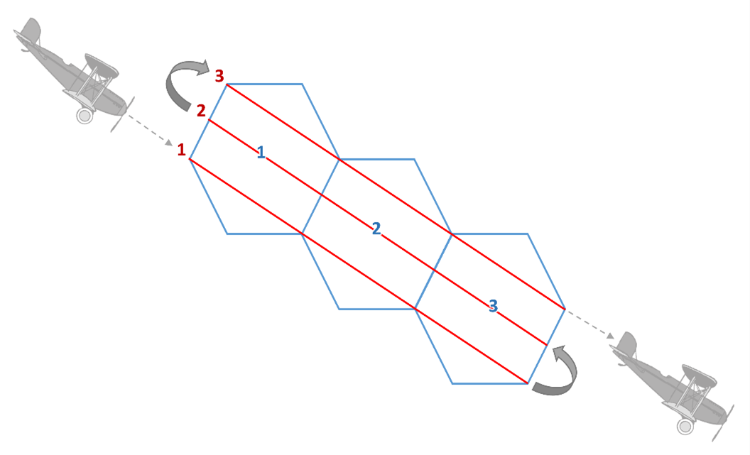
Hexagon-based aerial survey design with transects overlaid. The EPA 40 km2 hexagons (White et al. 2018) were overlaid across the entirety of the northern Gulf of Mexico. Sampled hexagons were then selected using a Generalized Random Tesselation Stratified (GRTS) sampling scheme. Three parallel standard strip-transects (1 nm apart) spanned the length of the three-hexagon unit.
Author: Allison Sussman
Sources/Usage
Public Domain.
Related

Marine Bird Populations and the Gulf of Mexico Marine Assessment Program for Protected Species (GoMMAPPS)
The objective of the Gulf of Mexico Marine Assessment for Protected Species (GoMMAPPS) project was to document the occurrence and diversity of bird species in nearshore and open sea environments of the Gulf of America for the purposes of better informing regulatory and other decisions that influence the conservation of migratory birds.
Related
Marine Bird Populations and the Gulf of Mexico Marine Assessment Program for Protected Species (GoMMAPPS)
The objective of the Gulf of Mexico Marine Assessment for Protected Species (GoMMAPPS) project was to document the occurrence and diversity of bird species in nearshore and open sea environments of the Gulf of America for the purposes of better informing regulatory and other decisions that influence the conservation of migratory birds.