
The Klamath River: Year 1 Post-Dam Removal
Detailed Description
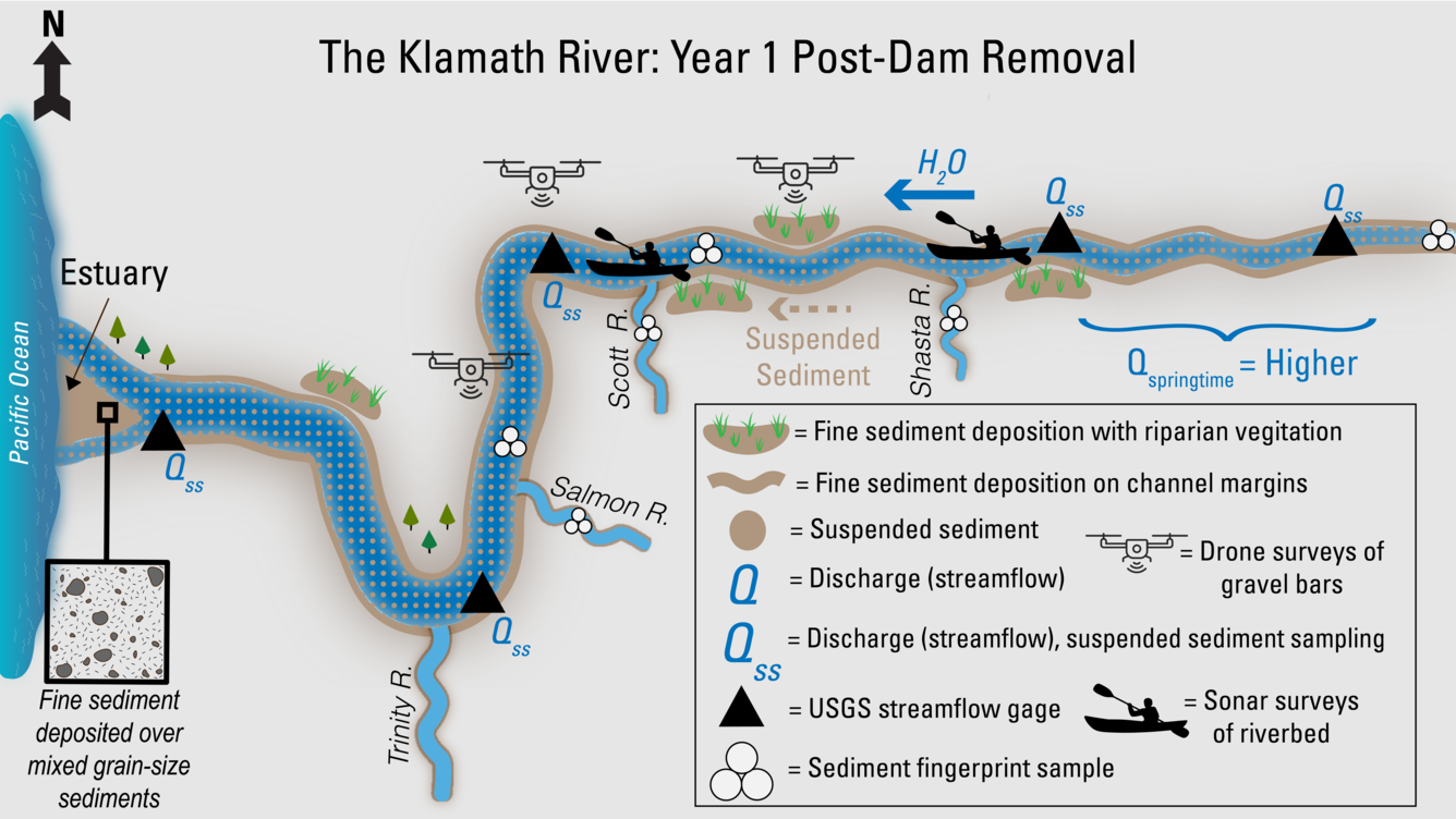
This illustration shows USGS work during the first year after dam removal. With the dams gone, the Klamath River now flows freely in the former hydroelectric reach, releasing stored sediment. Large amounts of fine sediment move downstream, depositing along channel edges and gravel bars, where new vegetation can grow. Springtime flows are higher. USGS gages continue to track streamflow and suspended sediment. Sediment fingerprinting samples are still taken from the main river and the Salmon, Scott, and Shasta tributaries. Drones survey sediment-covered bars, and boats use sonar to map streambed changes underwater. At the estuary, mixed grain-sized sediment is now covered by a layer of fine material from upstream.
Sources/Usage
Public Domain.