
Landsat Mosaic of Fort Peck Lake, Montana

Detailed Description
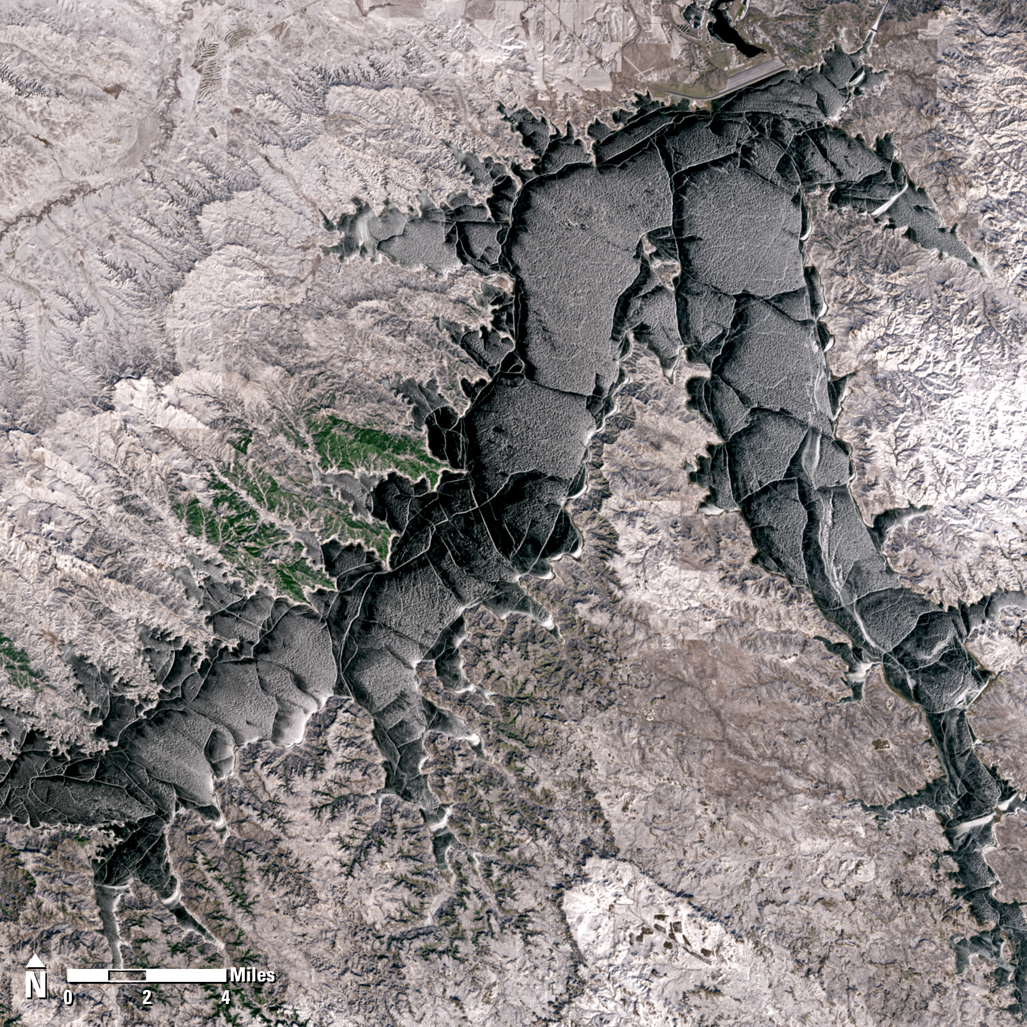
Fort Peck Lake, a sprawling reservoir formed by the Fort Peck Dam on the Missouri River, lies in the eastern prairie region of Montana near the city of Glasgow. According to the U.S. Army Corps of Engineers, it ranks as the fifth largest reservoir in the United States, and it has over 1,500 miles (2,415 kilometers) of shoreline—a distance that exceeds the length of California’s coastline. The vast size of Fort Peck Lake and its remoteness make it a popular recreational destination year-round.
During the winter months, the vast expanse freezes over, transforming the area into a landscape of ice and snow that attracts outdoor enthusiasts, including ice fishers and ice skaters. The average ice season for Fort Peck Lake is about 90 days, but it has ranged from 23 days in 2000 to 144 days in 1956. This season, Fort Peck Lake was declared fully covered with ice on January 19, 2025, just one week prior to Landsat 8 and Landsat 9 acquiring these frosty and picturesque scenes of the area.
This image is a mosaic of two different Landsat scenes:
Landsat 8 Operational Land Imager (OLI)
Path 037/027
January 26, 2025
Landsat 9 Operational Land Imager 2 (OLI-2)
Path 036/027
January 27, 2025
Sources/Usage
Public Domain.