
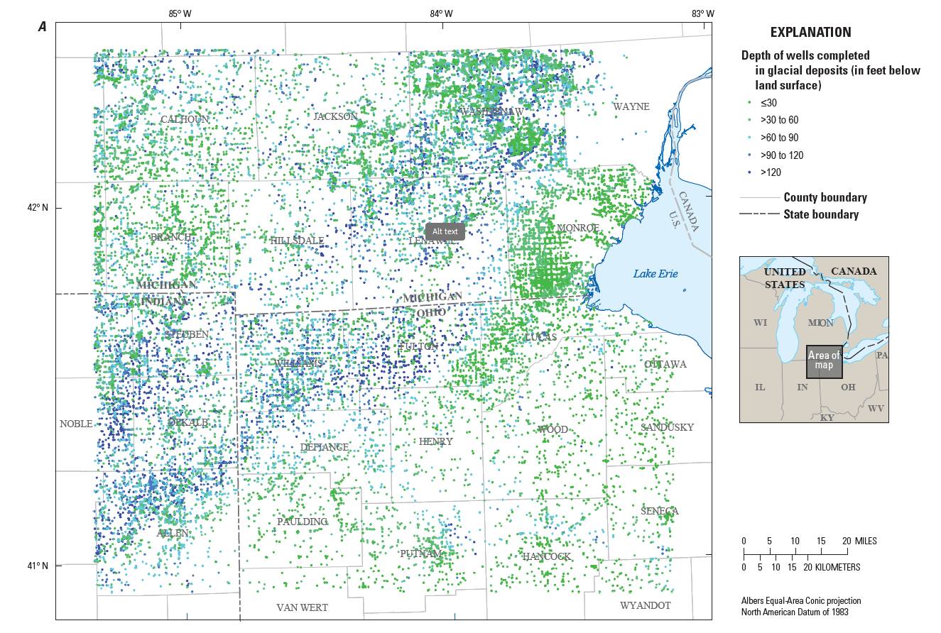
Map showing the distribution of wells in glacial deposits
By Ohio-Kentucky-Indiana Water Science Center
May 2025 (approx.)
Detailed Description
Description: Maps showing the distribution of wells completed in glacial deposits used to create maps of hydrogeologic information and a three-dimensional volumetric model for the glacial deposits.
Sources/Usage
Public Domain.
Created by Scientists at the USGS Ohio-Kentucky-Indiana Water Science Center for use in the project
Related

Hydrogeologic Mapping and Three-Dimensional Geologic Modeling of Glacial Deposits in a Multicounty Area of Southeastern Michigan, Northeastern Indiana, and Northwestern Ohio
Groundwater resources in southern Michigan, northeastern Indiana, and northwestern Ohio, have been a recurring subject of interest related to sources of public, irrigation, and other water supplies and the potential of glacial deposits to supply water to adjacent parts of Ohio. The glacial deposits that are part of the aquifer system informally known as the “Michindoh aquifer” are a principal...
Related
Hydrogeologic Mapping and Three-Dimensional Geologic Modeling of Glacial Deposits in a Multicounty Area of Southeastern Michigan, Northeastern Indiana, and Northwestern Ohio
Groundwater resources in southern Michigan, northeastern Indiana, and northwestern Ohio, have been a recurring subject of interest related to sources of public, irrigation, and other water supplies and the potential of glacial deposits to supply water to adjacent parts of Ohio. The glacial deposits that are part of the aquifer system informally known as the “Michindoh aquifer” are a principal...