
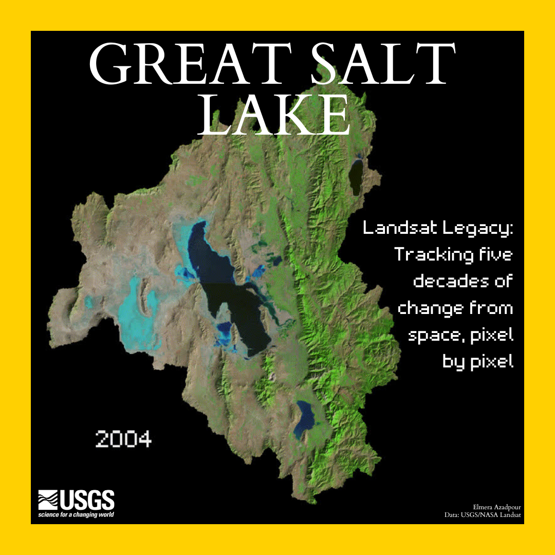
Satellite imagery of Great Salt Lake, which goes from 2000 to 2022. Stylized to look similar to a magazine cover.
Detailed Description
Monitoring the Great Salt Lake from space 🛰️
Landsat satellites provide decades of consistent, high-resolution images of Earth's surface. These are essential for tracking changes in water, land, and ecosystems. By capturing multispectral data at regular intervals, Landsat helps detect shoreline recession, quantify surface area loss, and assess ecosystem responses to drought, climate change, and water management decisions.
This capability is critical for monitoring systems like the Great Salt Lake, which has undergone substantial declines in water levels over recent years due to increased water demand, diversion, and climatic variability. Landsat provides a record of long-term observations necessary for quantifying changes and informing hydrologic and management responses.
Learn more about Landsat
National Geographic Theme #30DayChartChallenge
Image: Great Salt Lake. Landsat Legacy: Tracking five decades of change from space, pixel by pixel. Satellite imagery of Great Salt Lake, which goes from 2000 to 2022. Stylized to look similar to a magazine cover, with a black background and yellow border.
Sources/Usage
Public Domain.