
Social media for Superfund Site drone survey
By Woods Hole Coastal and Marine Science Center
July 2025 (approx.)
Detailed Description
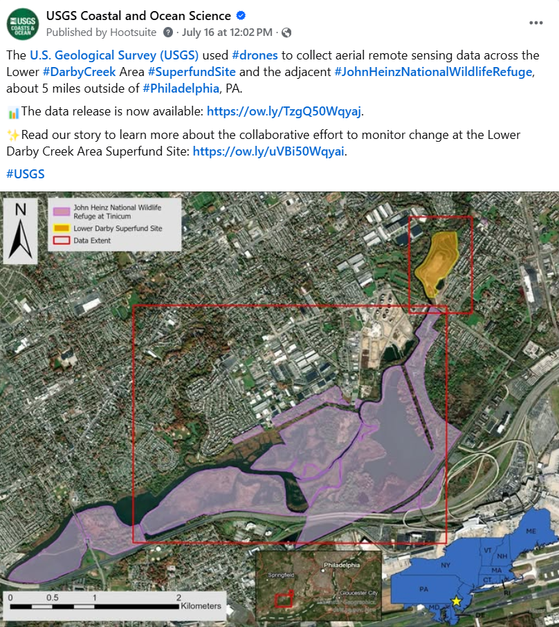
The USGS used #drones to collect aerial remote sensing data across the Lower #DarbyCreek Area Superfund Site and the adjacent #JohnHeinzNationalWildlifeRefuge, about 5 miles outside of #Philadelphia, PA. The data release is now available: https://doi.org/10.5066/P134HU3Y.
Read our story to learn more about this collaborative effort to monitor change at the Lower Darby Creek Area #SuperfundSite: https://www.usgs.gov/centers/whcmsc/news/monitoring-change-lower-darby-creek-area-superfund-site.
Sources/Usage
Public Domain.