
Volcano Watch — Remembering a destructive Mauna Loa eruption 75 years ago
Lava fountains at the summit of Kīlauea have been shining a spotlight on Hawaii’s most active volcano but let us not forget the larger one looming in the background of Kīlauea. Mauna Loa is currently quiet and now is a good opportunity to remember the 1950 Southwest Rift Zone eruption—the volcano’s most recent eruption to have caused significant damage—75 years ago.
Volcano Watch is a weekly article and activity update written by U.S. Geological Survey Hawaiian Volcano Observatory scientists and affiliates. Today's article is by HVO geologist Katie Mulliken.
Mauna Loa erupted frequently prior to 1950. Consistent written records of Mauna Loa eruptions begin in 1843. Between then and 1950, there were 30 Mauna Loa eruptions which means that before 1950, Mauna Loa erupted on average every 3–4 years.
Fast forward to 2025, and there have been only three eruptions of Mauna Loa in the past 75 years since 1950: 1975, 1984, and 2022. While the frequency of Mauna Loa eruptions has decreased in the past 75 years compared to the century before that, Mauna Loa remains an active volcano that will erupt again someday.
Eruptions of Mauna Loa generally start high in the summit region, above 12,000 feet (3,660 m) elevation. From there, eruptions can migrate into one of the two rift zones—the Northeast Rift Zone or the Southwest Rift Zone—or, less commonly, radial vents on the northwest flank.
During the spring of 1950, Mauna Loa inflation due to magma accumulating beneath the surface was evident on monitoring stations at the summit of Kīlauea. In May 1950, seismic activity in Mauna Loa increased, with the largest earthquake—a magnitude-6.4—occurring on May 29. On June 1, a swarm of earthquakes occurred, and at 9:25 p.m. HST the night sky was illuminated with red glow as a fissure system 2.5 miles (4 km) long opened high on the southwest flank of the summit region of Mauna Loa.
Activity at the initial fissure system only lasted a few hours, and lava flows stalled at about 9,000 ft (2,800 m) elevation. Soon after, two other sets of fissure vents opened lower on the Southwest Rift Zone, between 10,500–8,500 ft (3,200–2,590 m) and 8,200–7,810 ft (2,500–2,380 m) elevation. Lava fountains nearly 200 ft (60 m) high fed a system of complex braided lava flows that were moving nearly 15 miles (24 km) per hour down the steep west flanks of Mauna Loa. About three hours after these lower fissures opened, the first lava flow crossed Highway 11 and entered the ocean, destroying a gas station, post office, and several homes along the way.
Fourteen and a half hours after the eruption began, another lava flow crossed Highway 11; this second flow destroyed several homes and entered the ocean about 1.2 miles (2 km) south of the first flow. Activity at both of these lava flows and their ocean entries ceased within about a day.
Yet another set of fissure vents opened even lower on the volcano later the night of June 1, between 8,200–7,810 ft (2,500–2,380 m) elevation. A lava flow from this fissure entered the ocean by the afternoon of June 2, farther south than the two earlier flows. For the next three weeks, lava would drain from Mauna Loa volcano via this channelized lava flow into the ocean.
Before the eruption ended on June 23, Hoʻokena village was destroyed, including a post office, church, gas station, cemetery, and 5–6 homes. Structures of the Magoon Ranch, the Ohia Lodge, and several other vacation/fishing cottages were also destroyed. Lava flows crossed Highway 11 in three locations and one man, who had been looking after cattle on a ranch, was trapped between two lava flows for 28 hours before being rescued by the U.S. Coast Guard. Thirty-five homestead lots were later opened in Kona for people whose property had been covered by lava in 1950.
The 1950 eruption was the largest-volume eruption of the Southwest Rift Zone since written records began; lava flows moved quickly down steep slopes in the region to enter the ocean within hours of the eruption onset. Mauna Loa has been quiet since the Northeast Rift Zone eruption in 2022, but monitoring data indicates that magma is slowly accumulating within the volcano. As communities on the flanks of Mauna Loa continue to grow, Island of Hawaiʻi residents should not forget these past eruptions. While 75 years is long in the human time scale, it goes by like the blink of an eye for an active volcano.
Volcano Activity Updates
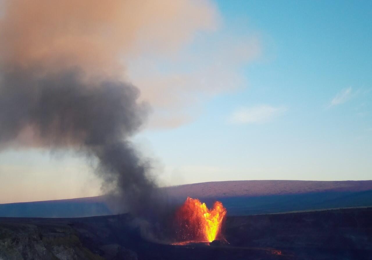
Kīlauea has been erupting episodically within the summit caldera since December 23, 2024. Its USGS Volcano Alert level is WATCH.
Episode 28 of the Kīlauea summit eruption in Halemaʻumaʻu crater occurred on July 9, with approximately 9 hours of fountaining from the north vent. Summit region inflation since the end of episode 28, along with persistent tremor, suggests that another episode is possible. Current inflation data indicate that episode 29 is likely to start between July 17 and 18. Sulfur dioxide emission rates are elevated in the summit region during active eruption episodes. No unusual activity has been noted along Kīlauea’s East Rift Zone or Southwest Rift Zone.
Mauna Loa is not erupting. Its USGS Volcano Alert Level is at NORMAL.
One earthquake was reported felt in the Hawaiian Islands during the past week: a M3.0 earthquake 5 km (3 mi) SSW of Pāhala at 31 km (19 mi) depth on July 15 at 6:14 p.m. HST.
HVO continues to closely monitor Kīlauea and Mauna Loa.
Please visit HVO’s website for past Volcano Watch articles, Kīlauea and Mauna Loa updates, volcano photos, maps, recent earthquake information, and more. Email questions to askHVO@usgs.gov.