USGS Streamgage on the Connecticut River with Infrastructure
USGS Streamgage on the Connecticut River with InfrastructureA view looking across the Connecticut River from a USGS streamgage in Suffield, Connecticut.

Official websites use .gov
A .gov website belongs to an official government organization in the United States.
Secure .gov websites use HTTPS
A lock () or https:// means you’ve safely connected to the .gov website. Share sensitive information only on official, secure websites.
Photos, videos, audio files, and webcam photos described and linked on this webpage come from a wide variety of USGS science activities and presentations done by USGS Science Center staff members in the Northeast Region. The "View All" link buttons at the bottom of the sections on this page lead to webpages containing links to additional multimedia files.

This video is an introduction of the USGS Northeast Region's science efforts to support society's evolving needs through its engaged and skilled workforce.

Check out the winning photographs from the latest Northeast Region Photo Contest. Categories include People, USGS at Work, Where We Work, and Honorable Mention.
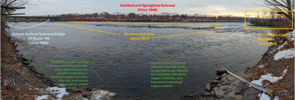
A view looking across the Connecticut River from a USGS streamgage in Suffield, Connecticut.
A view looking across the Connecticut River from a USGS streamgage in Suffield, Connecticut.
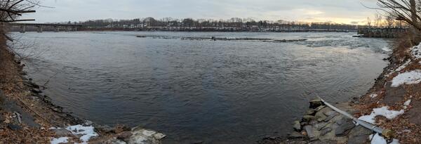
A view looking across the Connecticut River from a USGS streamgage in Suffield, Connecticut.
A view looking across the Connecticut River from a USGS streamgage in Suffield, Connecticut.
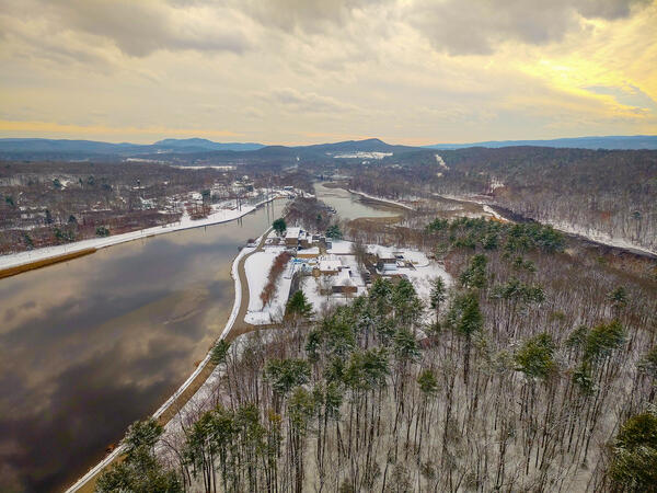
Aerial view of the USGS S.O. Conte Anadromous Fish Research Laboratory and Connecticut River at Turners Falls, Massachusetts.
Fall 2025 Photo Contest Winner: Shannon Fisher, Honorable Mention category
Aerial view of the USGS S.O. Conte Anadromous Fish Research Laboratory and Connecticut River at Turners Falls, Massachusetts.
Fall 2025 Photo Contest Winner: Shannon Fisher, Honorable Mention category
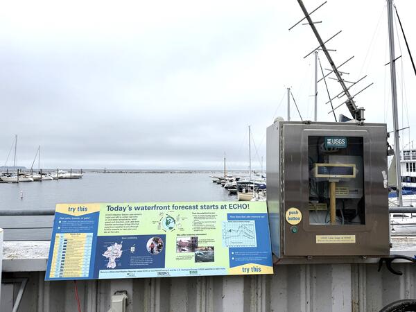
The USGS streamgage on Lake Champlain in Burlington, Vermont, is near the ECHO Leahy Center, Vermont’s Science and Nature Museum.
The USGS streamgage on Lake Champlain in Burlington, Vermont, is near the ECHO Leahy Center, Vermont’s Science and Nature Museum.
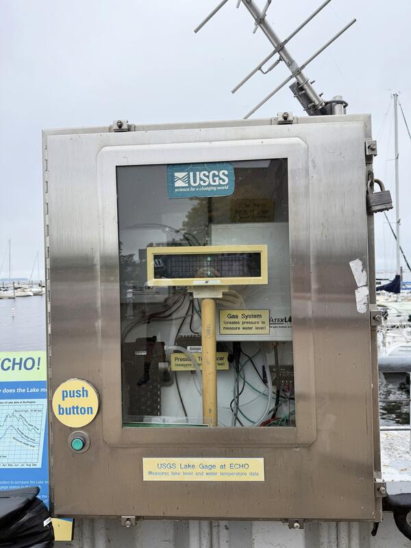
The USGS New England Water Science Center operates a streamgage on Lake Champlain in Burlington, Vermont.
The USGS New England Water Science Center operates a streamgage on Lake Champlain in Burlington, Vermont.
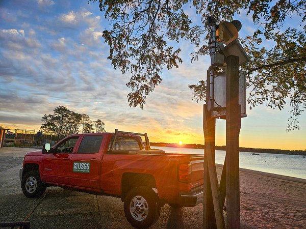
Sunrise during early morning checks at a USGS water quality/elevation station in West Harbor Beach Memorial Park, in Bayville, New York.
Fall 2025 Photo Contest Winner: Natalie Cheung, Where We Work category
Sunrise during early morning checks at a USGS water quality/elevation station in West Harbor Beach Memorial Park, in Bayville, New York.
Fall 2025 Photo Contest Winner: Natalie Cheung, Where We Work category

Discover what a career in science with the U.S. Geological Survey looks like. The Maryland-Delaware-DC Water Science Center is home to skilled scientists of many disciplines: hydrologists, geomorphologists, geographers, data scientists, statisticians, biologists, technicians, and more. You name it, we need it.
Discover what a career in science with the U.S. Geological Survey looks like. The Maryland-Delaware-DC Water Science Center is home to skilled scientists of many disciplines: hydrologists, geomorphologists, geographers, data scientists, statisticians, biologists, technicians, and more. You name it, we need it.

USGS is committed to monitoring water quality and quantity in all conditions, and sometimes that means walking out onto frozen rivers to make a measurement. In this episode, we join a team as they cut through the ice to safely access the water that still flows underneath.
USGS is committed to monitoring water quality and quantity in all conditions, and sometimes that means walking out onto frozen rivers to make a measurement. In this episode, we join a team as they cut through the ice to safely access the water that still flows underneath.

Did you know the USGS is involved in understanding how PFAS travel through the environment?
Did you know the USGS is involved in understanding how PFAS travel through the environment?

Are you afraid of the dark?
Not this scientist. He is using a special technique to examine sediment samples that can help scientists study historical hurricanes.
Are you afraid of the dark?
Not this scientist. He is using a special technique to examine sediment samples that can help scientists study historical hurricanes.

On a fair sunny day in March, hydrologic technician Michael Brownley makes his way up the metal rung ladder to a platform. From there he beards a cableway, no bigger than a twin-sized bed. Luckily, he’s the only one aboard the cableway, space is tight as it is.
On a fair sunny day in March, hydrologic technician Michael Brownley makes his way up the metal rung ladder to a platform. From there he beards a cableway, no bigger than a twin-sized bed. Luckily, he’s the only one aboard the cableway, space is tight as it is.

Narrated presentation that provides a unique synthesis of the story of nutrient water quality in the Susquehanna watershed.
Narrated presentation that provides a unique synthesis of the story of nutrient water quality in the Susquehanna watershed.

Quonopaug Brook at Rt 116 near North Scituate, Rhode Island. Monitoring location 01115183 is a tributary to the Scituate Reservoir in Providence County, Rhode Island. Current conditions of discharge and gage height are available.
Quonopaug Brook at Rt 116 near North Scituate, Rhode Island. Monitoring location 01115183 is a tributary to the Scituate Reservoir in Providence County, Rhode Island. Current conditions of discharge and gage height are available.
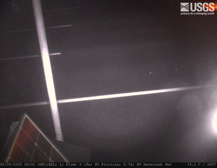
MA-HWY-I95S-HMA-STATION 00567 Needham, MA. The highway monitoring station 421650071120401 is located along Interstate 95 in Norfolk County, Massachusetts.
MA-HWY-I95S-HMA-STATION 00567 Needham, MA. The highway monitoring station 421650071120401 is located along Interstate 95 in Norfolk County, Massachusetts.
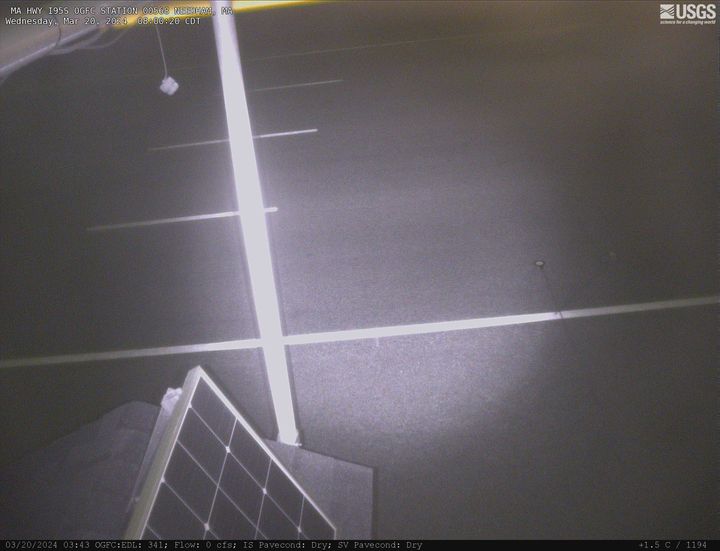
MA-HWY-I95S-OGFC-STATION 00568 Needham, MA. The highway monitoring station 421652071120601 is located along Interstate 95 in Norfolk County, Massachusetts.
MA-HWY-I95S-OGFC-STATION 00568 Needham, MA. The highway monitoring station 421652071120601 is located along Interstate 95 in Norfolk County, Massachusetts.
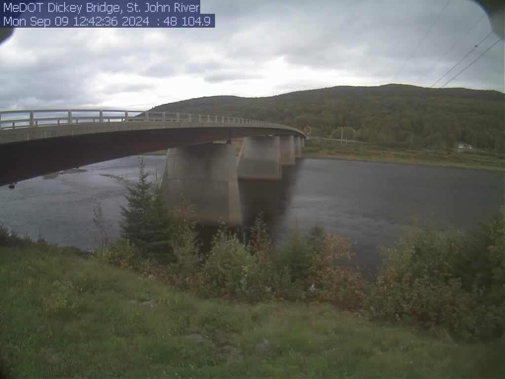
View of the St. John River from the webcam located at St. John River at Dickey, Maine (01037050)
View of the St. John River from the webcam located at St. John River at Dickey, Maine (01037050)
PLEASE NOTE: During winter months, ice and snow can affect the picture quality. The camera is cleaned as often as it is safe to do so.
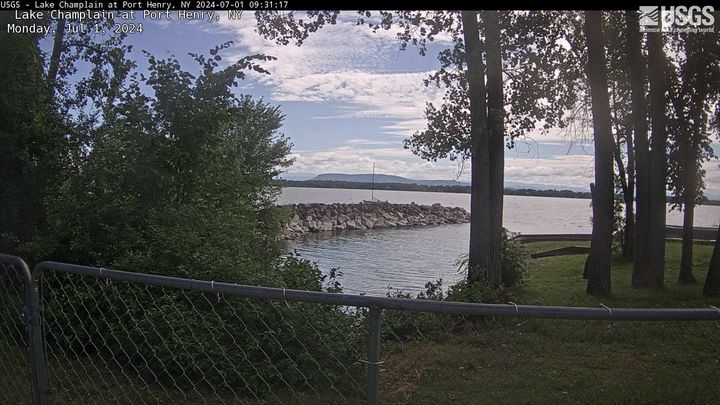
Lake Champlain at Port Henry, NY (04294413)
PLEASE NOTE: During winter months, ice and snow can affect the picture quality. The camera is cleaned as often as it is safe to do so.
Lake Champlain at Port Henry, NY (04294413)
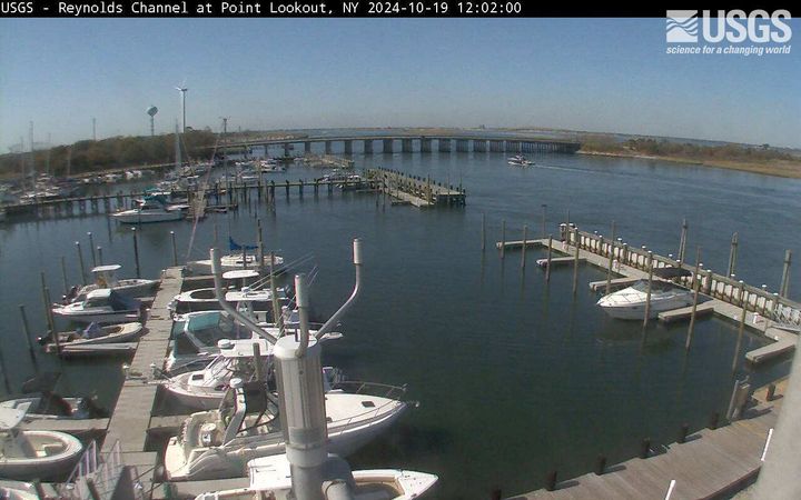
Latest webcam image of Reynolds Channel (01310740).
Image timestamp is in Eastern Standard Time.
Webcam is located on tower at USGS gaging station, looking west-northwest toward Loop Parkway Bridge.
Latest webcam image of Reynolds Channel (01310740).
Image timestamp is in Eastern Standard Time.
Webcam is located on tower at USGS gaging station, looking west-northwest toward Loop Parkway Bridge.