
Presentation summarizing a study to characterize the magnitude and extent of the December 18-21, 2023, flood in various portions of the State of Maine.
Amanda Tudor
Amanda Tudor is a Hydrologist in the New England Water Science Center.
Amanda's work focuses primarily on the development of hydraulic models for flood risk assessment.
Science and Products

December 2023 Flood in Maine
The U.S. Geological Survey (USGS) New England Water Science Center, in cooperation with the Federal Emergency Management Agency (FEMA), is conducting a study to characterize the magnitude and extent of the December 18-21, 2023 Flood in various portions of the State of Maine.

Water Resources Inventory and Assessment at Katahdin Woods and Waters National Monument
The U.S. Geological Survey (USGS) New England Water Science Center, in cooperation with the National Park Service, is compiling and evaluating all known water resources, and documented infrastructure associated with these resources, within the Katahdin Woods and Waters National Monument and contributing associated watersheds.

A Statewide Hydraulic Modeling Tool for Stream Crossing Projects in Massachusetts
The U.S. Geological Survey (USGS) and the University of Massachusetts at Amherst (UMass Amherst), in cooperation with the Massachusetts Department of Environmental Protection (MassDEP), began a series of studies in 2019 to develop a GIS-based hydraulic modeling tool and to provide preliminary culvert designs for stream-crossing replacement projects in Massachusetts on USGS StreamStats.

Development of Flood Insurance Maps in New England
FEMA has requested USGS expertise in hydraulics, hydrology, and mapping to generate flood insurance maps for New England.
Flood in Maine - December 2023
Presentation summarizing a study to characterize the magnitude and extent of the December 18-21, 2023, flood in various portions of the State of Maine.
A GIS-Based Hydraulic Modeling Tool for Massachusetts Stream Crossing Replacement Projects in USGS Streamstats - Massachusetts Association of Floodplain Management Annual Conference, 2024
A GIS-Based Hydraulic Modeling Tool for Massachusetts Stream Crossing Replacement Projects in USGS Streamstats - Massachusetts Association of Floodplain Management Annual Conference, 2024The U.S.
A GIS-Based Hydraulic Modeling Tool for Massachusetts Stream Crossing Replacement Projects in USGS Streamstats - Massachusetts Association of Floodplain Management Annual Conference, 2024
A GIS-Based Hydraulic Modeling Tool for Massachusetts Stream Crossing Replacement Projects in USGS Streamstats - Massachusetts Association of Floodplain Management Annual Conference, 2024A GIS-Based Hydraulic Modeling Tool for Massachusetts Stream Crossing Replacement Projects in USGS Streamstats - Massachusetts Association of Floodplain Management Annual Conference, 2024
A GIS-Based Hydraulic Modeling Tool for Massachusetts Stream Crossing Replacement Projects in USGS Streamstats - Massachusetts Association of Floodplain Management Annual Conference, 2024The U.S.

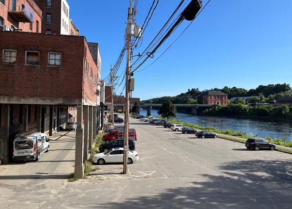
Kennebec River in downtown Augusta, Maine during flooding and normal flow
Kennebec River in downtown Augusta, Maine during flooding and normal flowKennebec River in downtown Augusta, Maine during flooding and normal flow. The left photo was taken on December 19, 2023 after a heavy rainstorm. The right photo was taken in September 2024.
An Automated Hydraulic Modeling Tool for Stream Crossing Replacement Projects in Massachusetts - Transportation Research Board Annual Meeting, 2024
An Automated Hydraulic Modeling Tool for Stream Crossing Replacement Projects in Massachusetts - Transportation Research Board Annual Meeting, 2024The U.S.

Recording a High-Water Mark After Maine Flooding
A USGS hydrologist records a high-water mark on a tree near the Crooked River in Waterford, Maine in the days following a significant flood event.
A USGS hydrologist records a high-water mark on a tree near the Crooked River in Waterford, Maine in the days following a significant flood event.
Science and Products
December 2023 Flood in Maine
The U.S. Geological Survey (USGS) New England Water Science Center, in cooperation with the Federal Emergency Management Agency (FEMA), is conducting a study to characterize the magnitude and extent of the December 18-21, 2023 Flood in various portions of the State of Maine.
Water Resources Inventory and Assessment at Katahdin Woods and Waters National Monument
The U.S. Geological Survey (USGS) New England Water Science Center, in cooperation with the National Park Service, is compiling and evaluating all known water resources, and documented infrastructure associated with these resources, within the Katahdin Woods and Waters National Monument and contributing associated watersheds.
A Statewide Hydraulic Modeling Tool for Stream Crossing Projects in Massachusetts
The U.S. Geological Survey (USGS) and the University of Massachusetts at Amherst (UMass Amherst), in cooperation with the Massachusetts Department of Environmental Protection (MassDEP), began a series of studies in 2019 to develop a GIS-based hydraulic modeling tool and to provide preliminary culvert designs for stream-crossing replacement projects in Massachusetts on USGS StreamStats.
Development of Flood Insurance Maps in New England
FEMA has requested USGS expertise in hydraulics, hydrology, and mapping to generate flood insurance maps for New England.
Flood in Maine - December 2023
Presentation summarizing a study to characterize the magnitude and extent of the December 18-21, 2023, flood in various portions of the State of Maine.
Presentation summarizing a study to characterize the magnitude and extent of the December 18-21, 2023, flood in various portions of the State of Maine.
A GIS-Based Hydraulic Modeling Tool for Massachusetts Stream Crossing Replacement Projects in USGS Streamstats - Massachusetts Association of Floodplain Management Annual Conference, 2024
A GIS-Based Hydraulic Modeling Tool for Massachusetts Stream Crossing Replacement Projects in USGS Streamstats - Massachusetts Association of Floodplain Management Annual Conference, 2024The U.S.
A GIS-Based Hydraulic Modeling Tool for Massachusetts Stream Crossing Replacement Projects in USGS Streamstats - Massachusetts Association of Floodplain Management Annual Conference, 2024
A GIS-Based Hydraulic Modeling Tool for Massachusetts Stream Crossing Replacement Projects in USGS Streamstats - Massachusetts Association of Floodplain Management Annual Conference, 2024A GIS-Based Hydraulic Modeling Tool for Massachusetts Stream Crossing Replacement Projects in USGS Streamstats - Massachusetts Association of Floodplain Management Annual Conference, 2024
A GIS-Based Hydraulic Modeling Tool for Massachusetts Stream Crossing Replacement Projects in USGS Streamstats - Massachusetts Association of Floodplain Management Annual Conference, 2024The U.S.
Kennebec River in downtown Augusta, Maine during flooding and normal flow
Kennebec River in downtown Augusta, Maine during flooding and normal flowKennebec River in downtown Augusta, Maine during flooding and normal flow. The left photo was taken on December 19, 2023 after a heavy rainstorm. The right photo was taken in September 2024.
An Automated Hydraulic Modeling Tool for Stream Crossing Replacement Projects in Massachusetts - Transportation Research Board Annual Meeting, 2024
An Automated Hydraulic Modeling Tool for Stream Crossing Replacement Projects in Massachusetts - Transportation Research Board Annual Meeting, 2024The U.S.
Recording a High-Water Mark After Maine Flooding
A USGS hydrologist records a high-water mark on a tree near the Crooked River in Waterford, Maine in the days following a significant flood event.
A USGS hydrologist records a high-water mark on a tree near the Crooked River in Waterford, Maine in the days following a significant flood event.