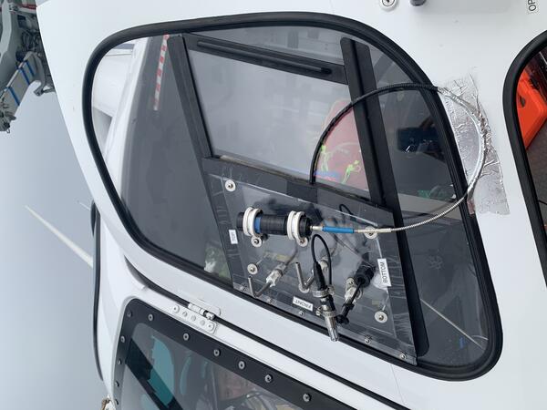
U.S. flag

An official website of the United States government

Multimedia

Images

Color photos of the summit of Mount Rainier with snow on the mountain and clouds below.
Aerial view of the summit of Mount Rainier taken during the gas flight.

Aerial view of the summit of Mount Rainier taken during the gas flight. The photo was taken looking south, and Rainier (14,411’) rises prominently above the cloud deck at about 8,000’. Mount St. Helens (8,357’) is faintly visible in the distance.  

Aerial view of the summit of Mount Rainier taken during the gas flight. The photo was taken looking south, and Rainier (14,411’) rises prominently above the cloud deck at about 8,000’. Mount St. Helens (8,357’) is faintly visible in the distance.  

Color photo of a hand held computer tablet displaying data in real time.
Gas composition data is displayed in real time during gas flights.

Gas composition data is displayed in real time during gas flights. The tablet display shows measurements of CO2 (blue line), SO2 (red line) and H2S (green line) that are collected every second.

Gas composition data is displayed in real time during gas flights. The tablet display shows measurements of CO2 (blue line), SO2 (red line) and H2S (green line) that are collected every second.

Color photo of the sampling equipment connected to the window of the helicopter.
Gas inlet window plate holding gas sampling equipment.

Gas inlet window plate holding rear-facing gas inlet ports, a temperature/relative humidity sensor, and an upward looking UV telescope that is connected to a spectrometer by fiber optic cable.

Gas inlet window plate holding rear-facing gas inlet ports, a temperature/relative humidity sensor, and an upward looking UV telescope that is connected to a spectrometer by fiber optic cable.

plot of earthquake magnitudes and numbers at Mount Rainier over July 8 - August 25, 2025 both are decreasing with time
Earthquake magnitudes and numbers over time during July 8 - August 25, 2025, Mount Rainier earthquake swarm

Plots of earthquake magnitudes (top) and numbers (bottom) over the course of the July 8 - August 25, 2025 seismic swarm at Mount Rainier, Washington.  The swarm was greatest in terms of numbers of events on the morning of July 8.  After that time, earthquake rates slowly decreased over the course of the following days.

Videos

Rainier seismic swarm update - July 14, 2025

In this video, Cascades Volcano Observatory (CVO) scientists Tyler Paladino and Alex Iezzi and Mount Rainier National Park Geologist Scott Beason provide an update on the earthquake swarm at Mount Rainier.

In this video, Cascades Volcano Observatory (CVO) scientists Tyler Paladino and Alex Iezzi and Mount Rainier National Park Geologist Scott Beason provide an update on the earthquake swarm at Mount Rainier.

 A distant view of Mount Rainier volcano over Puyallup Valley, near Orting, Washington. A distant view of Mount Rainier volcano over Puyallup Valley, near Orting, Washington.
Mount Rainier Lahars: Hazards for the Puyallup and Nisqually River Drainages

Large lahars (volcanic mudflows) pose substantial threats to people and property downstream from Mount Rainier, Washington. Lahars can occur during an eruption, as happened at Mount St. Helens on May 18, 1980. Lahars can also begin as large landslides that occur without warning, traveling down river channels to densely populated areas downstream.

Large lahars (volcanic mudflows) pose substantial threats to people and property downstream from Mount Rainier, Washington. Lahars can occur during an eruption, as happened at Mount St. Helens on May 18, 1980. Lahars can also begin as large landslides that occur without warning, traveling down river channels to densely populated areas downstream.

Status of (mostly) WA Volcanoes: Report to Emergency Managers 2020-21

Jon Major, scientist-in-charge of the USGS Cascades Volcano Observatory, provides an overview of the major volcano hazards in the Cascades, the function and responsibilities of the Cascades Volcano Observatory, and a brief synopsis of what's been going on at Mount Baker, Glacier Peak, Mount Rainier, Mount Adams, Mount St.

Jon Major, scientist-in-charge of the USGS Cascades Volcano Observatory, provides an overview of the major volcano hazards in the Cascades, the function and responsibilities of the Cascades Volcano Observatory, and a brief synopsis of what's been going on at Mount Baker, Glacier Peak, Mount Rainier, Mount Adams, Mount St.

Mitigating Hazards at Cascade Range Volcanoes

The 1980 eruption of Mount St. Helens was monumental in so many different ways. It had a huge impact on the geography of southwestern Washington, ash affected many people, lives were lost, and lessons were learned. The eruption also led to the creation of the USGS Cascades Volcano Observatory in Vancouver, Washington.

The 1980 eruption of Mount St. Helens was monumental in so many different ways. It had a huge impact on the geography of southwestern Washington, ash affected many people, lives were lost, and lessons were learned. The eruption also led to the creation of the USGS Cascades Volcano Observatory in Vancouver, Washington.

Volcano Hazard Maps: Past, Present, and Future

Throughout most of human existence, we haven't known much about how volcanoes work. Because of their immense power, they have terrified and fascinated us, and remain places of great spiritual importance for many people. The lack of knowledge about volcanoes has sometimes resulted in tragic and deadly disasters.

Throughout most of human existence, we haven't known much about how volcanoes work. Because of their immense power, they have terrified and fascinated us, and remain places of great spiritual importance for many people. The lack of knowledge about volcanoes has sometimes resulted in tragic and deadly disasters.

Audio

CoreFacts
CoreFacts Album Artwork
What is the greatest hazard presented by Mount Rainier?
CoreFacts
CoreFacts Album Artwork
What is the greatest hazard presented by Mount Rainier?

Welcome to CoreFacts, where we're always short on time and big on science. I'm Steve Sobieszczyk. Let's get right to it, today's question is:

What is the greatest hazard presented by Mount Rainier?

Welcome to CoreFacts, where we're always short on time and big on science. I'm Steve Sobieszczyk. Let's get right to it, today's question is:

What is the greatest hazard presented by Mount Rainier?

Was this page helpful?