
January 2023 - Vol. 2 | Issue 1

USGS Opens Door to Landsat 9 Data
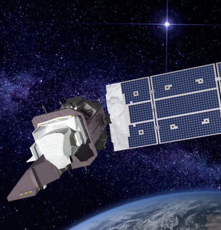
The U.S. Geological Survey will make Landsat 9 data available from the Landsat archive beginning February 10, 2022.
Landsat 9: USGS assumes control of newest satellite in Landsat program from NASA
Sioux Falls, S.D. — The U.S. Geological Survey assumed complete operational control of the Landsat 9 satellite from NASA today at the USGS Earth Resources Observation and Science (EROS) Center in a ceremony featuring Assistant Secretary for Water and Science Tanya Trujillo and Cathy Richardson, deputy director of flight projects at NASA's Goddard Space Flight Center.

Landsat: 50 Years Observing a Changing Earth
For a half-century, the Landsat satellites have revealed patterns of change across our crowded planet. Learn more with this interactive that ESRI and USGS created together.
Reviewing the Events of the Past Year

Landsat 7 Lowered from Standard Landsat Orbit
For the first time since May 1999, the Landsat 7 satellite has left the Worldwide Reference System-2 (WRS-2) orbit. Following two maneuvers, the satellite was lowered last week to an altitude of 697 kilometers, placing it outside the official envelope of the Earth Observation Satellite (EOS) constellation.

New Landsat Collection 2 Science Products Released
Landsat Collection 2 Level-2 Provisional Aquatic Reflectance (AR) and Level-3 Provisional Actual Evapotranspiration (ETa) science products are now available. Landsat 9 is also now available for both products.

Landsat 7 Extended Science Mission to Continue into the New Year
Initially, when the Landsat 7 Enhanced Thematic Mapper Plus (ETM+) resumed imaging after moving to a lower orbit in early 2022, it was decided to collect data through September to capture the Northern Hemisphere growing season. However, because the quality of the data remains nominal, and the health of the satellite remains steady, the ETM+ will continue data acquisitions into 2023.

Landsat 9 Captures Swirling Hurricane Ian
For five decades, Landsat satellites have captured a variety of natural disasters and their effects. The most recently launched, Landsat 9, peered down at Hurricane Ian on Tuesday morning as the dangerous storm swept over Cuba and then headed toward Florida, where it made landfall Wednesday afternoon.

Landsat Science Products Overview
Explore an overview of the Landsat Science Products.

Eyes on Earth Episode 85 – Landsat 7 Extended Science Mission
Eyes on Earth is a podcast on remote sensing, Earth observation, land change and science, brought to you by the USGS Earth Resources Observation and Science (EROS) Center. In this episode, we learn more about Landsat 7’s extended science mission and the resulting circumstance of collecting data from three Landsat satellites.