July 2022 - Vol. 1 | Issue 2
The 50th anniversary of the U.S. Landsat program occurs this July. In this issue, read about the history of the Landsat program, learn about recent updates to accessing Landsat data, and catch up on highlighted Landsat publications.
Newly Updated EarthNow! Landsat Image Viewer Includes Landsat 9
The EarthNow! Landsat Image Viewer displays near-real time imagery created from data acquired by Landsat satellites as they cross over the Earth. Along with live stream video of the acquisitions, recordings of the passes are captured, and available to replay for up to 24 hours.
Fifty Years of Landsat: Sharing Earth information for the benefit of all
In 2022, the Landsat series of satellites, a program conducted jointly by the U.S. Geological Survey and NASA, celebrates a half century of worldwide Earth observations for the good of humankind.
Landsat: Celebrating 50 Years
The Landsat program conceived of in the 1960s, has been running longer than any remote sensing program. The idea was simple: position a satellite in a nearly polar orbit fixed to the solar angle so that each daytime pass would cross the equator at roughly the same local time. Data representing bands of the spectrum are captured and processed into grayscale recordings, which can be combined to…
Landsat's Golden Anniversary
Celebrate 50 Years of Landsat Data With Us
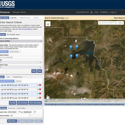
New GloVis Release Features Include Landsat Collection 2
The USGS Global Visualization Viewer (GloVis) has been updated to add Landsat Collection 2 and includes Landsat 9 scenes.
Landsat 9 Data to be Reprocessed at the End of 2022
All Landsat 9 Collection 2 Operational Land Imager (OLI) and Thermal Infrared Sensor (TIRS) data will be reprocessed at the end of 2022 to take advantage of calibration updates identified during the first year of operation.
West Virginia and Landsat
Many may recall “Take Me Home, Country Roads,” made famous by John Denver, leads with the lyric “almost heaven, West Virginia, Blue Ridge Mountains, Shenandoah River.” The descriptors are apt. Nicknamed the “Mountain State,” West Virginia inspires thoughts of coal mining or logging in the Appalachian Mountains and valleys, or the leaping trout in the winding waters of New River Gorge...
Landsat 9 Overview
Landsat 9 launched September 27, 2021, to acquire images of Earth, extending Landsat's record of our planet to over half a century. Learn more about the mission.
Quarterly Reports Contain Latest Landsat Calibration/Validation Information
The USGS Earth Resources Observation and Science (EROS) Calibration and Validation (Cal/Val) Center of Excellence (ECCOE) focuses on improving the accuracy, precision, calibration, and product quality of remote-sensing data, leveraging years of multiscale optical system geometric and radiometric calibration and characterization experience.
How Do You Landsat Overfly
An optimal opportunity for in-flight cross-calibration occurred when Landsat 9 flew underneath Landsat 8 while moving into its final orbit. Since the two satellites nearly identical imaging systems, the underfly event offered ideal cross-calibration conditions. Three types of uncertainty were considered: geometric, spectral, and angular. Differences caused by geometric uncertainty were found…
How do I search for and download Landsat data?
Landsat data products held in the USGS archives can be searched and downloaded at no charge from a variety of sources. Visit Landsat Data Access for information about how Landsat data products can be downloaded individually or in bulk. Landsat imagery not found in the USGS archive might have been collected by one of the USGS International Cooperator ground stations, each of which are the primary...
How Do You Landsat Research with Jacques Cousteau
A joint NASA-Jacques Cousteau expedition sought to verify Landsat bathymetry data. Scientists used the Bahamas and Florida as a testing site for their experiment. Two ships, Calypso and Beayondan, were at anchor during the Landsat overpasses. Satellite remote bathymetry was verified up to twenty two meters deep with specific water clarity parameters. The results were used to update charts,…
Missed Imaging Opportunity for Landsat 8
On June 14, 2022 (DOY165), Landsat 8 missed imaging opportunities due to an issue with the payload scheduling software. The issue was quickly identified, and a correction was implemented to resolve it going forward.


