
Sediments swirl in Lake Erie and Lake St. Clair in this Landsat 9 image of both Detroit, Michigan, and Windsor, Ontario, from Oct. 31, 2021. The Great Lakes serve as sources of freshwater, recreational activity, transport, and habitat for the upper-midwestern US, and water quality remains a high priority.
Landsat 9 Overview
June 21, 2022
Learn more about Landsat 9
See first light images and significant events
See first light images and significant events
Landsat 9 launched September 27, 2021, to acquire images of Earth, extending Landsat's record of our planet to over half a century. Learn more about the mission.
Related
Landsat 9 First Light Images
Landsat 9 launched into space on September 27th, 2021. The "first light" images arrived on October 31st. On that day the satellite captured: algal blooms in Lake Erie, the glaciers of the Himalayas, bush fires in Australia's Eucalypt Woodlands, coastal communities on the Florida panhandle, and deserts, mountains and mesas across the Navajo Nation. Imagery from Landsat 9 will maintain and extend...

Landsat 9 First Light Detroit & Lake Erie
Sediments swirl in Lake Erie and Lake St. Clair in this Landsat 9 image of both Detroit, Michigan, and Windsor, Ontario, from Oct. 31, 2021. The Great Lakes serve as sources of freshwater, recreational activity, transport, and habitat for the upper-midwestern US, and water quality remains a high priority.

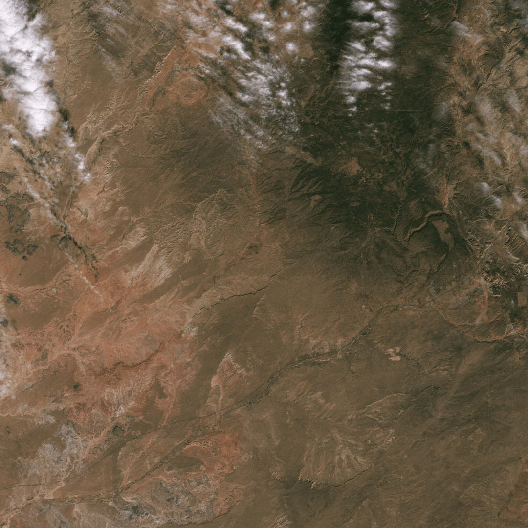
Landsat 9 First Light Image of the Himalayas
The city of Kathmandu, Nepal, seen at the bottom left of this Landsat 9 image, lies in a valley south of the Himalayan Mountainsbetween Nepal and China. Glaciers, and the lakes formed by glacial meltwater, are visible in the top middle of this image.
The city of Kathmandu, Nepal, seen at the bottom left of this Landsat 9 image, lies in a valley south of the Himalayan Mountainsbetween Nepal and China. Glaciers, and the lakes formed by glacial meltwater, are visible in the top middle of this image.
Related
Landsat 9 First Light Images
Landsat 9 launched into space on September 27th, 2021. The "first light" images arrived on October 31st. On that day the satellite captured: algal blooms in Lake Erie, the glaciers of the Himalayas, bush fires in Australia's Eucalypt Woodlands, coastal communities on the Florida panhandle, and deserts, mountains and mesas across the Navajo Nation. Imagery from Landsat 9 will maintain and extend...
Landsat 9 First Light Detroit & Lake Erie
Sediments swirl in Lake Erie and Lake St. Clair in this Landsat 9 image of both Detroit, Michigan, and Windsor, Ontario, from Oct. 31, 2021. The Great Lakes serve as sources of freshwater, recreational activity, transport, and habitat for the upper-midwestern US, and water quality remains a high priority.
Sediments swirl in Lake Erie and Lake St. Clair in this Landsat 9 image of both Detroit, Michigan, and Windsor, Ontario, from Oct. 31, 2021. The Great Lakes serve as sources of freshwater, recreational activity, transport, and habitat for the upper-midwestern US, and water quality remains a high priority.
Landsat 9 First Light Image of the Himalayas
The city of Kathmandu, Nepal, seen at the bottom left of this Landsat 9 image, lies in a valley south of the Himalayan Mountainsbetween Nepal and China. Glaciers, and the lakes formed by glacial meltwater, are visible in the top middle of this image.
The city of Kathmandu, Nepal, seen at the bottom left of this Landsat 9 image, lies in a valley south of the Himalayan Mountainsbetween Nepal and China. Glaciers, and the lakes formed by glacial meltwater, are visible in the top middle of this image.