
September 2022 - Vol. 1 | Issue 4

Landsat Collection 2 Provisional Aquatic Reflectance Science Product
Landsat Collection 2 Provisional Aquatic Reflectance is a provisional science product with the potential to make a valuable contribution to science and monitoring capabilities for aquatic ecosystems, especially in coastal environments and inland waters.

New Landsat Collection 2 Science Products Released
Landsat Collection 2 Level-2 Provisional Aquatic Reflectance (AR) and Level-3 Provisional Actual Evapotranspiration (ETa) science products are now available. Landsat 9 is also now available for both products.

Landsat Collection 2 Provisional Actual Evapotranspiration Science Product
Actual Evapotranspiration (ETa) is the quantity of water that is removed from a surface due to the processes of evaporation and transpiration and is measured in millimeters (mm). ETa can be fundamental in the understanding of the spatiotemporal dynamics of water use over land surfaces.
USGS assumes control of Landsat 9 from NASA
All systems go to extend the Landsat program
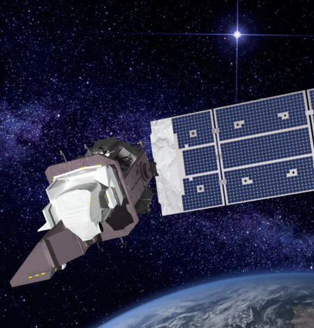
Landsat 9: USGS assumes control of newest satellite in Landsat program from NASA
Sioux Falls, S.D. — The U.S. Geological Survey assumed complete operational control of the Landsat 9 satellite from NASA today at the USGS Earth Resources Observation and Science (EROS) Center in a ceremony featuring Assistant Secretary for Water and Science Tanya Trujillo and Cathy Richardson, deputy director of flight projects at NASA's Goddard Space Flight Center.

Event Celebrates a Satellite’s New Phase and Landsat’s Legacy
On a pleasant, breezy summer day, a crowd gathered under a white event tent on the USGS Earth Resources Observation and Science (EROS) Center’s lawn to witness a milestone in the life of the Landsat 9 satellite.

Landsat Collection 1 Datasets To Be Removed By End of 2022
All Landsat Collection 1 data and science products will be removed from USGS data access platforms by the end of 2022.

Dynamic surface water maps of Canada from 1984 to 2019 Landsat satellite imagery
This paper presents dynamic surface water products over Canada from the first in a series of satellite sensors that will be used to develop a multi-sensor dynamic surface water monitoring system. The dataset uses 1984 to 2019 Landsat data to create annual water masks, inundation frequency and wetting/drying trends. Inundation frequency will be used to generate future annual water masks to…

Landsat 9 Image of Kangerdlugssuaq Glacier, Greenland
Named after a Greenlandic word meaning “large fjord,” Kangerdlugssuaq Glacier is one of the largest tidewater outlet glaciers in Greenland. It flows from the fjord of the same name, the second largest found on the east side of the island. This false color Landsat 9 image was acquired July 29, 2022, using Bands 5|4|3. Ice and snow appear as light blue while water is a dark blue and barren, rocky…

LCMAP Adds Data for 2021 with Release of Collection 1.3
The USGS Land Change Monitoring, Assessment, and Projection (LCMAP) initiative has released the third update to its conterminous United States (CONUS) science products, adding the most recent calendar year of data to an unparalleled annual land cover and land surface change time series that stretches back to 1985.

LCMAP Change Stories: Sequoias under Siege, Progression of a Wildfire
Sequoia National Park encompasses over 400,000 acres across the Sierra Nevada mountains. The park’s giant old growth sequoias are the largest trees in the world, growing 30 feet (9.1 m) in diameter and 250 feet (76.2 m) tall over their 3,000-year lifespans.

Landsat 7 Data Acquired at a Lower Orbit Now Available
Landsat 7 imaging resumed on May 5, 2022, at a lower orbit of 697 kilometers (km) after a series of maneuvers in early April lowered the satellite out of its standard 705-km WRS-2 orbit. Data from the Landsat 7 extended science mission are currently being released and will all be available by the end of August.

Landsat 7 Scenes Acquired May 5 to August 23, 2022
This map displays the density of over 48,000 scenes that have been acquired by the Landsat 7 extended science mission from May 5 to August 23, 2022. (A continuously updated map is available.)Landsat 7 imaging resumed on May 5, 2022, at a lower orbit of 697 kilometers (km) after a series of maneuvers in early April lowered the satellite out of its standard 705-kilometer WRS-2 orbit. The current…