



Low-flow Frequency and Mean Annual Flow Statistics Publication
Drought Conditions persist in the Carolinas
Strengthening Partnerships for Chattahoochee River Stewardship
SAWSC Management Attends Chattahoochee River National Recreation Area Ceremony
SAWSC Management Attends Chattahoochee River National Recreation Area Ceremony
Triangle Area Water Supply Monitoring Project (TAWSMP) Listening Session
USGS scientists, TAWSMP partners, and NCDEQ gathered to discuss emerging contaminants and optimize future data collection activities.
USGS scientists, TAWSMP partners, and NCDEQ gathered to discuss emerging contaminants and optimize future data collection activities.
SAWSC Scientists Attend Inaugural South Carolina Department of Environmental Services (SCDES) Water Summit
South Atlantic Water Science Center (SAWSC)
Welcome to USGS South Atlantic Water Science Center's (SAWSC) Website. We offer water information for Georgia, North Carolina, and South Carolina.
Hydrologic Data at SAWSC
Hydrologic Data at SAWSC

We provide current and historical surface-water, groundwater, water quality, water use, and ecological data in various formats (map, graphical, tabular).
Science at SAWSC
Science at SAWSC

The South Atlantic Water Science Center collects high-quality hydrologic data and conducts unbiased, scientifically sound research on Georgia's, North Carolina's, and South Carolina's water resources.
News
SAWSC Scientists Share Latest Research Results at North Carolina Water Resources Research Institute (NC WRRI) Conference
SAWSC Scientists Share Latest Research Results at North Carolina Water Resources Research Institute (NC WRRI) Conference
Wildfires continue to burn in Georgia, North and South Carolina
Wildfires continue to burn in Georgia, North and South Carolina
USGS experts responding simultaneously to two major natural hazards
USGS experts responding simultaneously to two major natural hazards
Publications
Methods for estimating selected low-flow frequency and mean annual flow statistics at gaged and ungaged locations on streams in Georgia, North Carolina, and South Carolina Methods for estimating selected low-flow frequency and mean annual flow statistics at gaged and ungaged locations on streams in Georgia, North Carolina, and South Carolina
The U.S. Geological Survey, in cooperation with the Georgia Department of Natural Resources (Environmental Protection Division), North Carolina Department of Environmental Quality (Division of Water Resources), North Carolina Department of Public Safety (Office of Recovery and Resiliency), and South Carolina Department of Environmental Services, updated low-flow frequency, mean annual...
Assessing streams in the Chesapeake Bay Watershed to guide conservation and restoration activities Assessing streams in the Chesapeake Bay Watershed to guide conservation and restoration activities
Freshwater streams in the Chesapeake Bay watershed are home to numerous aquatic organisms (like fish, amphibians, mussels, and insects) and provide drinking water and recreational opportunities to people living in or visiting the watershed. Land-use changes, such as urban development and increased activities in certain agricultural sectors, have degraded water quality and altered...
Simulation of groundwater flow in Wake County, North Carolina, 2000 through 2070 Simulation of groundwater flow in Wake County, North Carolina, 2000 through 2070
In 2019, the U.S. Geological Survey and Wake County Environmental Services began a collaborative study to evaluate groundwater resources and long-term groundwater availability in the county’s fractured-rock groundwater system. Wake County, in central North Carolina, is experiencing rapid population growth, associated land development, and changing water use. Hydrogeologic data including
Science

River WebCams of the South Atlantic Water Science Center (Georgia, North and South Carolina)
We have installed webcams at a number of locations in Georgia, North Carolina, and South Carolina to allow you to view, in real time, the current river-stage conditions. Some cameras allow users to temporarily control the tilt, pan, and zoom. During periods of flooding, the South Atlantic Water Science Center might take control of the camera. Click on the Study Area Map icons for more information...
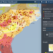
South Atlantic Water Science Center Drought Monitoring
When rainfall is less than normal for several weeks, months, or years, the flow of streams and rivers declines, water levels in lakes and reservoirs fall, and the depth to water in wells increases. If dry weather persists and water-supply problems develop, the dry period can become a drought.

Monitoring water-quality and geomorphology in the French Broad River during I-26 construction
The North Carolina Department of Transportation (NCDOT) has partnered with the U.S. Geological Survey (USGS) to assess the water-quality and geomorphologic impacts resulting from the I-26 construction projects in western North Carolina. Streamflow, precipitation, and water-quality monitoring data, coupled with periodic assessments of geomorphology, will support the NCDOT construction-site...