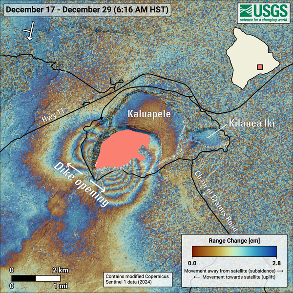
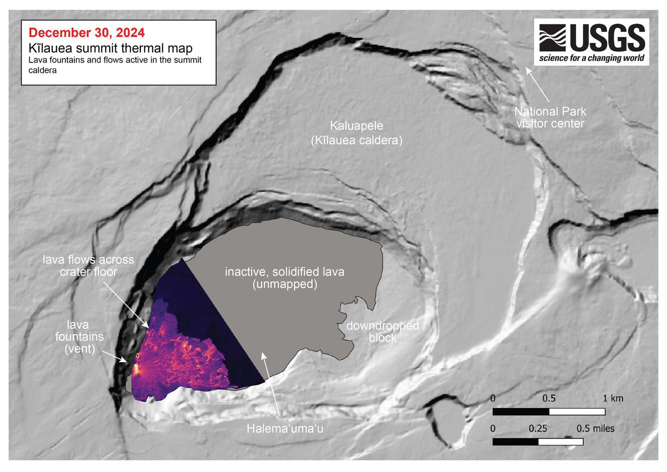
This compilation shows thermal maps of Kīlauea summit eruption from December 23-30, 2024. Initially high eruption vigor resulted in lava flows covering much of the southwest portion of the caldera with active lava flows on December 23, 2024.
December 30, 2024 — Thermal map of eruption at Kīlauea summit
Related
This compilation shows thermal maps of Kīlauea summit eruption from December 23-30, 2024. Initially high eruption vigor resulted in lava flows covering much of the southwest portion of the caldera with active lava flows on December 23, 2024.
This map shows deformation at Kīlauea volcano associated with the ongoing eruption that started on December 23, 2024. The image covers the timespan from December 17–29, 2024, using data acquired by the European Space Agency's Sentinel-1A satellite. Colored fringes denote areas of ground deformation, with more fringes indicating more deformation. Each