
Mount Carmel Fire
Detailed Description
The Camp Fire became the California’s deadliest in November 2018. Strong winds propelled the fire’s rapid spread, ultimately consuming more than 153,000 acres and killing at least 85 people.
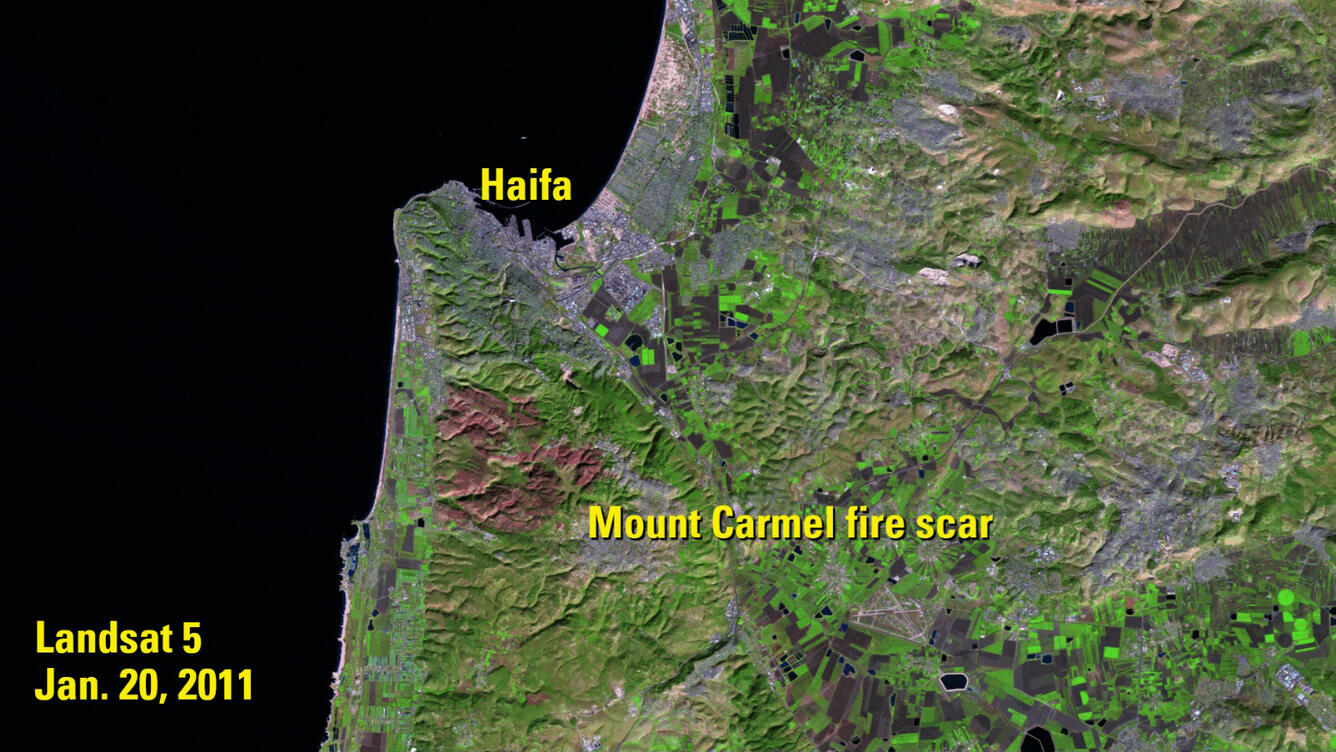
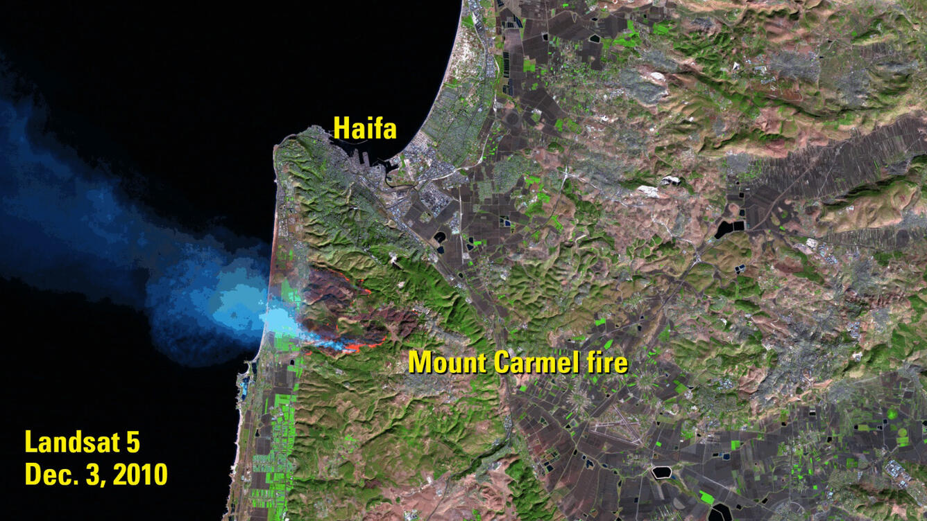
Israelis in the Mount Carmel region saw a similarly devastating fire eight years ago this month, when a blaze sparked southeast of the port city of Haifa and tore through hills of Aleppo pines, burning 12,000 acres in less than four days.
The fire began on Dec. 2, 2010. By the time it was extinguished on Dec. 5, it had become the deadliest fire in Israel’s history, killing 44.
These Landsat 5 images (Bands 5,4,3) show Mount Carmel during and after the fire. The forest fire is bright orange in the Dec. 3, 2010 image, sending smoke west across the coast and Mediterranean Sea. The second image, from Jan. 20, 2011, shows the full burn scar left behind in red.
Landsat imagery can be used to monitor fires, mudslides, floods and other disasters, with imagery starting in 1973. Landsat imagery is archived at the USGS Earth Resources Observation and Science (EROS) Center and available for download at no charge from EarthExplorer, GloVis and LandsatLook.
Sources/Usage
Public Domain.