
12-11-25 Satellite Imagery of Surface Roughness at Hubbard Glacier

Detailed Description
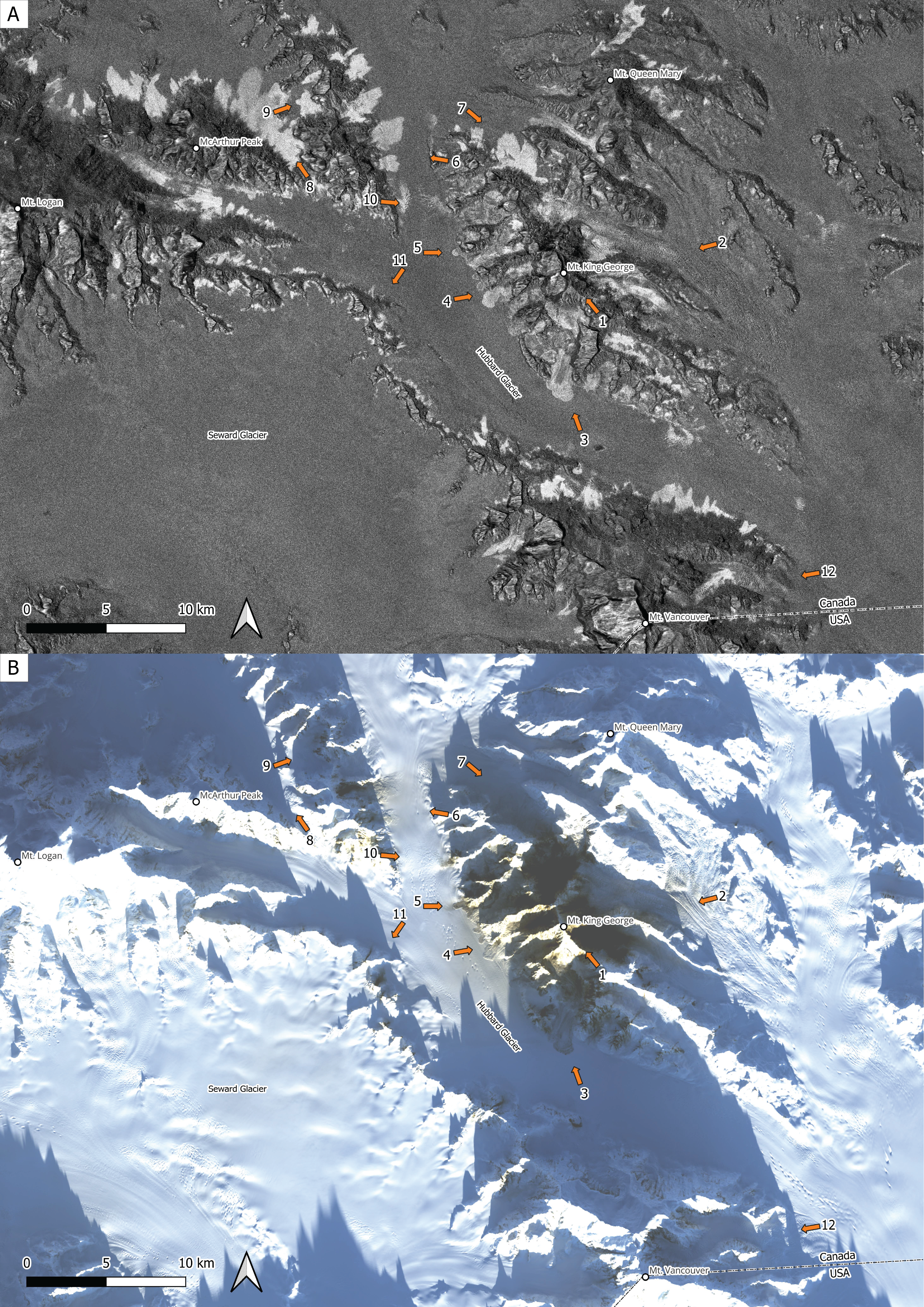
A) Map of Sentinel-1 radar surface roughness change with photo locations and azimuths. B) Landsat 8 optical imagery from December 11, 2025, with photo locations and azimuths.
Sources/Usage
Public Domain.
Related

Additional Research Glaciers
The USGS Glacier Project has conducted research beyond the Benchmark Glaciers, both past and present. This work has focused on infrastructure hazards, rapid glacier change, landscape destabilization, and glacier dynamics and processes not captured by the Benchmark Glacier network. These glaciers include Black Rapids, Kahiltna, Kennicott, Columbia, Hubbard, and Taku.

2025 M7.0 Hubbard Glacier Earthquake-Triggered Landslides and Snow Avalanches
A M7.0 oblique-slip earthquake initiated about 10 km below the Hubbard Glacier in the St. Elias Mountains about 88 km north of Yakutat, Alaska, at approximately 11:40am AKST (1:40pm YST) on December 6, 2025. The U.S. Geological Survey (USGS) Ground Failure product estimated that landslides triggered by this earthquake would likely be significant in number and/or spatial extent. This was confirmed...
Related
Additional Research Glaciers
The USGS Glacier Project has conducted research beyond the Benchmark Glaciers, both past and present. This work has focused on infrastructure hazards, rapid glacier change, landscape destabilization, and glacier dynamics and processes not captured by the Benchmark Glacier network. These glaciers include Black Rapids, Kahiltna, Kennicott, Columbia, Hubbard, and Taku.
2025 M7.0 Hubbard Glacier Earthquake-Triggered Landslides and Snow Avalanches
A M7.0 oblique-slip earthquake initiated about 10 km below the Hubbard Glacier in the St. Elias Mountains about 88 km north of Yakutat, Alaska, at approximately 11:40am AKST (1:40pm YST) on December 6, 2025. The U.S. Geological Survey (USGS) Ground Failure product estimated that landslides triggered by this earthquake would likely be significant in number and/or spatial extent. This was confirmed...